• Hello, please take a minute to check out our awesome content, contributed by the wonderful members of our community. We hope you'll add your own thoughts and opinions by making a free account!

Wintry 01/28-29/2022 Winter Weather Potential

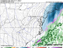
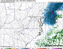
I see why no one is talking about the GEM. It's downright terrible for winter weather. Little precipitation outside of the Outer Banks. Even NE North Carolina doesn't get a lot of snow on this run.

View attachment 110660View attachment 110661
Yeah we shouldn’t expect a big storm but I do expect a light event for that backside band fro is talking about .. that’s really always been the feature that was going to give us winter weather and we should expect only this outcome or else hearts could get broken .. interestingly enough Mets were only expecting flurries and a dusting before January 2000 storm 24 hours out
 
The NAM is the only one digging the trough that deep. It’s on an island
With such a sensitive set up you can’t just look at one run and think it’s 100% the right answer .. windshield wiper effect is always happening especially for a storm more than 2 days away .. we’re not going to get a pants bursting run every 6 hours especially when the H5 can take small steps in any direction and cause major impacts .. we will bring you up from the cliff in 24 hours
 
i am so sick of these conditional systems where a hiker farting in the grand canyon can drag the shortwave further west and be the difference between 4 and 14 inches in elizabeth city, please just give me a situation where we're arguing about highway corridors again
 
Honestly I'm happy to keeps things as modeled (GFS, EURO) and take our chances with that band over the CLT metro.
Yep, even the bleak gem had that band. The UK does as well. these setups typically do decent for the NC Piedmont around the Charlotte/gso areas, I’m alright with a 1-2 ground covering setup. 7C mid level lapse rates and steep low level lapse rates could allow that band to be intense. Shouldn’t be long lasting but should be fun, if it holds
 
i am so sick of these conditional systems where a hiker farting in the grand canyon can drag the shortwave further west and be the difference between 4 and 14 inches in elizabeth city, please just give me a situation where we're arguing about highway corridors again
Was just thinking the model snow amount outputs have some odd configurations in various places across the state. Final outcomes would have to be more smoothed.
 
last weenie post for a while- did some scouting and once again, just like last week, the difference between the nam and everyone else is... not very much. 42 hours out the NAM is a touch weaker and 120 miles east with that four corners shortwave and that makes all the difference. still time to claw our way back
 
LOL: 8.2 inches for me an packfan

363540074_sn10_acc.us_ma(19).png.90d7180f0f2fb6b5cf78f7e1ecf26245.png
 
I cant pull sounding , but Id imagine its some sort of convective thunder deal, localized like you see in summer. This all is going to be interesting to watch unfold. Its borderline miss for all the coastal areas NC northeast or gonna swing back and burry folks. Hopefully we can cash in a grass blade cover event. February was predicted to be scorched earth and its looking nothing like that. So still 5 more weeks to go after another one. Still think this one does one more shift for better or worse as we run the last warmup lap before the green flag drops.
 
Back
Top