-
Hello, please take a minute to check out our awesome content, contributed by the wonderful members of our community. We hope you'll add your own thoughts and opinions by making a free account!
You are using an out of date browser. It may not display this or other websites correctly.
You should upgrade or use an alternative browser.
You should upgrade or use an alternative browser.
Wintry 01/28-29/2022 Winter Weather Potential
- Thread starter weather nerd
- Start date
It will drop quickly too. Made it to 46f before the front came through and then dropped 12 degrees since in a matter of a few hours, before the sun went down.Temp starting to drop, 44F from 48F a hour ago
33.8 currently.
LukeBarrette
im north of 90% of people on here so yeah
Meteorology Student
Member
2024 Supporter
2017-2023 Supporter
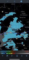
Believe it or not it’s still raining in Roanoke. 35 degrees and it was supposed to transition an hour ago. Snow reports surrounding me but no snow. The Roanoke curse strikes again.
Snow reported in Easley
NBAcentel
Member
Turner Team
Member
Im in Cave Spring and it has been snowing for about an hour here. Starting to get a dusting on the deck and the grass. Probably only a matter of time before it changes over there.Believe it or not it’s still raining in Roanoke. 35 degrees and it was supposed to transition an hour ago. Snow reports surrounding me but no snow. The Roanoke curse strikes again.
D
Deleted member 609
Guest
Interesting. I thought it was trending a little better.View attachment 111337501pm totals cut by GSP
NBAcentel
Member
They probably going off runs between 12z-18zInteresting. I thought it was trending a little better.
48 to 40 at the airport...wow!!It will drop quickly too. Made it to 46f before the front came through and then dropped 12 degrees since in a matter of a few hours, before the sun went down.
33.8 currently.
Nomanslandva
Member
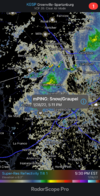
Have a legit beginning of a dusting. Was working so could not read and post. I had flurries to light snow starting at 2 PM with 38 on my thermometer, but seemed like as soon as we lost the dry air, then it it went to more of a wet rain snow mix to mostly rain. Then about 4 it transitioned back to snow but was not sticking until just recently. I picked up my wife from work at 5 near downtown and it was mostly rain. Got home and have the dusting. 300 feet in elevation is a good thing!
31 now so lets see if we can catch a good band! ?
31 now so lets see if we can catch a good band! ?
LukeBarrette
im north of 90% of people on here so yeah
Meteorology Student
Member
2024 Supporter
2017-2023 Supporter
The rates have been awful here, probably the reason whyIm in Cave Spring and it has been snowing for about an hour here. Starting to get a dusting on the deck and the grass. Probably only a matter of time before it changes over there.
NBAcentel
Member
LukeBarrette
im north of 90% of people on here so yeah
Meteorology Student
Member
2024 Supporter
2017-2023 Supporter
I hope. It’s still 35 degrees here. Kindve insane how unlucky I’ve gotten so farHave a legit beginning of a dusting. Was working so could not read and post. I had flurries to light snow starting at 2 PM with 38 on my thermometer, but seemed like as soon as we lost the dry air, then it it went to more of a wet rain snow mix to mostly rain. Then about 4 it transitioned back to snow but was not sticking until just recently. I picked up my wife from work at 5 near downtown and it was mostly rain. Got home and have the dusting. 300 feet in elevation is a good thing!
31 now so lets see if we can catch a good band! ?
Starting to mix here 35.7
D-Ray
Member
had some snow mixed with the rain as the heavier precip moved over
SC_Wildcat
Member
I wish it was SCThese Snow reports must be in Florence AL… remember to add your state as there is a Florence, SC as well.
Sent from my iPhone using Tapatalk
NBAcentel
Member
Hrrr is gonna uptrend again
I got a gut feeling eastern SC and NC will wake up to a surprise tomorrow morning. The air almost got that snow  feel to it.
norcarolinian
Member
Rain and 39°
Typical snowstorm conditions here. 44 degrees, overcast, and waiting for a dying band to roll through around 2:00 am.
Teach Lesley
Member
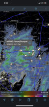
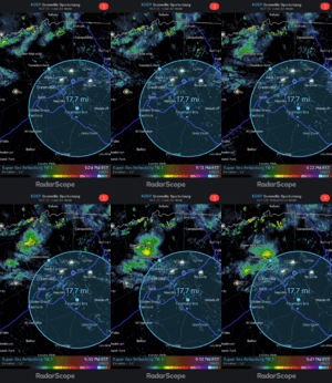
I am about the H. in Bethlehem no thunder when it came over. Snowed like crazy for about 10 minutes. Mangled flakes started to turn the ground white real quick. Soon as it started to let up. It went back to mix. Should be fun for those east of me once it gets going good.The benchmark for thunder/lightning with this is getting tops at/over 15kft View attachment 111341
Nomanslandva
Member
Yes, I think very light rates did not help wet bulb or the transition. Now I am not in love with the radar.The rates have been awful here, probably the reason why
weatherguy
Member
Been having micro flurries in Franklin county AL, gusts were likely over 35 mph as the cold front came thru, freezing at just 1000' up but 40F at surface.
D
Deleted member 1449
Guest
Dropped three degrees in the past hour. 38.8 and light rain.
SimeonNC
Member
Just light drizzle rn.
Sent from my LM-Q730 using Tapatalk
Sent from my LM-Q730 using Tapatalk
LukeBarrette
im north of 90% of people on here so yeah
Meteorology Student
Member
2024 Supporter
2017-2023 Supporter
Yeah it’s embarrassingYes, I think very light rates did not help wet bulb or the transition. Now I am not in love with the radar.
that would put CAE in the game ?
Nomanslandva
Member
I am in Penn Forrest so looks like I have someone close to keep me honest!Im in Cave Spring and it has been snowing for about an hour here. Starting to get a dusting on the deck and the grass. Probably only a matter of time before it changes over there.
NBAcentel
Member
NBAcentel
Member
Can we talk about how the hrrr has been trending NE NC into the CCB
37 here after 48 earlier and dropping. Got a shelf of clouds filling the western sky. Should have some dandruff blowing around tonight.It will drop quickly too. Made it to 46f before the front came through and then dropped 12 degrees since in a matter of a few hours, before the sun went down.
33.8 currently.
Temp drop underway @ RDU. 43/28 down 2F in 15min
pcbjr
Member
Uhh it’s snowing in Frosty’s Winter Wonderland 

 ️
️

Sent from my iPhone using Tapatalk


 ️
️

Sent from my iPhone using Tapatalk
D-Ray
Member
all snow now....nice sized flakes !!!
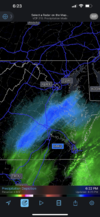
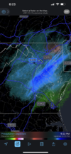
HRRR is starting to correct with this banding setting up just north of RIC, I’d be worried if I was in DC but just SE of the city looks to be in a solid spot and not matching up against HRRR. You can clearly see along the eastern seaboard where the western extent of the axis will be, really through New Jersey. The southern tail will roll through the Carolina’s this evening and overnight aided by interaction with the negatively tilting upper air trough with some mesoscale enhancements overnight.


lexxnchloe
Member
CCB? Would that be a surprise upside for them?Can we talk about how the hrrr has been trending NE NC into the CCB

