Ron Burgundy
Member
All snow now - don’t know for how long but I’m loving every minute of it!!
Curious how those soundings look too but so far I agree the more aggressive HRRR seems to be winning the battle against the NAM and WRF coresAll hail the HRRR, it nailed this.

Those maps were way overdoneSorry guys for posting the "COD" gefs for days now just for you!! Is it working??


Right on cue it’s sleeting.Down to 39.7 now. Still rain, but getting really close. Probably gonna see some sleet in the next 15-30 minutes.
There were overdone, but it's snowing in places where it did show and little more than what people expectedThose maps were way overdone
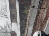
Really nice snow band on 400 right nowView attachment 59972
Radar looks promising for you.Corinth, Ms still reporting light snow. Hoping some of that moves this way. Clouds are definitely getting darker after being mostly sunny most of the afternoon.

I was down off exit 6 at the time. Heading north and it has transitioned back to a rain/snow mixwhat part of 400??
Is it going to move into sc as well seen someone posted 18z gfs and it showed it moving into sc as well
Weird that we were colder and earlier to transition over in metro ATL than you and @BufordWX.Full on snow shower here now. No accumulations.
Is it going to move into sc as well seen someone posted 18z gfs and it showed it moving into sc as well
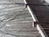
Ground turning white!Full on snow shower here now. No accumulations.