Blue_Ridge_Escarpment
Member
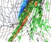
Must be the snow cover in Atlanta. ??NWS blend of models shows Atlanta struggling to make it above freezing on Xmas.
View attachment 59598

Must be the snow cover in Atlanta. ??NWS blend of models shows Atlanta struggling to make it above freezing on Xmas.
View attachment 59598
In 2015 Columbia was 79! My home in Irmo actually hit 81 if I remember correctly. I'm really looking forward to the chance for Columbia not to get out of the 30's for onceThe coldest high temp on Christmas in Atlanta was in 1983 with a high of 17, which is pretty remarkable. The warmest Christmas was 75 in 2015 !

The RGEM and NAM nailed the 11/30 eventRGEM looks like it’s on an island. WRF may be the nail in the coffin for North Georgia.
Sent from my iPhone using Tapatalk
The hrrr has done well with these shallow moist setupsThe RGEM and NAM nailed the 11/30 event
i hate to be desperate but please lord jesus verify.immaculate
FINALLY. A model shows snow over my house. Nice swath right over Jimmy Ranch!immaculate View attachment 59602


thats an odd look. do you know if those streamers are caused by geography, or is that just an estimation and we just know there will be streamers in the general area. i think you mentioned convection earlier, so maybe its just wherever the convection sets up and then goes downstream?
Little bit of both, favorable areas of convergence favor here, but this stuff could pop up unexpectedly, and yesthats an odd look. do you know if those streamers are caused by geography, or is that just an estimation and we just know there will be streamers in the general area. i think you mentioned convection earlier, so maybe its just wherever the convection sets up and then goes downstream?
cool. i was out of town, but several years ago i remember people telling me about a day where it would be sunny, clouds would come up and snow would cover the ground, then sun come back out and it would melt, then it would repeat like that several times, and this was in north ATL metro area. So hoping something like that can happen with this.Little bit of both, favorable areas of convergence favor here, but this stuff could pop up unexpectedly, and yes
I’m honestly wondering if some folks get accumulating snow from those Convective streamers IF the HRRR is right (D-0.5) not bad 0-3km cape with this setup, and it’s not even during peak heating during the day
i want a flurry ?

i just literally spit my coffee out!There ya go
surprised you found a McDonald’s that the ice cream machine actually works.There ya go

Su
surprised you found a McDonald’s that the ice cream machine actually works.

Starting to look like your area out over the triad will see flakes. Definitely trending favorably.Not. Gonna. Happen.
Starting to look like your area out over the triad will see flakes. Definitely trending favorably.
Yeah... this is certainly the type of set up that it could happen due to all the energy over the region. I can remember it happening several instances back in the 90s.Little bit of both, favorable areas of convergence favor here, but this stuff could pop up unexpectedly, and yes
I’m honestly wondering if some folks get accumulating snow from those Convective streamers IF the HRRR is right (D-0.5) not bad 0-3km cape with this setup, and it’s not even during peak heating during the day
Me too. Latest run looks like the GFS with backside changover, however brief it might be.I’m riding the RGEM . Everything else sucks cause it does show what I want
Sent from my iPhone using Tapatalk
Starting to look like your area out over the triad will see flakes. Definitely trending favorably.
Can someone explain to me why the Icon has been consistently showing this moisture feature in the gulf? Looks like it would cross over me but with no moisture than blossom on the northern gulf coast.

Ride it like there's no tomorrow

Do you not believe in a Macon bullseye and snow in Mexico Beach, FL? @deltadog03 is licking his chops, I'm sure. ?Is the image itself considered banter since it’s so ridiculous?
Sent from my iPhone using Tapatalk