Interesting update from Robert on his WxSouth FB page. At the end he discusses the jet streak that Chris has been honking for days here:
Quick Update: Slightly wetter is the rule of thumb. I had that on my paid site and still may have to up the numbers in part of GA, SC NC and VA one more time though.
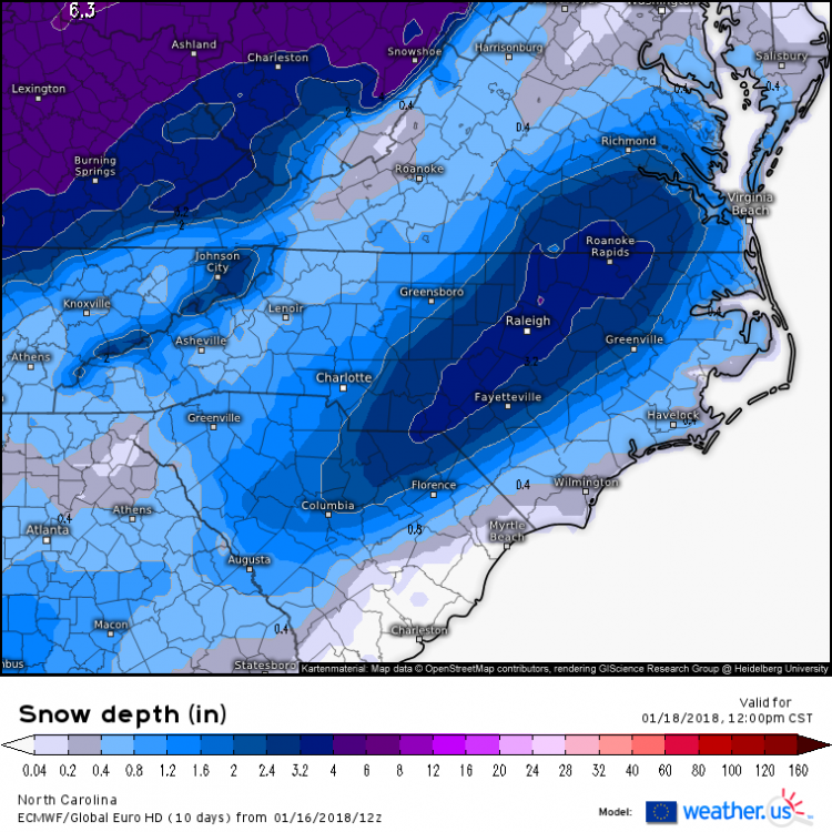
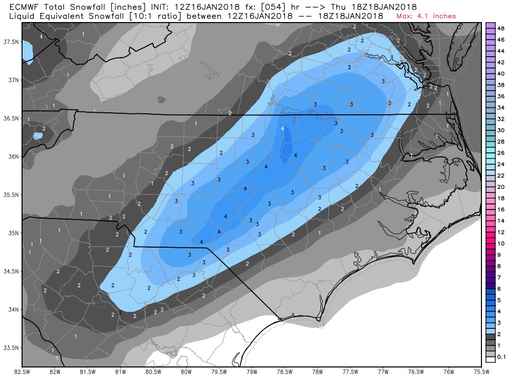
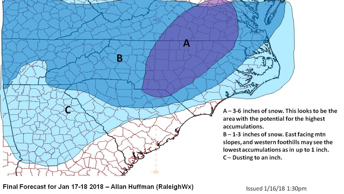
What is going to happen is that the wave will begin to amplify in eastern TN tonight and that will suddenly stream the moisture more northeast bound up through the spine of the Apps overnight and begin spreading over most of central and eastern half of Georgia, the west Carolinas, Western Virginia by early morning. The Short Range models are the best guidance now, and they update hourly. Here's the latest one from one of them showing the suddenly increase in moisture totals by 8 AM. This animation shows the moisture in tenths. Light green .01, the next green is .10" and the third shade of green .25" . By midday, some .50" amounts are shown around Charlotte, Greensboro Raleigh, Richmond area where all lifing is maxed out in this storm, but its obvious more moisture is coming to eastern GA and central SC as well.
Also, a 300 millibar JetStreak is now shown on short range modelling, right up the Spine of the Apps at 8 AM. Thats a sign of a burst of extra lift immediately to it's right, so no wonder models are now wetter in the Carolinas and part of Georgia than they were.