I feel this event will over perform given there are light snow flurry returns on radar here this morning. Saw one or two flurries briefly.
Sent from my iPhone using Tapatalk
Sent from my iPhone using Tapatalk
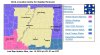
Yep I agree not sure why winter storm watch local met is saying only up to one inch lolBirmingham will most likely be replaced with a winter weather advisory
Sent from my SM-J320VPP using Tapatalk
Even im their AFD they say snowfall amounts dont meet the winter storm watch criteria of 2 inches. But they keep talking about an enhanced snowfall band . just seems like 2014 is on their mind as they pound home the possible traffic impacts.Yep I agree not sure why winter storm watch local met is saying only up to one inch lol

Yea. Kind of ridiculous to put out a WSW when zero guidance shows we will meet the criteria...HSV has it right with an advisory. May be able to remove that if qpf doesnt juice up.Birmingham will most likely be replaced with a winter weather advisory
Sent from my SM-J320VPP using Tapatalk
To be fair all the offices coordinatedYea. Kind of ridiculous to put out a WSW when zero guidance shows we will meet the criteria...HSV has it right with an advisory. May be able to remove that if qpf doesnt juice up.

YesUmmm a winter weather advisory is an upgrade from a winter storm watch...
Sent from my SM-G955U using Tapatalk
No problem. Just put those kind of posts in the banter thread.Sorry about last comments I'm new here
Well, the 09 SREF Plumes are out. Looks very similar to 03z to me. Maybe a little more on the first wave west of the mountains and a little less east??I think all models are going to juice up a little today
Sent from my iPhone using Tapatalk
I like this one

What time should the snow arrive in Atlanta?The main thing about this threat if simply plays out as some of Models has it will be the travel and workers commute issues thru Metro areas a half of inch or so of snow in ATL near rush hour with super cold ground temps and 20s temps is alot like the nightmare people endured in 2014.
Lol, i know rightThis system will cover a large area of the United States. Outside of Florida every state east of the Mississippi will see snowfall.
probably around Tuesday evening sometimeWhat time should the snow arrive in Atlanta?