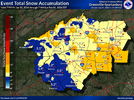
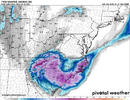
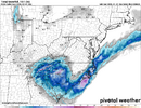
...how may models have RDU dry slotted right now? I wouldn't say they are "bullish".21z SREF plumes mean snowfall for RDU: 10.5", GSO: 9.5", CLT: 8.2", GSP: 5.2", CAE: 3.2", ILM: 9.8".
Not much reason to care at this point, but I am surprised to see them continuing to be so bullish for RDU right up to the end here.
-
Hello, please take a minute to check out our awesome content, contributed by the wonderful members of our community. We hope you'll add your own thoughts and opinions by making a free account!
You are using an out of date browser. It may not display this or other websites correctly.
You should upgrade or use an alternative browser.
You should upgrade or use an alternative browser.
Wintry Machine Learning Mauler 1/30-2/1
- Thread starter SD
- Start date
I never said "models" were bullish for RDU, I said the SREF in particular is bullish, with 10.5". It's not alone, there are other models that show 5-10" for RDU, but yes you are right that there are also models that put Raleigh in the dry slot or really close to it. I don't feel confident....how may models have RDU dry slotted right now? I wouldn't say they are "bullish".
thekidcurtis
Member
...how may models have RDU dry slotted right now? I wouldn't say they are "bullish".
They continue to increase. If I recall correctly, they were moved 8” to 9” a few cycles ago. So in this regard I would say bullish.
Sent from my iPhone using Tapatalk
NBAcentel
Member
NorthGaWinter4
Member
Hardest part about these storms coming at night like this, trying to decide how long to stay up or how early to wake up. Radar has snow right on me. A few tiny flakes in the lights
HREF mean with at/over 1” per hour rates tomorrow around CLTView attachment 192289
Charlotte is in a pretty good spot right now and for this event. According to radar returns are you getting flurries now?
Not yet. It’s overhead atm.Charlotte is in a pretty good spot right now and for this event. According to radar returns are you getting flurries now?
NBAcentel
Member
Just virga right now, patiently waiting. I’d estimate it starts reaching around ground around CLT between 5-7amCharlotte is in a pretty good spot right now and for this event. According to radar returns are you getting flurries now?
J1C1111
Member
First flakes just started at 1:45 just a few miles west of Forest City right off hwy 221. Just getting going.
NBAcentel
Member
Take that back. Got a couple flakes coming down
31 and snow in the floodlights.
WxBlue
Meteorologist
WxBlue
Meteorologist
rburrel2
Member
Steady light flurries have broken through here in Clemson with the main show!!! That's a couple hours earlier than I expected.
PawpawMawmawsnowlovers
Member
Yea we getting very light flurries here in Liberty scSteady light flurries have broken through here in Clemson with the main show!!! That's a couple hours earlier than I expected.
We’ve got snow in Matthews!!
Seems strange waiting for the radar to start lighting up over North Georgia. Nothing yet other than a few meager returns in extreme NE and NW Ga.
Not having returns in Alabama to track seems surreal.
Not having returns in Alabama to track seems surreal.
PawpawMawmawsnowlovers
Member
Coming down steady now in Liberty sc
Bigedd09
Member
Snowing in huntersville
Sent from my iPhone using Tapatalk
Sent from my iPhone using Tapatalk
rburrel2
Member
You can already tell this is gonna be high ratio powder. Wind is probably going to keep it up from getting 20:1 though.
iGRXY
Member
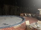
It’s coming down really good already. Probably been snowing 10-15 minutes and the grass is covered
Pouring snow here. Ground white in less than 30 minutes.
I can't get over how fast the snow is reaching the ground based on ground truth under such meager radar returns. Very little virga with this one, it seems.Pouring snow here. Ground white in less than 30 minutes.
SimeonNC
Member
Ground is starting to turn a bit white, parked cars already have a coating on snow on them.
When the wind gusts, visibility drops significantly due to the amount of flakes that are falling. Quite impressive so farI can't get over how fast the snow is reaching the ground based on ground truth under such meager radar returns. Very little virga with this one, it seems.
Light snow Fort Mill, sc 28/16
Sent from my iPhone using Tapatalk
Sent from my iPhone using Tapatalk
PawpawMawmawsnowlovers
Member
Coming down pretty decent here very dry powder can tell, steps and driveway a little white. I think we make a run at some big totals here in Charlotte, hrrr looks insane. Tried to go back to sleep but heart was pounding out of my chest lol
That's great news! watching carefully for the radar to fill in southward over the next couple of hours.When the wind gusts, visibility drops significantly due to the amount of flakes that are falling. Quite impressive so far
NWS just updated my warning to 3-6 inches. Was 1-3
Up too early. Can’t sleep. Gotta sit here til 7 and wait. Not getting on the roof tho. Lol

