-
Hello, please take a minute to check out our awesome content, contributed by the wonderful members of our community. We hope you'll add your own thoughts and opinions by making a free account!
You are using an out of date browser. It may not display this or other websites correctly.
You should upgrade or use an alternative browser.
You should upgrade or use an alternative browser.
Wintry Machine Learning Mauler 1/30-2/1
- Thread starter SD
- Start date
Is the upstate decreasing? Haven’t seen anything to support that.RAH and FFC increasing yet GSP lowered. Hmm
ILM talking of earlier onset and all snow which would help our totals down here. Earlier there was thought we’d start out as rain showers before quickly transitioning to snow.
Still a widespread area forecast of 4-8 inches all over ENC and NESC.
Still a widespread area forecast of 4-8 inches all over ENC and NESC.
packfan98
Moderator
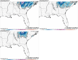
Just because I can, here's the Canadian Ensembles. Significant improvement for areas in the west and south with the ULL.


“Mainly” for areas that develop those conditions? Isn’t that just the criteria to be considered a blizzard?
Blue_Ridge_Escarpment
Member
When the totals are pretty much verbatim the NMB, yes. GSP I’m speaking ofThey do? This is a common trend of theirs?
I think you’re in a great spot. Spartanburg to Charlotte imho is going to feast on the mesolow to the SW, the slowing warm front to your east, and the heavy, efficient banding pivoting over you
I know that Corolla n the OBXZx might be a sweet spot for the beaches. I’m exactly 21.4 miles away from there in KECG. I’m hoping that some of that thump might make it westward to us.
AREA FORECAST DISCUSSION
NATIONAL WEATHER SERVICE CHARLESTON SC
143 PM EST FRI JAN 30 2026
WHAT HAS CHANGED
A WINTER STORM WARNING HAS BEEN ISSUED FOR ALL OF THE SC LOWCOUNTRY,
IN GEORGIA, EFFINGHAM, BULLOCH, CANDLER, JENKINS, AND SCREVEN
COUNTIES FROM 7 AM SATURDAY TO 1 PM SUNDAY. WINTER WEATHER ADVISORY
FOR AREAS ALONG AND SOUTH OF INTERSTATE 16 ACROSS SOUTHEAST GEORGIA
FROM NOON SATURDAY TO 7 AM SUNDAY. EXTREME COLD WATCH HAS BEEN
UPGRADED TO A WARNING FROM SATURDAY NIGHT/SUNDAY MORNING. LAKE WIND
ADVISORY FROM 7 PM SATURDAY TO 9 AM SUNDAY.
KEY MESSAGES
- 1) A SIGNIFICANT WINTER STORM IS EXPECTED TO BRING MODERATE TO
HEAVY IMPACTS ACROSS PORTIONS OF THE SOUTH CAROLINA LOWCOUNTRY
AND SOUTHEAST GEORGIA SATURDAY MORNING INTO SUNDAY MORNING.
SNOW IS FORECAST TO BE THE PRIMARY PRECIPITATION TYPE.
- 2) EXTREMELY COLD TEMPERATURES ARE EXPECTED ACROSS OUR ENTIRE
AREA THIS WEEKEND INTO EARLY NEXT WEEK. HISTORICALLY COLD
WIND CHILLS ARE EXPECTED SATURDAY NIGHT INTO SUNDAY MORNING
AND AN EXTREME COLD WARNING HAS BEEN ISSUED FOR THE ENTIRE
AREA.
NoIs the upstate decreasing? Haven’t seen anything to support that.
packfan98
Moderator
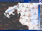
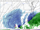
Pretty interesting snowfall probabilities that outline the modeling today. Check out the max and mins of getting 2" and 4"


n1accord93
Member
WPC is reinforcing their strong language around the development of this storm in their Friday 1:35 update. It's a long read but worth the read if you are interested in their thought process.
Couple of highlights:
Some of this WAA could be intense as
reflected by strengthening 925-700mb fgen, well aligned into the
deep DGZ (>70% chance of at least 100mb of DGZ depth according to
the SREF). This will support not only expanding snowfall, but
intensifying snowfall such that by 00Z/Sunday at least moderate
snowfall rates should encompass nearly the entirety of the
Carolinas and into northeast GA and southern VA.
WPC probabilities for the event are quite robust for both the
Appalachians and eastern North Carolina, where they are above 50%
for 8+ inches, and 30-50% for 12+ inches. The greatest potential
for more than 12 inches appears to be eastern NC where the
deformation band may pivot, but a widespread 4-8" snowfall appears
likely from southern VA through northern SC, with impactful
accumulations expected in areas like Richmond, VA, Charlotte and
Raleigh, NC, Columbia, SC, and even into Atlanta, GA. Farther
northeast, WPC probabilities are 30-50% for 4+ inches across the
Cape and Islands.
Sctvman
Member
My NWS point forecast holding on to about 2” but the gradient in the Charleston metro is gonna be crazy. Edisto Beach might not even get to 1” while Summerville likely to get 3”+ and northern Berkeley closer to 5. Ocean water temps might cut accumulations down closer to the beaches
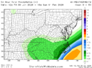
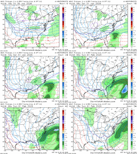
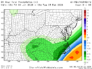
6z for comparison not much change, locked in nowMaybe slight improvement on WeatherNext2, held serve at the very least
View attachment 191914
packfan98
Moderator
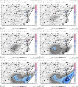
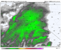
I think a lot of us would be happy to be guaranteed .25" of precip with these ratios. These SV maps are so crude though. I'd love to see more detail. Lots of difference between .25 and .49 in this setup. Can you post the snow map? That will give us a better idea who gets .4 with the 4" snow contour line.Maybe slight improvement on WeatherNext2, held serve at the very least
View attachment 191914
rusrius
Member
Interesting and that the SC Midlands increased. I just don’t see it.Is the upstate decreasing? Haven’t seen anything to support that.
AKQ just upped totals for extreme NE NC.
Still hard to decipher details but here you goI think a lot of us would be happy to be guaranteed .25" of precip with these ratios. These SV maps are so crude though. I'd love to see more detail. Lots of difference between .25 and .49 in this setup. Can you post the snow map? That will give us a better idea who gets .4 with the 4" snow contour line.
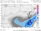
Round Oak Weather
Member
NWS bumped me into the 2-3 inch range. Officially forecasting 2.1 they must be leaning on the short ranges
Bumped up my area (north of Fayetteville/Linden NC) as well. 3 to 5 Saturday and 3 to 7 Saturday nightTotals bumped a bit by NWS RAH on daily forecast for Triangle area
beanskip
Member
This also caught my eye:WPC is reinforcing their strong language around the development of this storm in their Friday 1:35 update. It's a long read but worth the read if you are interested in their thought process.
Couple of highlights:
Some of this WAA could be intense as
reflected by strengthening 925-700mb fgen, well aligned into the
deep DGZ (>70% chance of at least 100mb of DGZ depth according to
the SREF). This will support not only expanding snowfall, but
intensifying snowfall such that by 00Z/Sunday at least moderate
snowfall rates should encompass nearly the entirety of the
Carolinas and into northeast GA and southern VA.
WPC probabilities for the event are quite robust for both the
Appalachians and eastern North Carolina, where they are above 50%
for 8+ inches, and 30-50% for 12+ inches. The greatest potential
for more than 12 inches appears to be eastern NC where the
deformation band may pivot, but a widespread 4-8" snowfall appears
likely from southern VA through northern SC, with impactful
accumulations expected in areas like Richmond, VA, Charlotte and
Raleigh, NC, Columbia, SC, and even into Atlanta, GA. Farther
northeast, WPC probabilities are 30-50% for 4+ inches across the
Cape and Islands.
"This will produce extreme anomalies of more than -5 sigma with respect to
500mb heights according to NAEFS across the Southeast/Gulf Coast,
indicative of how rare and extreme this setup will be."
I believe that reduced down to math for dummies, this is essentially a "one-in-millions" pattern set up.
My NWS point forecast holding on to about 2” but the gradient in the Charleston metro is gonna be crazy. Edisto Beach might not even get to 1” while Summerville likely to get 3”+ and northern Berkeley closer to 5. Ocean water temps might cut accumulations down closer to the beaches
Gulf Stream being much closer to you than it is to us up in Horry county doesn’t help but I still think yall will see a great storm for that area.
Latest rap crushes clt, crazy banding pushing from the ULL
Looks anemic based on snow total projectionsStill hard to decipher details but here you go
View attachment 191920
Bumped up my area (north of Fayetteville/Linden NC) as well. 3 to 5 Saturday and 3 to 7 Saturday night
It looks like the FAY area may get near the heaviest amounts of well inland NC based on a good number of models.
Ron Burgundy
Member
Bumped me up to 3-5” in west AthensFFC may be bumping up totals. Point and click forecast for downtown ATL now says 1.7"
Zoomed in for ATL
View attachment 191921
Do you think this is a reasonable map for the ATL area? I may send this to my sis, who lives in NE ATL, and a friend who lives in Cobb.
This implies sis is near the 2” line. She had no idea that anything at all was even possible til I texted her late Tue night.
It’s certainly reasonable. I think the boom/bust potential is much higher than usual given the setup. You may have one part of a county get 2-3 inches while one part of a county gets 1. It’s just going to depend on where banding sets up, etc…Do you think this is a reasonable map for the ATL area? I may send this to my sis, who lives in NE ATL, and a friend who lives in Cobb.
This implies sis is near the 2” line. She had no idea that anything at all was even possible til I texted her late Tue night.
I think it's pretty close, if not slightly underdone. I expect 3-5 at my location, NWS is saying 3.8.Do you think this is a reasonable map for the ATL area? I may send this to my sis, who lives in NE ATL, and a friend who lives in Cobb.
This implies sis is near the 2” line. She had no idea that anything at all was even possible til I texted her late Tue night.
Of course the further west you go, the fringier the forecast gets.
rburrel2
Member
Oh this hrrr run is gonna be big for charlotte
beanskip
Member
NBAcentel
Member

