Nomanslandva
Member
Sun angle truthers where you at!?
Had some of that too.
Sun angle truthers where you at!?
Icon, canadian,fv3 line up perfect with it. Whole bunch been in lock step since 0z last nightI do like the 12z GEFS. It looks like the best output to benefit the most on this board. Of course it's not the best model for some, but again a great compromise.
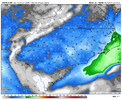
10:1 ratios:
View attachment 191888
My brain agrees with you, but since I began following wx with Dec 2018 I have not been present in the Burg for a snow greater than 1 inch. You'll excuse me for being a little snakebitI think you’re in a great spot. Spartanburg to Charlotte imho is going to feast on the mesolow to the SW, the slowing warm front to your east, and the heavy, efficient banding pivoting over you


Yeah I thought the Euro and AIFS overall increases west to east were notable and important.12z euro is better than 6z. I’m in the dryslot this run but I like the overall look much better.
View attachment 191882
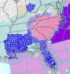
we have a chance to get an inch of snow or more on every single piece of ground in both statesI just came to the realization that every single county, all 146 of them, in North and South Carolina are under a Winter Storm Warning presently. Has this ever happened? Getting all 100 counties warned is hard enough.
January 1988 I believe. If not, this will be a first in my memory.I just came to the realization that every single county, all 146 of them, in North and South Carolina are under a Winter Storm Warning presently. Has this ever happened? Getting all 100 NC counties warned is hard enough.
View attachment 191894
strongly preferred that 78hr look

Its going right over my house perfectlyThat line of snow going north to south in Georgia is wild.
It looks like the only time that has ever happened on record was the February 1899 Great Blizzard, which ironically enough included accumulating Gulf Effect snow in Tampa. The closest that I could find since then was March 1980 when extreme southern SC low country got a trace to a dusting.we have a chance to get an inch of snow or more on every single piece of ground in both states
Big ice storm/mixed precip south of the heavy snow. The Arctic front actually was draped to the Gulf Coast. I don't think at the time there were specific ice storm warnings used in 1988.Even that one was pretty paltry on the direct coastal regions for NC (not that they might've not gotten a Winter Storm Warning still):
View attachment 191897
Ah, that's right. It was a little before my time (I wasn't born until a few years later, hah!). I guess the question mark would be the OBX since you'd think they may stay too warm at the surface for an ice storm if they aren't snowing, but perhaps not!Big ice storm/mixed precip south of the heavy snow. The Arctic front actually was draped to the Gulf Coast. I don't think at the time there were specific ice storm warnings used in 1988.
Icon, canadian,fv3 line up perfect with it. Whole bunch been in lock step since 0z last night
Icon, canadian,fv3 line up perfect with it. Whole bunch been in lock step since 0z last night
It's funny because these kinds of comments are so location specific. For ATL, Canadian is totally different than Icon for example (and NAM/HRRR).
would you put me at them same totals here in liberty scIm gonna be honest. The end of these latest RAP and Hrrr runs are looking rather nice for the upstate. Don't wanna get my hopes up yet, but dang.
Indeed.What's taking @BullCityWx so long to chime in on the new 15z SREF??? Even jucier than prior runs!

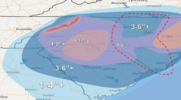
Final Call. Watch hwy 49 corridor and northern, central coastal plain for exceeding expectations.
Said it 2 days ago. Snow hill has its town name for a reason. See Downeast talking about as well. Thats my pick for the max lollipop. Enjoy, long overdue
View attachment 191890
Oh yeahhhh
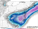
View attachment 191910
4.5" now here from FFC. Double earlierOh yeahhhh
View attachment 191910
That run confused me. The ULL went neutral to almost looking negative to positive in like 4-5 frames.What's taking @BullCityWx so long to chime in on the new 15z SREF??? Even jucier than prior runs!
I would have covered you if I was paying attn. seriously see 5-10 from the escarpment to coastal plain. better shot at 10 further east you go. Then its game on out there. everyone should ring out every morsel of moisture there is , with column so cold. Trick is finding any lifting mechanism. small or large, doesn't matter and it will do the trick. I gotta head up your way this spring/ summer a lot, family stuff. We need to get powerstroke and others , to tee it upI like how you curved that 7 - 12 around my house there, and made sure you left me in the 3 - 6 appreciate that pal. lol
Sent from my iPhone using Tapatalk
They rely way too much on NMB. Which is always a cycle behind.RAH and FFC increasing yet GSP lowered. Hmm
They do? This is a common trend of theirs?They rely way too much on NMB. Which is always a cycle behind.
They only bumped a couple of 2-4 proggs up to 3-5. Not exactly going out on a limb there.They rely way too much on NMB. Which is always a cycle behind.
