• Hello, please take a minute to check out our awesome content, contributed by the wonderful members of our community. We hope you'll add your own thoughts and opinions by making a free account!

Wintry Machine Learning Mauler 1/30-2/1

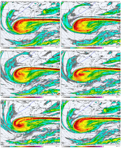
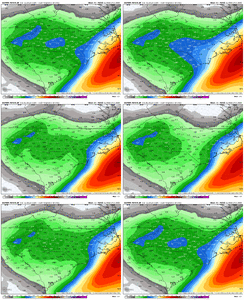
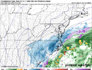
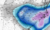
UKMET is similar to the Euros and AI’s. Slightly better for the western folks with the ULL. That’s been solid all day. I don’t have access to the Kuchera map. Paging @RBR71
View attachment 191861
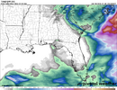
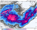
That precip band over ga is crazy. It has liquid totals approaching an inch in the heart of it. Obviously that would equal over a foot lol

1uk.png
 
Imho, elevated warm fronts/warm advection like this is usually the ultimate trump card when it comes to winter storms around here.

Every model just plain sucks at forecasting it, whether that’s AI, traditional models, cams, etc. I’ve learned to always respect it, particularly when I see it in the very short range like this.

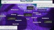
Seeing it this consistently across different models at the moment (even the globals) so close to the event makes me feel like there’s a shot for places around Fayetteville and Raleigh to bust higher on the snow totals depending on where the warm front sets up shop

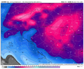
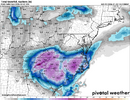
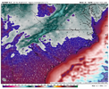
View attachment 191857


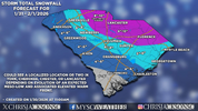
View attachment 191858

View attachment 191859
Eric, Do these things tend to move or migrate or do they just set up over a section and dump?
 
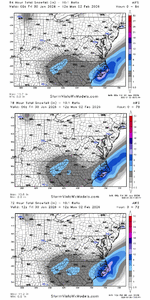
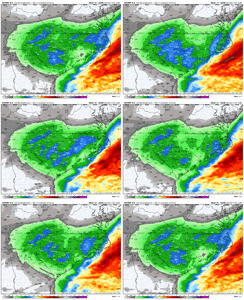
The 4 12z OPs, so far, roughly inline...AI-GFS/GFS/ICON/CMC

All show that PGV jackpot zone...they are best chance to get 10"+. If you wanted to chase....

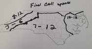
View attachment 191832

A really might be better 20 miles SW from here at the little town of Snow Hill. I am to jaded to believe it just yet though these hi res models have me hoping for 12-18 if it all goes just right.
 
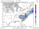
12z AIFS is pretty good. With ratios, this is 5"+ for almost all of NC...This is a much better run than 06z in general (doubled MBY's totals). Of course, 18z will probably be worse since this model has been jumping around big time with QPF. I noticed it really mutes the initial band that comes into N NC on some of the other modeling, which is a little weird.

1769793759146.png
 
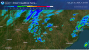
Dry slot is in the triad. Could just as easily jump to the triangle on 18z run. After that we are more or less done with globals imho. Maybe a glance at 0z but that will tell you little at range
 
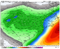
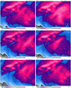
I've plotted every model qpf output for Clemson for a few days now... the mean has went up about .05 since yesterday afternoon which is a good sign.

For the 12z runs: The worst model is at .19(Hrrr) and the best model is at .46(Nam 3k). The mean is .312

As such I'm expecting about 1/3rd of inch of liquid here and expect ratio's to conservatively be around 15:1 yielding about 4.5 inches of snow.

I'd say a floor is 3 inches and the ceiling is around 7 inches.

(Note that Clemson/My area is a relative minima on qpf across several models so most of the upstate is in better shape than this).
 
Sitting atop Newfound Gap at the moment. It’s 29 degrees with the occasional flurries. I have a feeling this place won’t look the same in a few hours….
You’re in one of my favorite spots up there. Would love to see some pics once it gets going
 
I am Charlie Brown sprinting towards the football currently


View attachment 191887

I think you’re in a great spot. Spartanburg to Charlotte imho is going to feast on the mesolow to the SW, the slowing warm front to your east, and the heavy, efficient banding pivoting over you
 
The front end thump will be crucial to those who will be victimized by the dry slot wherever it forms. If it forms out further out towards the western part of NC/SC then chances are better that they will get more snow from the front end thump than if it forms in eastern areas due to the timing of the transfer from the upper level low to the coastal low.
 
Back
Top