foothillscrewzone
Member
The 18Z HRRR might be a doozy since it initializes of the RAP
Nothing falling in Gadsden right nowCurrent radar has a small blob of snow on the Bama/GA line near Gadsden. Whats that about? Im sure its just virga but interesting.
they got me in the 3 to 7 rangeFFC's warning here now is 3 to 5 inches, up from 2 to 4 this morning.
Yet CheerExpo is putting on a Cheer Comp in Gwinnett tomorrow and Sunday and not cancelling?!?! Reached out to that org and they were like "Forecast" for this area been spotty so we are continuing with event. Then you are hamstring into feeling obligated to attend because Team isn't backing out and now looking at booking a nearby Hotel.... Stupidity for sureHad multiple fellow A-List members reach out to me yesterday, which gave me a chance to inform them and urge them to pay attention and prepare. I talked to my ticket rep and told him the way the forecast was trending, I wasn’t planning on attending. Hate it, but they had no choice but to cancel it.
The back and forth kind of tells me, its locking onto the overall large scale players.Interesting that the AIGEFS went in the wrong direction. Better for Ga, worse for almost everyone else.
View attachment 191850
Brad just upped totals
What forecast are they even looking at? These snow ratios are literally similar to Snowmaggedon.Yet CheerExpo is putting on a Cheer Comp in Gwinnett tomorrow and Sunday and not cancelling?!?! Reached out to that org and they were like "Forecast" for this area been spotty so we are continuing with event. Then you are hamstring into feeling obligated to attend because Team isn't backing out and now looking at booking a nearby Hotel.... Stupidity for sure
His primary focus is Charlotte so you have to keep that in mind, however he normally bats a 1000 up and down the I-85 corridorI don't understand is logic over the western upstate/ne ga unless he just hasn't put any thought into it at all. It doesn't match up with any modeling at all.
You mean he doesn’t get emotional over any model run? Could you imagine a MET who screams generational storm one run and the cries it’s all gone the next? The nerve I tell you!His primary focus is Charlotte so you have to keep that in mind, however he normally bats a 1000 up and down the I-85 corridor
I don’t get his logic for central NC. Seems like he is really buying the 1-2 models showing a massive dryslotI don't understand his logic over the western upstate/ne ga unless he just hasn't put any thought into it at all. It doesn't match up with any modeling at all.
Keep in mind it’s not in his viewing area, either. I can plausibly see it happening with a massive dry slot like some modeling shows, although I don’t favor it. Of course, I’m biased!I don’t get his logic for central NC. Seems like he is really buying the 1-2 models showing a massive dryslot
this thing has to transition from land to sea somewhere and unless the ULL traverses all the way to the Carolina coast before making the transition history tells us there will be a minimum somewhereI don’t get his logic for central NC. Seems like he is really buying the 1-2 models showing a massive dryslot
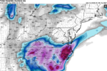
The boom potential is implicitly shown even in areas "dryslotted". What is an unexpected surprise is between Charleston and Myrtle Beach on what looks like an enhanced pocket, possibly deform band. Kuchera method paints a stripe of 12"+ in Eastern Berkeley and Charleston Counties! 8.6" Charleston would beat 1989 (8.0") for the all time record if that occurs!View attachment 191846
RAP is showing what I've been cautiously optimistic will be the case -- with a storm this strong, "dry slot" areas are still gonna pick up a few inches even with the two separate pieces of energy. 4.8 looks to be the LOWEST total across NC, and the footprint shows how that is the area that at certain hours is dry slotted but the rates are high enough when it's hitting that it still turns out v decently.
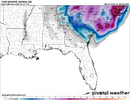
Exactly i thought he always did well forecasting for the upstate which is why i'm surprised. I mean he shows a lot of focus on the carolina coast which is further away than ne ga/western upstate. It doesn't even match the footprint of what the models are putting down. I don't get it.His primary focus is Charlotte so you have to keep that in mind, however he normally bats a 1000 up and down the I-85 corridor
what on earth has that got to do with what we are talking about? This isn't about jumping back and forth between model runs, i don't understand his logic since if the western HALF of the upstate only gets 1 to 3, that would be rather incredible.You mean he doesn’t get emotional over any model run? Could you imagine a MET who screams generational storm one run and the cries it’s all gone the next? The nerve I tell you!
Is the rap model reliable or just meh?The boom potential is implicitly shown even in areas, as in what was an unexpected surprise between Charleston and Myrtle Beach on what looks like an enhanced pocket, possibly deform band. Kuchera method paints a stripe of 12"+ in Eastern Berkeley and Charleston Counties! 8.6" Charleston would beat 1989 (8.0") for the all time record if that occurs!
View attachment 191856
A guess: The AI model is taking what it "knows" from previous events. It sees the two systems and knows that there should be a transfer of energy. Hence, there should be a dry slot. The info it's receiving places the most likely spot as central NC ... which isn't that unusual. So, to AI, the solution is cut and dried -- literally.Gary trolling View attachment 191852
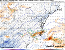
I haven't really used it too much honestly. About to find out how it ends up doing for future reference. I'm sure some pros can answer that question of how useful it is or not.Is the rap model reliable or just meh

Thats yesterdays 12z run...it hasn't updated on WB since then.Interesting that the AIGEFS went in the wrong direction. Better for Ga, worse for almost everyone else.
View attachment 191850
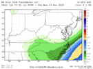
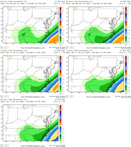
I think this is an uptick for central NC from the 00z run, at least.UKMET is similar to the Euros and AI’s. Slightly better for the western folks with the ULL. That’s been solid all day. I don’t have access to the Kuchera map. Paging @RBR71
View attachment 191861
