-
Hello, please take a minute to check out our awesome content, contributed by the wonderful members of our community. We hope you'll add your own thoughts and opinions by making a free account!
You are using an out of date browser. It may not display this or other websites correctly.
You should upgrade or use an alternative browser.
You should upgrade or use an alternative browser.
Pattern January Joke
- Thread starter SD
- Start date
NCHighCountryWX
Member
- Joined
- Dec 28, 2016
- Messages
- 699
- Reaction score
- 1,918
LukeBarrette
im north of 90% of people on here so yeah
Meteorology Student
Member
2024 Supporter
2017-2023 Supporter
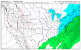
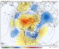
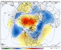
If you like cold and dry, this Euro run belongs in the hall of fame
That part has been a repeating theme this fall/winter. Things seem to dampen out from the earlier forecasts. is it the nina?If you like cold and dry, this Euro run belongs in the hall of fame
That's not a really suppressive look to me. Imagine if we had an active STJ. But we don't. Thanks La Nina. I've heard too many in the SE start saying they prefer La Nina lately. This La Nina was tired of hearing that and decided to show us why they suck.Just stupid cold & dry. View attachment 182509
accu35
Member
Does anyone have EPS panels for storm #1 #2? I know the Euro was dry but seeing if the ens follow
Can someone please post the model skill score chart? I'm sure it shows the Euro leading as usual.
i believe it goes euro/eps, graphcast/weathernext, AIFS/AI EPS on H5 scores at the momentCan someone please post the model skill score chart? I'm sure it shows the Euro leading as usual.
CNCsnwfan1210
Member
i believe it goes euro/eps, graphcast/weathernext, AIFS/AI EPS on H5 scores at the moment
I believe the graphcast is the same thing or built off of the AI GFS, someone correct me if I’m wrong.
Sent from my iPhone using Tapatalk
That is not the case as far as I am aware. believe the AI GFS is similar to the AIFS in that it is a ML model run off of GFS initial condition. graphcast/weathernext is google's dealI believe the graphcast is the same thing or built off of the AI GFS, someone correct me if I’m wrong.
Sent from my iPhone using Tapatalk
CNCsnwfan1210
Member
That is not the case as far as I am aware. believe the AI GFS is similar to the AIFS in that it is a ML model run off of GFS initial condition. graphcast/weathernext is google's deal
Ok thanks, yeah I forgot Google had their hand in the model jar.
Sent from my iPhone using Tapatalk
This is the point where all models lose the storm!!! It’ll be back on Tuesdays runs young grasshopperBoth system dried up
Just stupid cold & dry. View attachment 182509
That 12Z Euro 360 hour map has about as much chance of verifying closely as I have to win the lottery. Almost 200 hours earlier (at 168) it’s not even consistent with its own prior runs’ day 7!
I wouldn’t be upset if op runs were to go back to stopping at 240. Once past day 7 (and likely before), the ensemble means start having much higher credibility and even they sometimes struggle at just day 7.
Last edited:
Clippers workJust stupid cold & dry. View attachment 182509
But @JHS said we were going to back into the 70s!?!Just stupid cold & dry. View attachment 182509
CNCsnwfan1210
Member

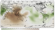
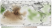
I like the Euro MJO progression into phase 7 MLK week and then phase 8 after that.
Sent from my iPhone using Tapatalk
Does anyone have EPS panels for storm #1 #2? I know the Euro was dry but seeing if the ens follow
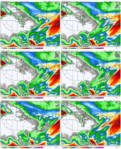
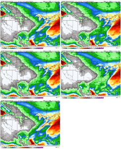
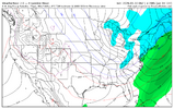
I have the 12Z EPS panels for the combined 2 storms. This is another reason to take the major hit (3-4”) of storm #2 on the 12Z GFS for esp. N AL and N GA with a big grain as I can find only 3 members (6%) (7, 41, and 46) with widespread 2”+ S of the TN/GA border:
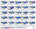
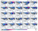
Op euro wasn't overly bad through day 16, I would assume the eps members have a lot of action through their run. Likely to have some crazy cold members in the day 12-15 range too
I counted at a minimum 16-17 hits off eps for triad. Most ive seen by far, significant increase.. Thanks for posting
They always play it safe so they don’t look bad. No different than watching local news. Forecast the same even in the spring and summer. Always safeOfficial Guidance from NWS GSP
KEY MESSAGE #1: CONFIDENCE REMAINS LOW ON THE POTENTIAL FOR WINTER PRECIP
THE PATTERN SHOULD BEGIN TO AMPLIFY MID-WEEK AS SUCCESSIVE Z500
SPEED MAXXES DIP OUT OF CENTRAL CANADA INTO THE MIDWEST...RESULTING
IN THE DEVELOPMENT OF A DEEP, ELONGATED TROUGH EASING INTO THE OHIO
VALLEY LATE WEDNESDAY. THE ASSOCIATED SURFACE PATTERN WILL BE QUITE
COMPLEX, WITH A BAROCLINIC ZONE DEVELOPING JUST EAST OF THE FORECAST
AREA ON WEDNESDAY AFTERNOON, AND A DISTINCT COASTAL FRONT SETTING UP
ALONG THE NC-SC COASTLINE. THE TROUGH WILL FIRST INTERACT WITH THE
BAROCLINIC ZONE TO OUR WEST, PRODUCING AN OPEN WAVE (OR PERHAPS, AS
IN SOME GEFS SOLUTIONS, A CLOSED LOW) ALONG THE FRONTAL BOUNDARY AS
IT PUSHES INTO THE WESTERN CAROLINAS. ACTIVATION OF THE COASTAL
FRONT WON'T TAKE PLACE UNTIL LATER - WEDNESDAY NIGHT OR EARLY
THURSDAY, AT WHICH POINT RAPID CYCLOGENESIS IS STILL EXPECTED TO
TAKE PLACE.
THE RESULT, UNFORTUNATELY, IS A HIGHLY-UNCERTAIN FORECAST SCENARIO.
ON THE ONE HAND, THE FIRST LOW LOOKS AN AWFUL LOT LIKE A TYPICAL
CLIPPER LOW; INDEED, THE OPERATIONAL GFS AND ECMWF BOTH DEPICT
PRECIPITATION ASSOCIATED WITH THE ADVANCING TROUGH ESCAPING THE
NORTHERN BLUE RIDGE AND EXPANDING INTO THE NC FOOTHILLS AND UPPER
PIEDMONT. HOWEVER, THE PRESENCE OF THE COASTAL FRONT PRESENTS A
UNIQUE COMPLICATING FACTOR: UNDER NORMAL CIRCUMSTANCES, THE MOISTURE
NEEDED TO PRODUCE PRECIP OUTSIDE THE MOUNTAINS WOULD NEED TO COME
FROM THE ATLANTIC, BUT THE COASTAL FRONT SHOULD FUNCTION ESSENTIALLY
AS A MOISTURE SINK...KEEPING MUCH OF THAT MOISTURE FROM MAKING IT
FAR ENOUGH WEST TO IMPACT US. SUCH A DRIER SOLUTION IS DEPICTED IN
THE OPERATIONAL GDPS, AS WELL AS MANY OF THE CMC-GEPS ENSEMBLE
MEMBERS. THE GOOD NEWS IS THAT WHATEVER PRECIPITATION DOES DEVELOP
SHOULD BE TEMPERATURE-DEPENDENT RAIN OR SNOW - WITH LITTLE IF ANY
POTENTIAL FOR ICE BASED ON CURRENT MODEL
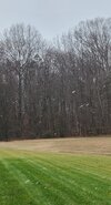
Lol. Snowing Graupel ole back yard
Yeah, I mean it’s better than what we have now with having to get something to dig super deep to get it cold enough / and in the right spot for precipOp euro wasn't overly bad through day 16, I would assume the eps members have a lot of action through their run. Likely to have some crazy cold members in the day 12-15 range too
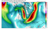
Cold TPV is going to want to work south down into central and eastern Canada. Biggest question is do we get renewed ridging along / off the west coast. If yes, we should have that conus wide bowl trough look with high pressure up top, with big north to south temperature gradient. If no, it’s mostly too warm
Tropical forcing / MJO would favor the renewed western ridging. EAMT (-) would favor us not seeing it
Makeitsnow
Member
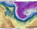
Quite cold shot coming with it too.If you've enjoyed tracking system #1 and believe in dejavu, I present to you the 12Z UKMET:View attachment 182521
It's been the trend since the end of the summer. We have no moisture anymoreIf you like cold and dry, this Euro run belongs in the hall of fame
packfan98
Moderator
Yeah, crazy little snow squall here. Wasn’t on my bingo card for today.
a_gilmore88
Member
Charlotte and upstate SC are never getting snow again. Not really worth tracking or getting worked up about anymore
It does feel this way. If one thing isn’t the issue, it’s another. Years ago, the threats were plentiful and we hit on at least one, usually multiple, every year. I don’t really understand what’s changed.
Sure enough. In fact, 850's are solidly below freezing the entire time post-system#1.
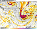
If we have to go through the next week with a dominant northern stream, I don't hate this look.
View attachment 182528
I’m just loving the cold. Better for outdoors. The 82F record high was enough warmth for awhile!
NCWeatherNow
Member
I saw snow in HP
NBAcentel
Member

