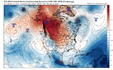
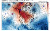
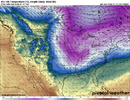
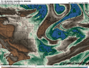
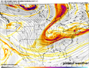
That's about how 96 rolled best sleet event of my lifeThis one of the most insanely cold modeled CADs I’ve ever seen View attachment 182547View attachment 182548
-
Hello, please take a minute to check out our awesome content, contributed by the wonderful members of our community. We hope you'll add your own thoughts and opinions by making a free account!
You are using an out of date browser. It may not display this or other websites correctly.
You should upgrade or use an alternative browser.
You should upgrade or use an alternative browser.
Pattern January Joke
- Thread starter SD
- Start date
NBAcentel
Member
I didn’t zoom in but should have known where you are. We have fescue looking good even in the cold here. Just fertilized last week. Needs a blanket of snow!!Its rye grass over bermuda. Yard stays green 101/2 months out of year. May into early June is rough as rye dies out and bermuda waits on sultry nights to appear.bermuda disappears mid sept and I throw out the rye. No fertilizer, pre emergent etc. Spend about 300 a year now, use to be cheaper / seed = $$.
My apologies. Id respond to this in banter, but dont know how
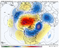
Can't hate this to be honest. Suppression isn't a concern but shearing of vorticity or over amping may beThese random OP runs with extremely cold air isn’t to far fetched to me though, I mean look how much red is in the Arctic… lotta bathtub sloshing going on there. Just don’t know if we sync up moisture (doubtful) View attachment 182551
Xlhunter3
Member
Gfs op #1 puts a good lick on SE VA and NE NC.
#2 one frame of snow shower in northern NC east of Apps.
Mtns rack up both still.
#2 one frame of snow shower in northern NC east of Apps.
Mtns rack up both still.
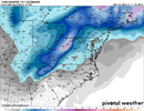
Crazy changes for system 2 on the GFS
View attachment 182550
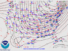
If we could just get that trough axis west.
 I
IXlhunter3
Member
By MLK day, we will have another opportunity in front us regardless of these next two timeframes working out or not. Just my take.
Hard to imagine with as much energy as what we’re seeing, that we don’t at least see some convective snow showers for a lot of us on Thursday.
What ingredient will we be missing then I wonder.By MLK day, we will have another opportunity in front us regardless of these next two timeframes working out or not. Just my take.
HailCore
Member
My guess is that as soon as short range models get a handle on this system, there will be. Not necessarily crazy convection, but a few flurries and snow showers will certainly form at the minimum across much of the region where enough moisture and cloud cover exist.Hard to imagine with as much energy as what we’re seeing, that we don’t at least see some convective snow showers for a lot of us on Thursday.
wow
Member
That's the one. It's mine. I'm calling it.Corn casserole. View attachment 182562
That's a classic.Corn casserole. View attachment 182562
rburrel2
Member
Man… all of a sudden the gfs and gfs ai both have monster biblical cold cad storms at the same time around 282hrs out. Absolute perfect wide goal post set up. If we can get that large scale look inside day 10 we’re set.
rburrel2
Member
FYI, not writing off system 2 yet. This is the range where they like to dry out… only to come back to life later on. We have the cold, just need our qpf back.
And the cold after that is very impressive. The day after this, highs in the NC Piedmont are 15-20 and lows that night 0-5. No one gets above freezing for about 84 hoursCorn casserole. View attachment 182562
HailCore
Member
Man I wish… but this winter has had too many of these threats showing up close to 300 hours out and disappearing. Heck, this storm threat for the MLK timeframe is inside 200 hours and now it may or may not happen. Maybe we can work one of these with the more favorable pattern shift though…Man… all of a sudden the gfs and gfs ai both have monster biblical cold cad storms at the same time around 282hrs out. Absolute perfect wide goal post set up. If we can get that large scale look inside day 10 we’re set.
LukeBarrette
im north of 90% of people on here so yeah
Meteorology Student
Member
2024 Supporter
2017-2023 Supporter
LukeBarrette
im north of 90% of people on here so yeah
Meteorology Student
Member
2024 Supporter
2017-2023 Supporter
View attachment 182566
Euro coming in now, not great initially
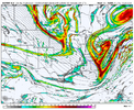
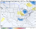
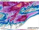
What am I looking at? Congrats Toronto???
NBAcentel
Member
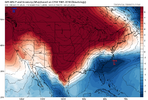
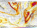
Anomalously strong western ridge (record breaking in certain parts) and we still can’t pull a cutoff low or load a trough base into the SEHot dog water. View attachment 182570
I only just realized this amazing GFS storm was for the following weekend (300+hrs away) and not for the MLK day storms we were tracking. I’m dumb. And now, mad.It's beautiful. If only...View attachment 182568
You know, if the first system doesn't scour everything, it may help system number 2 do something.
trackersacker
Member
What sucks about this too is I feel like the kicker is just absorbing this thing and not allowing it to phase properly and the kicker isn’t even doing anything specialHot dog water. View attachment 182570
Cad Wedge NC
Member
Well, 280 hours...... Not 300+ That's a little better.I only just realized this amazing GFS storm was for the following weekend (300+hrs away) and not for the MLK day storms we were tracking. I’m dumb. And now, mad.
trackersacker
Member
Ok I’m gonna try and make myself feel better right now and acknowledge that the end of that Euro run did look more interesting with trying to get some energy going to our southwest
NCHighCountryWX
Member
- Joined
- Dec 28, 2016
- Messages
- 699
- Reaction score
- 1,918
I swear. Bury me in Banner Elk. Or scatter my ashes
Cad Wedge NC
Member
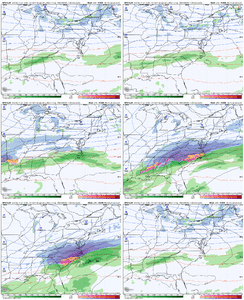
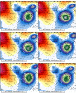
This hobby is not for the faint of heart. Don't worry about it.... most of us are in the same boat. We will hold on until the bitter end before we will let a threat go. One thing we have learned over the years is that things change quickly. Sometimes for the better and sometimes not. The challenge is to keep a level head.System #2 isn't that far off from at least a light overrunning event for the deep south. Yes, I don't know when to quit!
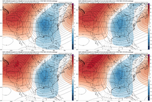
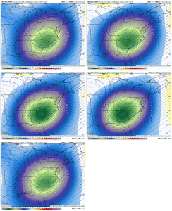
View attachment 182572View attachment 182573View attachment 182574
iwantsouthernsnow123
Member
Don't we all love these types of systems that feel like it's one 50-100 mile SW shift to being an all out southern winter storm.
Instead we're likely to get stuck with Toronto, Canada stealing our chance.
Instead we're likely to get stuck with Toronto, Canada stealing our chance.

