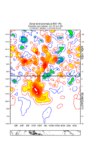
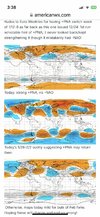
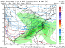
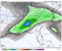
No we're not done with cold weather. I do wonder how we introduce moisture into this pattern and it be any different that what we've had? @JHS finally got his 2016 repeat. Except this time it didn't stop when Dec rolled around. I can't remember a winter this dry in at least 15 years. Regardless of eastern troughing I just can't see how we shake this endless pattern of fast flow northern stream clipper type stuff that will not workNot to be that guy but the forcing regime in early February supports EC troughing after a late Jan warmup…. Probably not done with missed opportunities View attachment 182529View attachment 182530
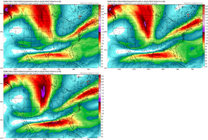
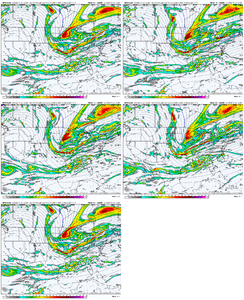
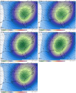
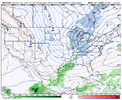
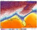
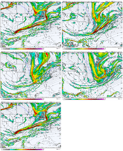
You can already see the jet extension showing up in response, and once again a western ridge View attachment 182531View attachment 182532
-
Hello, please take a minute to check out our awesome content, contributed by the wonderful members of our community. We hope you'll add your own thoughts and opinions by making a free account!
You are using an out of date browser. It may not display this or other websites correctly.
You should upgrade or use an alternative browser.
You should upgrade or use an alternative browser.
Pattern January Joke
- Thread starter SD
- Start date
accu35
Member
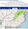
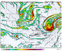
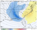
CMC has this look with the northern stream at this time frame. Clipper?If we have to go through the next week with a dominant northern stream, I don't hate this look.
View attachment 182528
That was cool. Poured graupel for about 5 minutes.
You should take it with a big grainOp euro wasn't overly bad through day 16, I would assume the eps members have a lot of action through their run. Likely to have some crazy cold members in the day 12-15 range too
It did it, that cloud that passed over spit out about 18 flakes.
#winning
 ️
️
Sent from my iPhone using Tapatalk
#winning

 ️
️Sent from my iPhone using Tapatalk
Not enough rain grain yield is downYou should take it with a big grain
HailCore
Member
JHS
Member
We have to go back to 1986 to find a winter like this. The spring and summer that year got real ugly too with hot and dry weather. We were the top news story some evenings that summer because of it and I'm expecting this summer to be worse than that one unless things change.No we're not done with cold weather. I do wonder how we introduce moisture into this pattern and it be any different that what we've had? @JHS finally got his 2016 repeat. Except this time it didn't stop when Dec rolled around. I can't remember a winter this dry in at least 15 years. Regardless of eastern troughing I just can't see how we shake this endless pattern of fast flow northern stream clipper type stuff that will not work
Webberweather53
Meteorologist
Some thoughts on Thursday: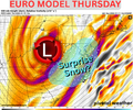
This setup looks great for snow in the mountains, BUT it does present the chance for at least some flakes in the Mid-Atlantic east of the Appalachian chain.
Pros:
- Strong vort max at 500mb
- Abundant diffluence aloft
- Favorable downsloping QG forcing
In normal terms all of these things are favorable for some snow to make it over the mountains.
The big con is the cold air isn't already in place, but that can be overcome with a stout upper level low like the one that will be present.
It's one of those setups that most wont see flakes outside of the mountains, but someone could easily see a surprise event depending on the specifics as we get closer.
NCHighCountryWX
Member
- Joined
- Dec 28, 2016
- Messages
- 699
- Reaction score
- 1,918
Snow would be nice, but just rain would be good too. Because this is my biggest fear.We have to go back to 1986 to find a winter like this. The spring and summer that year got real ugly too with hot and dry weather. We were the top news story some evenings that summer because of it and I'm expecting this summer to be worse than that one unless things change.
Though it’s crazy what yesterday’s rain did for Lake Allatoona.
Just hope that wasn’t a freak rain storm. Cuz this drought’s gotta go! Do not want a long hot, dry summer without storms like 1986.
What was the Enso that year? Were we going from a La Nina to El Nino? I'm hoping that saves us this yearWe have to go back to 1986 to find a winter like this. The spring and summer that year got real ugly too with hot and dry weather. We were the top news story some evenings that summer because of it and I'm expecting this summer to be worse than that one unless things change.
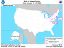
I will retract my trip to Gatlinburg.NOAA has retracted the previously further south risk of heavy snow for the 19th timeframe from the southern apps further north View attachment 182533
Webberweather53
Meteorologist
What was the Enso that year? Were we going from a La Nina to El Nino? I'm hoping that saves us this year
Yeah we entered into a moderate El Niño in 1986. That was the first El Niño event we successfully forecasted after being completely off guard in 1982-83.
Fescue looking good
Possibly. Of course, I'm hoping for something more. Preferably, the January version of 03/02/09CMC has this look with the northern stream at this time frame. Clipper?
As unlikely as it may be, that UKMET run wasn't too far from something crazy.
Been sunny here all dayIt did it, that cloud that passed over spit out about 18 flakes.
#winning️
Sent from my iPhone using Tapatalk
Pretty sure thats just because the 19th is past the range for both storms down there.NOAA has retracted the previously further south risk of heavy snow for the 19th timeframe from the southern apps further north View attachment 182533
Think very similar to now. At high level anyway. Weak La Niña transitioning to El Niño.What was the Enso that year? Were we going from a La Nina to El Nino? I'm hoping that saves us this year
Cad Wedge NC
Member
Yes, you are correct. That forecast is not for the short term.Pretty sure thats just because the 19th is past the range for both storms down there.
iwantsouthernsnow123
Member
Regarding the first system. I'd keep an eye on the trend of potentially losing the ULL to a more zonal look. This could be both a good or a bad thing as long as the initial trough doesn't turn zonal. Noticeable on some medium ranged models as we get closer to the shorter range. Zonal look could maybe make it easier to dive into the initial trough in time but not certain if that'll happen.
iwantsouthernsnow123
Member
RRFS run coming in, appears to kinda be suggesting this. NAM, GDPS, RGEM, and I believe UKMET although not 100% sure if UKMET was doing that or not tries to do this new look.Regarding the first system. I'd keep an eye on the trend of potentially losing the ULL to a more zonal look. This could be both a good or a bad thing as long as the initial trough doesn't turn zonal. Noticeable on some medium ranged models as we get closer to the shorter range. Zonal look could maybe make it easier to dive into the initial trough in time but not certain if that'll happen.
NBAcentel
Member
The initial GFS/GFSAI looks better for numero 1
packfan98
Moderator
Good! The ICON had nothing.The initial GFS/GFSAI looks better for numero 1
packfan98
Moderator
NBAcentel
Member
Its rye grass over bermuda. Yard stays green 101/2 months out of year. May into early June is rough as rye dies out and bermuda waits on sultry nights to appear.bermuda disappears mid sept and I throw out the rye. No fertilizer, pre emergent etc. Spend about 300 a year now, use to be cheaper / seed = $$.Fescue looking good
My apologies. Id respond to this in banter, but dont know how
ChattaVOL
Member
When are we getting a thread for Wednesday nights and this coming weekends event?
Sent from my iPhone using Tapatalk
Sent from my iPhone using Tapatalk
LukeBarrette
im north of 90% of people on here so yeah
Meteorology Student
Member
2024 Supporter
2017-2023 Supporter
packfan98
Moderator
Everything is going well here for now, don’t you think? I don’t see a reason to separate anything out at this point.When are we getting a thread for Wednesday nights and this coming weekends event?
Sent from my iPhone using Tapatalk
NBAcentel
Member
JHS
Member
North GA is in better shape now than in 1986 after this last event, but we all still need a lot more rain. As for SC and NC the fact that the mountains got hit good helps some as far as river and lake levels go, but we really need rain to fall over all of both states and back in GA too.Snow would be nice, but just rain would be good too. Because this is my biggest fear.
Though it’s crazy what yesterday’s rain did for Lake Allatoona.
Just hope that wasn’t a freak rain storm. Cuz this drought’s gotta go! Do not want a long hot, dry summer without storms like 1986.
packfan98
Moderator
NBAcentel
Member
packfan98
Moderator
LukeBarrette
im north of 90% of people on here so yeah
Meteorology Student
Member
2024 Supporter
2017-2023 Supporter
Long range has trended colder...

