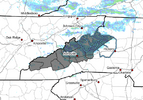
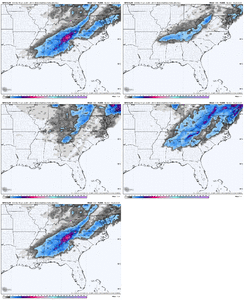
For you, it’s a ZedonkZebra stripe surface depiction for storm 2. Not sure I’ve seen this before View attachment 182411
NAM has been good this year for storms up here, even the long ranges, line really good!
For you, it’s a ZedonkZebra stripe surface depiction for storm 2. Not sure I’ve seen this before View attachment 182411

Much stronger surface low as a result!S/W was a little deeper moving across TX for the second system FWIW
Sent from my iPhone using Tapatalk
For what reason? This isn't to disagree, to be clear, just a newbie trying to learn
it's been consistentThis seems like a pretty extreme solution. So, take with a humongous grain:
View attachment 182453
Kuchera is much more accurate than snow depthSnow depth
View attachment 182457
Gives me January 28, 2014 vibesThis Kuchera is slightly more realistic:
View attachment 182456
For what reason? This isn't to disagree, to be clear, just a newbie trying to learn

Miami? lolFootprint wise, the 12z GFS verbatim gets about 90% of the board with some action between storm 1 and 2.
View attachment 182463
View attachment 182464
Thank you!I’m talking about taking the heavy amounts with a humongous grain. Because:
-It’s the GFS out a week
-Other models have much less
-It’s an unusual setup to get heavy snow. These amounts are more typically what you’d see with a Miller A low and one that skims Gulf coast or crosses N or C FL
-Prior GEFS runs had few members with this much. Let’s see what 12Z shows.
-GFS itself is jumping all around:
View attachment 182462
Just mean it's been consistent on a storm for some of us. Of course the amount/timing and exact location changes some, but it hasn't backed off.It hasn’t at all been consistent on amounts. See gif below.
Regardless, even it if had been consistent, it’s the 7 day GFS that strongly disagrees with other models, including better ones.
View attachment 182466
Coming down decent up in Avery County atm. Grandfather Mtn.Lol it's snowing
