• Hello, please take a minute to check out our awesome content, contributed by the wonderful members of our community. We hope you'll add your own thoughts and opinions by making a free account!

Pattern January Joke

We should be chasing southern stream activation instead of cold this year. I know we need cold for winter storms and cold always comes first, but man we need any moisture we can get. It hasn’t rained consistently in the Carolina’s since July and almost the entire southeast/east coast is in some level of drought. Cold/warm whatever upper air pattern develops, dry remains the theme. Until that changes we are just chasing cooler temps, not snow. If it can’t even rain I don’t know why we think it could snow in this pattern

 
We should be chasing southern stream activation instead of cold this year. I know we need cold for winter storms and cold always comes first, but man we need any moisture we can get. It hasn’t rained consistently in the Carolina’s since July and almost the entire southeast/east coast is in some level of drought. Cold/warm whatever upper air pattern develops, dry remains the theme. Until that changes we are just chasing cooler temps, not snow. If it can’t even rain I don’t know why we think it could snow in this pattern

Greensboro has only had 10 inches total of rain and some change since late July 2025.

Time for the snap back theory. Preferably starting next week through March as the Modeled Cold air shows up. Kill 2 birds with one stone.
 
We should be chasing southern stream activation instead of cold this year. I know we need cold for winter storms and cold always comes first, but man we need any moisture we can get. It hasn’t rained consistently in the Carolina’s since July and almost the entire southeast/east coast is in some level of drought. Cold/warm whatever upper air pattern develops, dry remains the theme. Until that changes we are just chasing cooler temps, not snow. If it can’t even rain I don’t know why we think it could snow in this pattern


Yeah seriously we had one of the wettest years on record til about August and ever since it's just been ridiculous. Totally stopped. It rained for 15 minutes the other morning and you would have thought it was snowing with all the excitement about it. It was kind of pathetic. I'm with you... All the people here keep asking for snow and I'm like if we don't get rain we're gonna have bigger problems

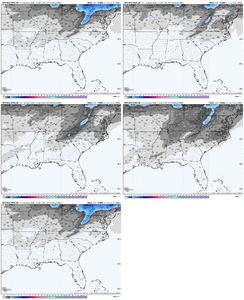
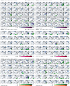
Maybe that's why the Euro had no precip despite a near perfect setup otherwise

Cold and dry coming 😭
 
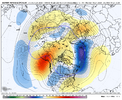
102a58ed5a9103ea61a24417649d811f.jpg

Eric, can you explain this morning’s vp chart?


Sent from my iPhone using Tapatalk
 
Im not onboard with the “it’s dry so it won’t snow” theory bc in the last 5 years I vividly remember wet winters when we thought “well it’s gotta snow a lot at some point” and it didn’t. So I’d like to think the recent dry spell isn’t necessarily a dealbreaker on its own here
 
I’m starting to think we are going to be dealing with a winter Npac ridge until the end of time.

Oh well…at least we don’t have to watch the Chiefs in the SB this year. 🎉

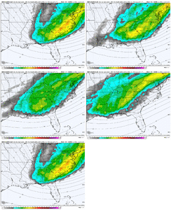
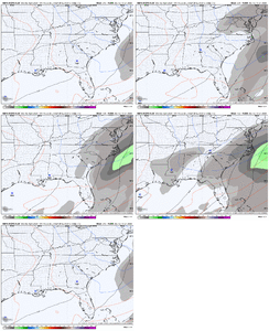
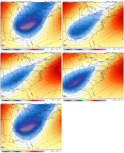
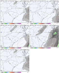
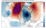
View attachment 181199View attachment 181200
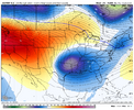
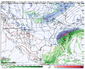
Yeah, this is very concerning. This evolution has been a long-term feature for days on all ensembles. Hopefully, before the PNA mean retrogrades, we will get a significant amplification, similar to the 6Z GFS, before this happens.
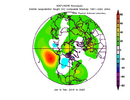
1767621185426.png
 
Im not onboard with the “it’s dry so it won’t snow” theory bc in the last 5 years I vividly remember wet winters when we thought “well it’s gotta snow a lot at some point” and it didn’t. So I’d like to think the recent dry spell isn’t necessarily a dealbreaker on its own here
Doesn’t matter to me either way. You can’t even enter the chat room if it’s not cold
 
102a58ed5a9103ea61a24417649d811f.jpg

Eric, can you explain this morning’s vp chart?


Sent from my iPhone using Tapatalk

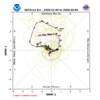
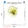
Legit MJO event emerging into the West Pac to couple with the low frequency state (I.e. a very warm tropical pacific). I hope you like North Pacific blocking & +TNH patterns, because you’re gonna see a lot of that coming up
 
Looking at the bigger picture of the 100% of -ENSO -PNA Decs since 1983-4 that switched to a +PNA for Jan: none of them did what the ensemble means are showing, which is a 6-7 day long +PNA that starts Jan 9-10 but unfortunately then turns back to a -PNA for the rest of the runs. That would seal the deal for no +PNA for Jan as a whole, which obviously is not at all what I would want to see and would be a first for -ENSO since 1983-4.

So, either the ensemble means very soon change their tune for 1/16+ to not go back toward a -PNA or the chance of getting a +PNA Jan is “cooked” using the term many of you guys like to use. Being that 1/16 is still 11 days out and considering the -PNA model bias, there’s still time for that to change. But if we don’t see this start to change within the next few days, the chance of getting a +PNA Jan will drop dramatically.

Edit: NG is way down this morning (-6%).
 
Last edited:
So, unless the +PNA hangs on instead of switching back within a week like the ensembles show, we’d likely not end up with a BN Jan.

But we can still look ahead to Feb., which has some encouraging signs:

1. There are long range model progs that the MJO will be headed into 8 near the start of Feb:
IMG_6752.png
IMG_6751.png

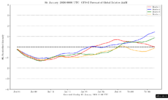
2. Though the CFS AAM outlook often jumps around and thus can’t be trusted, the latest does have a reversal to an El-Ninoish +AAM very late in Jan.
IMG_6750.png

3. Webb is now optimistic about Feb.
 
Last edited:
Looking at the bigger picture of the 100% of -ENSO -PNA Decs since 1983-4 that switched to a +PNA for Jan: none of them did what the ensemble means are showing, which is a 6-7 day long +PNA that starts Jan 9-10 but unfortunately then turns back to a -PNA for the rest of the runs. That would seal the deal for no +PNA for Jan as a whole, which obviously is not at all what I would want to see and would be a first for -ENSO since 1983-4.

So, either the ensemble means very soon change their tune for 1/16+ to not go back toward a -PNA or the chance of getting a +PNA Jan is “cooked” using the term many of you guys like to use. Being that 1/16 is still 11 days out and considering the -PNA model bias, there’s still time for that to change. But if we don’t see this start to change within the next few days, the chance of getting a +PNA Jan will drop dramatically.

Edit: NG is way down this morning (-6%).
Can someone please tell me what in the world Nat Gas has to do with everything? I hear this all the time & I don't have a clue about it. I mean I can pick up on the basics. Warm temps makes it go down, cold makes it go up..

But do people actually give that weight in the long range forecast? Not being sarcastic here.. Genuine question.
 
Back
Top