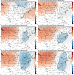
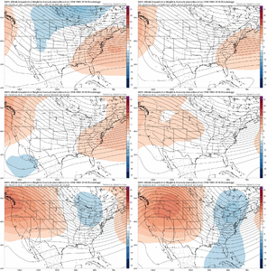
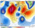
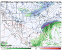
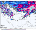
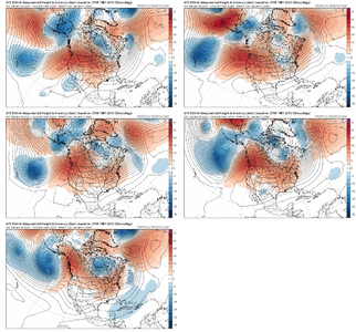
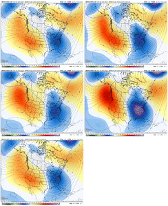
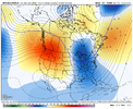
Do you think we are washed for January?My guess is the GEFS is picking up on another big subseasonal push towards El Niño in Feb, much like the weeklies are.
That is honestly pretty on brand for El Niño onset years and makes some sense to me. We usually see a nice surge in westerly wind burst activity in Feb-Mar, which is also the time of the year when the MJO is most active
-
Hello, please take a minute to check out our awesome content, contributed by the wonderful members of our community. We hope you'll add your own thoughts and opinions by making a free account!
You are using an out of date browser. It may not display this or other websites correctly.
You should upgrade or use an alternative browser.
You should upgrade or use an alternative browser.
Pattern January Joke
- Thread starter SD
- Start date
Webberweather53
Meteorologist
Do you think we are washed for January?
No.
NCHighCountryWX
Member
- Joined
- Dec 28, 2016
- Messages
- 699
- Reaction score
- 1,918
trackersacker
Member
NCWeatherNow
Member
Are they the ones that predicted above average snowfall for NC?
NBAcentel
Member
Sounds like backpedaling to me! Pretty sure last week he said ignore the torch or it would only be a few short days and now he’s seemed to have pushed back to “ possible “ changes in the end of January
CNCsnwfan1210
Member

Classic roller coaster temp forecast from my tempest wx station
Sent from my iPhone using Tapatalk
Does the onset of el nino for 2026, mean we can get some stj rains, benefits Feb into spring? Or do we have to wait till next fall, winter to reap the qpf rewards?
CNCsnwfan1210
Member


In today’s SPV news, the 12z Euro has the stretched polar vortex over eastern NA 1/13-1/16 and by 1/18 it scoots the SPV off into the western Atlantic. Keep in mind though, just as these ridges over the eastern US have trended to troughs, the same thing is happening with the SPV in the long range with the vortex trending back westward in the medium range.
Sent from my iPhone using Tapatalk
trackersacker
Member
No. They’ve talked about the idea of a warmup for weeks for that timeframe. You gotta learn to pay attention before you make wrong accusations like that.Sounds like backpedaling to me! Pretty sure last week he said ignore the torch or it would only be a few short days and now he’s seemed to have pushed back to “ possible “ changes in the end of January
Euro suite looked fine as an overall progression.
trackersacker
Member
I believe their analogs did have slightly above average snowfall yesAre they the ones that predicted above average snowfall for NC?
trackersacker
Member
GFS AI was a solid run. Lot of digging. Lot of energy.
PNA trying to do a thing here on the GFS. Beginning of a tide change?
LukeBarrette
im north of 90% of people on here so yeah
Meteorology Student
Member
2024 Supporter
2017-2023 Supporter
trackersacker
Member
Iceagewhereartthou
Member
Yeah getting snow all the time would suck. It's so much better to live in a place that can't even luck into it.When I lived in Yancey County I hated it. It would snow and inch or 2 then melt in between squalls when the sun came out. Then snow another inch, then the wind would blow it away. Almost always powdery, not good for snowmen, snowballs etc.
I like to see the pretty greens and blues over the east, but I'm not sure we're all aligned around what is best/proper to look at wrt the stratosphere stuff. Is it the temps? The temp anomalies? The height anomalies? At 50 mb? 10 mb?


In today’s SPV news, the 12z Euro has the stretched polar vortex over eastern NA 1/13-1/16 and by 1/18 it scoots the SPV off into the western Atlantic. Keep in mind though, just as these ridges over the eastern US have trended to troughs, the same thing is happening with the SPV in the long range with the vortex trending back westward in the medium range.
Sent from my iPhone using Tapatalk
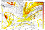
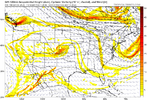
Did you see that southern stream wave fly in? Crossed Cabo San Lucas with origins out of the South PacificView attachment 181130
Energy will fly around confirmed
CNCsnwfan1210
Member


Just out of shear curiosity and from the “nobody cares about the CMC ensemble” files, there were a few members that had some overrunning events, CAD, and some coastal action on the 12z run around 1/19-1/20.
Sent from my iPhone using Tapatalk
CNCsnwfan1210
Member
I like to see the pretty greens and blues over the east, but I'm not sure we're all aligned around what is best/proper to look at wrt the stratosphere stuff. Is it the temps? The temp anomalies? The height anomalies? At 50 mb? 10 mb?
This just indicates a stretched SPV and the colder core is over eastern NA during that time period. Basically one of the avenues for cold air delivery.
Sent from my iPhone using Tapatalk
rburrel2
Member
The gfs ai ensemble mean will really knock your socks off. Can’t draw it up any better.GFS AI was a solid run. Lot of digging. Lot of energy.
A solid GFS run. Almost had a Winter Storm at the end.
CNCsnwfan1210
Member
Man, that’s starting to line with the EPS and Euro OP too.
Sent from my iPhone using Tapatalk
tennessee storm
Member
Almost ?A solid GFS run. Almost had a Winter Storm at the end.
trackersacker
Member
The only thing I believe in the gfs for is that it will be released 4 times a day! Other than that, nothing!
packfan98
Moderator
LukeBarrette
im north of 90% of people on here so yeah
Meteorology Student
Member
2024 Supporter
2017-2023 Supporter
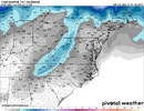
Definitely some activity on the 18z GEFS
View attachment 181134
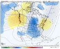
More dig to the west is probably why...
And ridge axis a little bit more west!
LukeBarrette
im north of 90% of people on here so yeah
Meteorology Student
Member
2024 Supporter
2017-2023 Supporter
It’ll happen overnight. I’ll wake up at 4 am to 1 page I am sure lolView attachment 181137
Well we are getting the good trends right now, so brace yourselves for bad trends tomorrow haha
*tonight starting around 11pmView attachment 181137
Well we are getting the good trends right now, so brace yourselves for bad trends tomorrow haha
Yep for sure. What puzzles me with this stuff is that sometimes the image you posted gets shared when the height anomaly shows yellow over the area. And when the height anomaly shows blue, the height anomaly is the one that gets posted. I'm just not sure which one is best to use. I mean, I guess we could just default to the one that has the most blues and greens and go with that!This just indicates a stretched SPV and the colder core is over eastern NA during that time period. Basically one of the avenues for cold air delivery.
Sent from my iPhone using Tapatalk
When the Banter thread is on top, you know it's not going to be pretty!It’ll happen overnight. I’ll wake up at 4 am to 1 page I am sure lol
It’s not bad until the stock thread as at the top with about 5 posts from Kylo explaining his bearish positions. Then it’s overWhen the Banter thread is on top, you know it's not going to be pretty!

