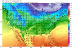
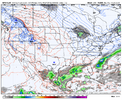
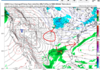
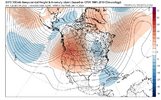
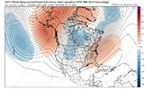
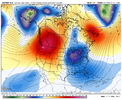
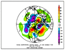
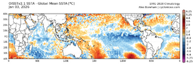
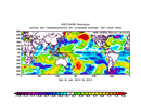
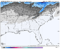
That lower one ehhh but that top one give it to me now.Wouldn't the storm track look something like this?
-
Hello, please take a minute to check out our awesome content, contributed by the wonderful members of our community. We hope you'll add your own thoughts and opinions by making a free account!
You are using an out of date browser. It may not display this or other websites correctly.
You should upgrade or use an alternative browser.
You should upgrade or use an alternative browser.
Pattern January Joke
- Thread starter SD
- Start date
Love thatOne weenie's suppression is another's perfection. Just saying.
CNCsnwfan1210
Member

Hmm
Sent from my iPhone using Tapatalk
NBAcentel
Member
CNCsnwfan1210
Member
cold rain
View attachment 181088
If that N/S wave would slow down and dig more to the S/SW but stay ahead of the S/S wave, we would probably have something.
Sent from my iPhone using Tapatalk
CNCsnwfan1210
Member
If that N/S wave would slow down and dig more to the S/SW but stay ahead of the S/S wave, we would probably have something.
Sent from my iPhone using Tapatalk
Pieces are there though, just needs some work.
Sent from my iPhone using Tapatalk
NBAcentel
Member
CMC is closer at H5 that time period
LukeBarrette
im north of 90% of people on here so yeah
Meteorology Student
Member
2024 Supporter
2017-2023 Supporter
packfan98
Moderator
NBAcentel
Member
NBAcentel
Member
CNCsnwfan1210
Member
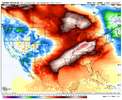
Just sayin. Western ridges can do things. Would be better if we somehow shift that PNA ridge further north View attachment 181096View attachment 181097

January 2014 FWIW
Sent from my iPhone using Tapatalk
Webberweather53
Meteorologist

January 2014 FWIW
Sent from my iPhone using Tapatalk
Indeed, Jan of 2014 had an average PNA of +0.97. Will Jan of 2025 end up with a notable +PNA like 2014? That’s obviously highly questionable at this point although all -PNA -ENSO Decs since 1983-4 did transition to a +PNA Jan, which I’ve been emphasizing. Also, models had a -PNA bias during late 2025. So, there’s still hope that can occur. The 12Z GFS *fwiw I know* has a transition to a +PNA on Jan 9th and it gets more + through the end of the run. That’s the kind of thing we’d probably need to end up with a solidly +PNA for Jan averaged out. The other models and ensemble means have the +PNA only for a few days, which would make having a solidly +PNA Jan unlikely. Those need to change. By the way, Jan of 2022 ended up with a +1.01 PNA and the first +PNA day was, coincidentally, Jan 9th.
*Edited
Last edited:
NorthHillsWx
Member
One word describes the short, medium and long range across guidance: Dry
Tsappfrog20
Member
One word describes the short, medium and long range across guidance: Dry
Yea currently it’s dry but the potential is also there for something to make us happy
Sent from my iPhone using Tapatalk
One word describes the short, medium and long range across guidance: Dry
Yea currently it’s dry but the potential is also there for something to make us happy
Sent from my iPhone using Tapatalk
A weaker than average subtropical jet is, as we know, the favored mean state for La Niña, which is still solid on a RONI basis (-0.98 in Dec) and is forecasted to weaken only slowly (-0.7 forecasted for Feb by Australian ENSO model). OTOH, as Ji correctly just mentioned in the MidAtlantic forum over there, there are usually periods of stronger ST jet during Niña just like there are periods of weak ST jet during Nino. So, hopefully we will get a period or two of a stronger ST jet this winter.
Good news. This coming Friday is Jan 10th. So all these Jan 13 -15 timestamps we been pattern chasing, what seems like forever. Will be under the 120 hr mark. Other words, we will know for sure if weve been chasing phantoms or another rug pull here in just a few days. Over the next few days we need to keep seeing pos trends, consistency. Then we can go looking for some moisture, shortwaves, vort phases etc.
NBAcentel
Member
Ole Northwest flow snow. If I lived in the mountains, I would be so sick of that being the only way I got snow. Sheesh.Man after a euro run that was close to something, this is absolutely deflating View attachment 181103
When I lived in Yancey County I hated it. It would snow and inch or 2 then melt in between squalls when the sun came out. Then snow another inch, then the wind would blow it away. Almost always powdery, not good for snowmen, snowballs etc.Ole Northwest flow snow. If I lived in the mountains, I would be so sick of that being the only way I got snow. Sheesh.
trackersacker
Member
If you’re *in* the mountains it’s great. If you’re just outside the mountains like I am and usually just get the scraps than yes we are sick of it.Ole Northwest flow snow. If I lived in the mountains, I would be so sick of that being the only way I got snow. Sheesh.
rburrel2
Member
The snow means continue to be awful, but my hope is we see more looks like the end of the euro and aigfs runs.Man after a euro run that was close to something, this is absolutely deflating View attachment 181103
And if so, the snow means should start signaling something in the 360-384hr range soon.
I still haven’t totally lost hope on the sharp trough drop down potential before that though. That’s something that could pop out of no where.
Still holding out hope that we can get a deep vortex stuck over the Aleutians some time in late January. Something like this with a little staying power and I like our chances. And by “our chances” I mean @BIG FROSTY chances 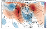

trackersacker
Member
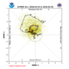
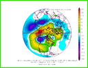
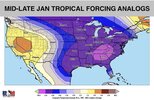
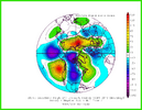
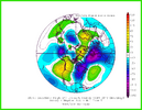 Looks like MJO wants to go 6, 7, 8?
Hard to put faith in 8 these days but 6 is the question mark. Some of these model runs do look like the classic Niña phase 6 composite shown above, but perhaps Bam is right with the alternative MJO/-AAM being the actual result from phase 6? Furthermore, getting into even 7 is a good look IMO as is 8.
View attachment 181105View attachment 181106View attachment 181110View attachment 181111View attachment 181112Looks like MJO wants to go 6, 7, 8?
Hard to put faith in 8 these days but 6 is the question mark. Some of these model runs do look like the classic Niña phase 6 composite shown above, but perhaps Bam is right with the alternative MJO/-AAM being the actual result from phase 6? Furthermore, getting into even 7 is a good look IMO as is 8.
Building on Webb’s optimism about Feb, note that the ext EPS that you posted and the ext GEFS (posted below) both show the MJO going into phase 8 in early Feb (admittedly very much fwiw since that’s 4 weeks out and the models recently did terribly <2 weeks out). The coldest Feb phases averaged out for all ENSO are 8-1-2-3 overall (inside and outside the circle are all included):
Ext GEFS
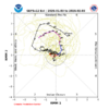
I must say, I'm for getting into a moderate to high phase 7-8-1-2 for February. This, inside the COD stuff, has been a dud this year.Building on Webb’s optimism about Feb, note that the ext EPS that you posted and the ext GEFS (posted below) both show the MJO going into phase 8 in early Feb (admittedly very much fwiw since that’s 4 weeks out and the models recently did terribly <2 weeks out). The coldest Feb phases averaged out for all ENSO are 8-1-2-3 overall (inside and outside the circle are all included):
Ext GEFS
View attachment 181113
iGRXY
Member
I would put my eggs in a nice overrunning event. They’re much easier to get and you don’t have to rely on so many variables going our way. Get the southern jet pumping which doesn’t appear to be an issue and just situate the cold to the north that it can be tapped into. Nothing is easy but in terms of drying to get a western ridge to cooperate and getting N/S energy to work for us or timing up an ULL out of Baja to eject at the right time, etc just doesn’t work these days. But pumping WAA over a cold dome that’s to our north? Very attainable and leaves a lot more opportunity to score
It's the best way tbh. I do agree but gulf lows can be threading the needle precip wise. Yeah we score big with them too but NW can give surprises. I've seen squall's quite often produce zero visibility with flow. Anyway I always enjoy your input. Happy New Year Mitch.Ole Northwest flow snow. If I lived in the mountains, I would be so sick of that being the only way I got snow. Sheesh.
I must say, I'm for getting into a moderate to high phase 7-8-1-2 for February. This, inside the COD stuff, has been a dud this year.
The inside the circle was a dud in Dec for sure. There’s lots of variance with all MJO phases and amplitudes. I know this based on my extensive research into actual temps at stations for each phase and amp. MJO is just a tool to indicate tendencies based on the aggregate of all cases and that’s it (similar to other indices). As is sometimes the case, these are treated more like crystal balls, which is a bad thing to do.
Edit: But to reiterate phase 8 was 5 BN in Dec.
Last edited:
No arguments with your research, Larry. I'm just ready for a shake-up. lolIt was a dud in Dec for sure. There’s lots of variance with all MJO phases and amplitudes. I know this based on my extensive research into actual temps at stations for each phase and amp. MJO is just a tool to indicate tendencies based on the aggregate of all cases and that’s it (similar to other indices). As is sometimes the case, these are treated more like crystal balls, which is a bad thing to do.
My last post on GEFS showed the strong trend toward colder in week 2 in the E US when going from yesterday’s 0Z to 18Z. Not surprisingly because of inherent instability of even ens means and the tendency to jump around, the GEFS since 18Z have gone back the other way (warmer) to some extent though not nearly the full amount:
On left side is HDDs. Light blue was that much colder 18Z GEFS, but the 3 runs since (12Z in purple) all warmed back up notably:
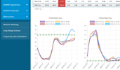
On left side is HDDs. Light blue was that much colder 18Z GEFS, but the 3 runs since (12Z in purple) all warmed back up notably:

trackersacker
Member
That is a great look, provided we don’t get hung up in 7 for FebruaryBuilding on Webb’s optimism about Feb, note that the ext EPS that you posted and the ext GEFS (posted below) both show the MJO going into phase 8 in early Feb (admittedly very much fwiw since that’s 4 weeks out and the models recently did terribly <2 weeks out). The coldest Feb phases averaged out for all ENSO are 8-1-2-3 overall (inside and outside the circle are all included):
Ext GEFS
View attachment 181113
Webberweather53
Meteorologist
That is a great look, provided we don’t get hung up in 7 for February
If we keep pushing the climate system away from La Nina like this, we won’t have to worry about that.
Thank you!!It's the best way tbh. I do agree but gulf lows can be threading the needle precip wise. Yeah we score big with them too but NW can give surprises. I've seen squall's quite often produce zero visibility with flow. Anyway I always enjoy your input. Happy New Year Mitch.
Maybe Ole Brad P was on to something when he called for a backloaded Winter haha. At least I think that’s what he said in his seasonal forecast
Webberweather53
Meteorologist
Building on Webb’s optimism about Feb, note that the ext EPS that you posted and the ext GEFS (posted below) both show the MJO going into phase 8 in early Feb (admittedly very much fwiw since that’s 4 weeks out and the models recently did terribly <2 weeks out). The coldest Feb phases averaged out for all ENSO are 8-1-2-3 overall (inside and outside the circle are all included):
Ext GEFS
View attachment 181113
My guess is the GEFS is picking up on another big subseasonal push towards El Niño in Feb, much like the weeklies are.
That is honestly pretty on brand for El Niño onset years and makes some sense to me. We usually see a nice surge in westerly wind burst activity in Feb-Mar, which is also the time of the year when the MJO is most active

