-
Hello, please take a minute to check out our awesome content, contributed by the wonderful members of our community. We hope you'll add your own thoughts and opinions by making a free account!
You are using an out of date browser. It may not display this or other websites correctly.
You should upgrade or use an alternative browser.
You should upgrade or use an alternative browser.
Pattern January Joke
- Thread starter SD
- Start date
CNCsnwfan1210
Member
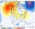
Unloading Canada.
View attachment 181227
Nice move getting that trough out of Alaska
Sent from my iPhone using Tapatalk
@griteater 's phat and thicc orientation!Unloading Canada.
View attachment 181227
LukeBarrette
im north of 90% of people on here so yeah
Meteorology Student
Member
2024 Supporter
2017-2023 Supporter
This is essentially the same overrunning look thats on all of the models right now. Super far out, but interesting to see there is agreementThere is your fantasy run for the Mid South.
You can call this unrealistic, but the Mid South has been good for at least one of these the last 4-5 Winters regardless of how crappy our Winters might be East of the mountains. Lol
View attachment 181228View attachment 181229
CNCsnwfan1210
Member
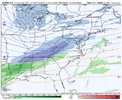
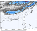
There is your fantasy run for the Mid South.
You can call this unrealistic, but the Mid South has been good for at least one of these the last 4-5 Winters regardless of how crappy our Winters might be East of the mountains. Lol
View attachment 181228View attachment 181229
I figured with that H5 look, there had to be something cooking.
Sent from my iPhone using Tapatalk
rburrel2
Member
Finally some noise on the GEFS snow mean starting around hr 300.
SnowNiner
Member
Unloading Canada.
View attachment 181227
I really want to stop seeing the ridge turn over like that though, tucking the flow and trough into the SW. It's irritably consistent and that hurts our cold feed IMO.
Oh absolutely.. And it keeps showing up. Speaks to the digging trough issue I mentioned & it fits the CPC outlook for the second half of January. Hopefully we can beat the ridge down. The look favors the Mid South if anyone in the South.. Hopefully everyone gets into some fun. We also know the look will change.I really want to stop seeing the ridge turn over like that though, tucking the flow and trough into the SW. It's irritably consistent and that hurts our cold feed IMO.
Yes. We can’t keep stranding cutoff after cutoff in the pacific just off the west coast. Need that thing to retrograde west back into the pacific to aid in pumping our ridge, go ahead and kick east and get out of the way or not be there at all. This seems like a running theme on modeling for mid/late JanuaryI really want to stop seeing the ridge turn over like that though, tucking the flow and trough into the SW. It's irritably consistent and that hurts our cold feed IMO.
but what if some of these pro forecasters are just in the pockets of NG and are helping to manipulate markets vs. forecast?
That manipulation could possibly apply to someone like JB, who is cold biased and even admitted that just the other day. He seems to like it when NG rises.
I’ve been following NG closely since the late 1990s and even traded it numerous times since. I even signed up for energy met. cos like Maxar and Freese-Notis for many years. What I saw was that their number 1 objective was always to remain objective and put aside any weenie or opposite based biases. They knew that their business depended on retaining their reputation for objectivity. JB was a laughing stock as regards energy traders as a result. Thus, serious NG traders ignore cold biased mets like him.
At Maxar, I talked to/emailed Brad Harvey numerous times. He was a great example of always keeping objectivity as the #1 goal. I’ve posted a few things from him here.
Maxar (and their predecessors) was #1 for decades. Another top energy co. is CWG out of DC and they’re also very objective.
These objective companies take hard data from models, obs of SSTs, and other things to produce forecasts. The models warmed substantially since last week, meaning the NG drop made perfect sense.
So, from my perspective, I don’t see NG intentionally being manipulated away from reality to any big extent.
I see that NG did just reduce its losses a a bit a few minutes ago. That may be due to colder 12Z ens means, but I don’t know yet as I have yet to see them.
Last edited:
Webberweather53
Meteorologist
The new Euro seasonal is trying to go full send on a Feb 2014 type scenario to end winter this year.
Certainly makes sense to me with how much stronger and eastward shifted the IPWP looks on the latest forecast and seeing another legit MJO wave coming down the pipe in week 2-3 to shove it eastward even more.
We’ve clearly moved out of a classical La Nina state already imho
Certainly makes sense to me with how much stronger and eastward shifted the IPWP looks on the latest forecast and seeing another legit MJO wave coming down the pipe in week 2-3 to shove it eastward even more.
We’ve clearly moved out of a classical La Nina state already imho
NBAcentel
Member
Im honestly more worried about suppressing the storm track to New Orleans again with a lobe of the TPV/strong northern stream troughing encroaching vs a SE ridge in later mid-late Jan
NBAcentel
Member
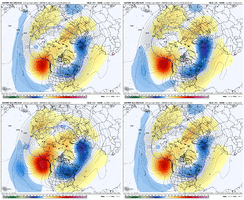
Even with the small mid level ridge over the SE (that’s trending more squashed) you have a bowl of northern stream/TPV nuts sagging right on us, extending to Atlantic Canada/50-50 region. Gonna be some really cold highs sliding to our north, with legit cold airmasses drag into them. Wedge watch here, and probably not wedges that seperate 40/70, but colder 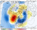


Snowman63
Member
Nice, I’ll take it.There is your fantasy run for the Mid South.
You can call this unrealistic, but the Mid South has been good for at least one of these the last 4-5 Winters regardless of how crappy our Winters might be East of the mountains. Lol
View attachment 181228View attachment 181229
CNCsnwfan1210
Member
In a nutshell, good trends overall with all the ensemble guidance. Hopefully these kind of trends keep going into the medium range. 1/13-1/22 has potential. I particularly like the 1/18-1/21 or so timeframe when the cold air seems to be more established. An overrunning/cad type scenario certainly not out of the question.
Sent from my iPhone using Tapatalk
Sent from my iPhone using Tapatalk
NBAcentel
Member
NCWeatherNow
Member
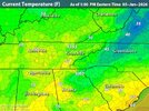
It is very dark outside hereWedge wedging. Downright cold out here working today. I was promised heat?View attachment 181242
Its a very unusual wedge, it feels different
The 12Z GEFS and EPS did go colder than 0Z/6Z late in the runs. However, it and 12Z EPS still go to a -PNA late. Hopefully those will change within the next few days. Otherwise, the best the SE can reasonably hope for imho are just short cold periods/ups and downs as any sustained cold stays to the north (strong gradient pattern N to S).
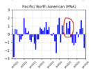
Do you recall off hand what the PNA index was last January? I feel like it spent more time in positive territory than it had in years.'Disappointing' to see the initial western ridge undercut the cold and strong TPV over the Yukon and AK...but signs pointing to the cold stuff getting sucked into the cross-polar flow down the road
View attachment 181249
tennessee storm
Member
It seeing nothing long range they suggest cold being sustained longer than 3 days on models. Everything still long range still , so we will see anything changes for betterThe 12Z GEFS and EPS did go colder than 0Z/6Z late in the runs. However, it and 12Z EPS still go to a -PNA late. Hopefully those will change within the next few days. Otherwise, the best the SE can reasonably hope for imho are just short cold periods/ups and downs as any sustained cold stays to the north (strong gradient pattern N to S).
Cad Wedge NC
Member
Are you drunk? I can't even read that post and make sense of it.It seeing nothing long range they suggest cold being sustained longer than 3 days on models. Everything still long range still , so we will see anything changes for better
Do you recall off hand what the PNA index was last January? I feel like it spent more time in positive territory than it had in years.
Per the NOAA table, Jan of 2025 PNA was +1.05, barely higher than the +1.01 of Jan of 2022 and the highest Jan since the +1.29 of 2011. 2010 was similar at +1.25.
Yes we are out applying fertilizer and its a bit chillyWedge wedging. Downright cold out here working today. I was promised heat?View attachment 181242
iGRXY
Member
This is a carbon copy of how you want to get overrunning going.Even with the small mid level ridge over the SE (that’s trending more squashed) you have a bowl of northern stream/TPV nuts sagging right on us, extending to Atlantic Canada/50-50 region. Gonna be some really cold highs sliding to our north, with legit cold airmasses drag into them. Wedge watch here, and probably not wedges that seperate 40/70, but colder View attachment 181234View attachment 181235
Webberweather53
Meteorologist
Very subtle shifts in the Indo-Pacific Warm Pool like this are all it can take to dramatically change the downstream wave pattern & late winter outcome over North America
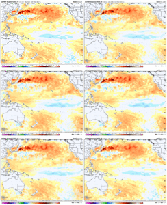
The difference between this
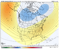
And this…
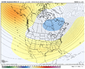
…can come down to a 10-15 ish degree shift in the eastern edge of the warm pool. Little nuances like these are not something that a traditional enso index (like SOI, ONI, MEI, etc.) will tell you about, and what oftentimes makes seasonal forecasting so challenging and fun at the same time.

The difference between this

And this…

…can come down to a 10-15 ish degree shift in the eastern edge of the warm pool. Little nuances like these are not something that a traditional enso index (like SOI, ONI, MEI, etc.) will tell you about, and what oftentimes makes seasonal forecasting so challenging and fun at the same time.
CNCsnwfan1210
Member
Very subtle shifts in the Indo-Pacific Warm Pool like this are all it can take to dramatically change the downstream wave pattern & late winter outcome over North America
View attachment 181260
The difference between this
View attachment 181261
And this…
View attachment 181262
…can come down to a 10-15 ish degree shift in the eastern edge of the warm pool. Little nuances like these are not something that a traditional enso index (like SOI, ONI, MEI, etc.) will tell you about, and what oftentimes makes seasonal forecasting so challenging and fun at the same time.
More +PNA, you can’t hate it, the new FEB run looks more or less what we’ll be dealing with in about 10-15 days roughly.
Sent from my iPhone using Tapatalk
After the +PNA leaning week of 1/12-18, which gives the SE NN/coldest anomalies of E US, today’s Euro Weeklies continue with the idea of a stronger than avg gradient N to S. The -PNA returns ~1/17 and the week of 1/19-25 has in the SE the NN area extending down into NC but slightly AN GA and it has moderately BN in New England. The subsequent 3 weeks all warm due to a continued -PNA and warm to NN NE and modestly AN SE though one can see the CADdies are helped on certain days thus keeping them only barely AN in the means.
The Weeklies now go through Feb 15th. So far, they’re showing no sign of a cold Feb anywhere. But hopefully that will drastically change! I sure hope its prog of a -PNA 1/17-2/15 is going to be dead wrong!
The Weeklies now go through Feb 15th. So far, they’re showing no sign of a cold Feb anywhere. But hopefully that will drastically change! I sure hope its prog of a -PNA 1/17-2/15 is going to be dead wrong!
Last edited:
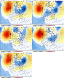
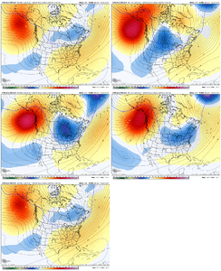
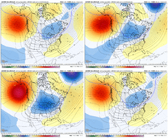
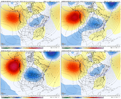
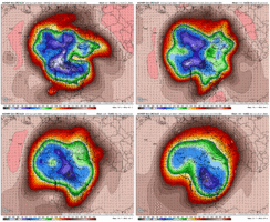
Possible scenario to watch: Scandi High > -EAMT > Retrograde the pattern > Greenland Block (not there yet on image below) > Cold TPV trapped in E Canada
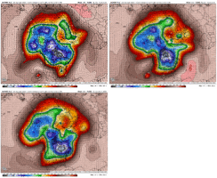
Here is -EAMT showing up on some modeling after mid-month
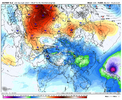
Combined 2 images on the right (green boxes) on the Euro clusters show this scenario a bit (along with 'somehow' holding some western ridging)
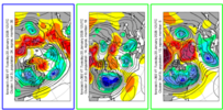

Here is -EAMT showing up on some modeling after mid-month

Combined 2 images on the right (green boxes) on the Euro clusters show this scenario a bit (along with 'somehow' holding some western ridging)

GFS / GEFS can be crazy at times of course.....I will say that last Jan, the GEFS was the best model in the medium range with the January +TNH / +PNA pattern (compared to EPS/CMCE). EPS was best in Dec 2024. This winter, I don't think there is a clear winner to date - take a model blendGFS Ens (not a fan of this model at all) is kicking the can with the ridge some.
View attachment 181230


