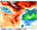
Cold lobe over Ak about to get kicked into NOAM, what a terrible look

so are we mad at the 12z Euro or something? Ive lost the plot
I mean, I could draw up better runs than the 12z OP Euro, sure—but holy cow, you’d think these runs were just printing endless SERs.More or less the Euro/AI had a cold shot around 1/12-1/13 and then another one later on. Details need to be refined as we get closer, but that’s what I got out of it..haven’t seen the EPS or AI ensemble.
Sent from my iPhone using Tapatalk
Yep!Remember Analog96? he's this decades Analog96.
Cold lobe over Ak about to get kicked into NOAM, what a terrible look
View attachment 180893

That is true. But it wasn't too many runs ago that it was showing a lot of cold. And it wasn't too many weeks ago it was showing warm in the long range that required a jacket when verification arrived. These models have been bouncing around in cycles showing good and bad outcomes. Every. Single. One of them.The EPS has above to much above for the US east of the Rockies for the entirety of its run past this weekend. The only solace is that it does reload Canadian cold at the end, fwiw.
View attachment 180894
That is true. But it wasn't too many runs ago that it was showing a lot of cold. And it wasn't too many weeks ago it was showing warm in the long range that required a jacket when verification arrived. These models have been bouncing around in cycles showing good and bad outcomes. Every. Single. One of them.
The reality is, it has been cold and it has been warm. I don't see any convincing evidence to suggest that the models are more apt to be right when they're showing warm than they are when they're showing cold. If you want to suggest that climate change compels us to lean in the direction of warm, ok, that's a fair point. But you (and I'm not saying you specifically) can't convince me that the rest of the winter is shot, that February is auto-toast, and that we're going to go through another winter with no snow. Other than feelings, I don't see any solid evidence for that.
Every single person that has posted on this forum that has made a forecast (and I don't mean a winter forecast) or a "suggestion" about an upcoming period and every single person who has been quoted here from other sources, like X, doing the same has already been wrong more than once. So, just because someone has changed their cold forecast to warm is irrelevant, at least to me. The weather has been variable. It is likely to continue to be. And models will continue to waffle in the long range. We just don't have the computing skill to be accurate that far out in time, at least not yet.
We're fine.
I suppose the thing that bothers most is that unlike much of December, soon the pattern will flood the northern US and much of Canada with Pacific air along with Chinook for the whole of N. America. The longer we wait to pop a strong PNA in this new pattern and establis cross polar flow, the shorter the window becomes. Particularly for us deep south weenies.That is true. But it wasn't too many runs ago that it was showing a lot of cold. And it wasn't too many weeks ago it was showing warm in the long range that required a jacket when verification arrived. These models have been bouncing around in cycles showing good and bad outcomes. Every. Single. One of them.
The reality is, it has been cold and it has been warm. I don't see any convincing evidence to suggest that the models are more apt to be right when they're showing warm than they are when they're showing cold. If you want to suggest that climate change compels us to lean in the direction of warm, ok, that's a fair point. But you (and I'm not saying you specifically) can't convince me that the rest of the winter is shot, that February is auto-toast, and that we're going to go through another winter with no snow. Other than feelings, I don't see any solid evidence for that.
Every single person that has posted on this forum that has made a forecast (and I don't mean a winter forecast) or a "suggestion" about an upcoming period and every single person who has been quoted here from other sources, like X, doing the same has already been wrong more than once. So, just because someone has changed their cold forecast to warm is irrelevant, at least to me. The weather has been variable. It is likely to continue to be. And models will continue to waffle in the long range. We just don't have the computing skill to be accurate that far out in time, at least not yet.
We're fine.

Not to bad those of us to the west
Playbook of occasional blue norther Arctic fronts banking up against an SER.
Sent from my iPhone using Tapatalk
Couple look ahead thoughts...That is true. But it wasn't too many runs ago that it was showing a lot of cold. And it wasn't too many weeks ago it was showing warm in the long range that required a jacket when verification arrived. These models have been bouncing around in cycles showing good and bad outcomes. Every. Single. One of them.
The reality is, it has been cold and it has been warm. I don't see any convincing evidence to suggest that the models are more apt to be right when they're showing warm than they are when they're showing cold. If you want to suggest that climate change compels us to lean in the direction of warm, ok, that's a fair point. But you (and I'm not saying you specifically) can't convince me that the rest of the winter is shot, that February is auto-toast, and that we're going to go through another winter with no snow. Other than feelings, I don't see any solid evidence for that.
Every single person that has posted on this forum that has made a forecast (and I don't mean a winter forecast) or a "suggestion" about an upcoming period and every single person who has been quoted here from other sources, like X, doing the same has already been wrong more than once. So, just because someone has changed their cold forecast to warm is irrelevant, at least to me. The weather has been variable. It is likely to continue to be. And models will continue to waffle in the long range. We just don't have the computing skill to be accurate that far out in time, at least not yet.
We're fine.


Looks great! Unfortunately it looks like we are losing the AI GEFS this run. Hopefully I’m wrong.
Couple look ahead thoughts...
1. I was picking on the GFS last night in terms of how it was handling the jet...but in looking at the model runs today, the EAMT signal is kind of meh, not heavy +EAMT or -EAMT. Having some stout +EAMT episodes would be beneficial for us.
2. Some have made comparisons to 2014, and there's certainly some reason for that when looking at the tropical forcing. Here for Jan 15-30 in 2014, the -VP uplift signal was locked in between 120E and 180 (Dateline)
View attachment 180900
View attachment 180903
Most modeling is moving to the same type forcing for the 2nd half of Jan. Here is today's Euro Wk which has this signal from Jan 11 to Feb 16
View attachment 180901
Here is the GEFS out to Jan 19
View attachment 180902
So, I think we have to first see if those tropical forcing forecasts verify...and if yes, do we get the W Pac to +TNH / -EPO connection? There is reason to believe that can help us in time...we'll see.


Low anomaly in the TN Valley is a pattern marker for a winter storm in the SE.west Canada ridging had been a winter storm staple in the past, just sayin View attachment 180914
Yeah you drop that trough axis any further SW and we start popping mega fantasy runsLow anomaly in the TN Valley is a pattern marker for a winter storm in the SE.


west Canada ridging had been a winter storm staple in the past, just sayin View attachment 180914
The only season where ip/sn/zr are possible because that's where the cold is. But down here moisture chases out cold, and cold chases moisture, so the third element is timing. It's raining here now, just a scattering of hours ago it was cold enough, so it's the timing that missed. I want moisture, then just cold enouth close by, so timing is possible, and that's in winter only that it can happen. Too cold it won't rain, too wet it won't cold. It's Goldielocks down here. It's just so damn hard to get good timing anymore. But give me a good southern stream first, and I'll know cold won't be too far off...they seem to attract, but are afraid to get too close, lol, unless the atmosphere bumps them together.Long term asides, the rain forecast has dropped significantly as well. I know most are looking for cold, but we need to find a moisture source as well at this point.


Come on PV, stretch like it’s 2014
Sent from my iPhone using Tapatalk


Hmm-


I like his optimism for sure!Had a friend send me this. I’ve never heard of this meteorologist either.
Just thought it was interesting with how the pattern is set to roll.
Meteorologist Ross Ellet
10h ·
**Weather Nerd Alert: Next Week’s Warmth Is A Warning Sign From Old Man Winter**
I have seen a lot of flashy headlines in the past 24 hours on social media that are either misleading or flat out wrong. Yes, we will warm up next week. No, winter isn’t over, and I would not describe what is coming as “A January Heat Wave” either as highs will be in the 40s. In fact, if you hate winter, I would not get too excited for the coming warmth. If you understand what will drive the mild pattern, then you also understand the warmth would be temporary, and it is likely a warning sign of a big arctic blast and potential for bigger winter storms. So what is going on behind the scenes?
The pattern so far this winter has generally mimicked what we have today, below normal temperatures in the Great Lakes to the Northeast, warm out west, and extremely cold in Alaska and the Yukon. Nobody up that way wants to hear, “it is Alaska, what do you expect?”. The interior of Alaska just had their coldest December in 45 years. Fairbanks hasn’t been above 0 degrees F in nearly 3 weeks. Lows have been between -40 and -50F every day for the past week. That is not normal cold up that way. Meteorologists have been closely watching this pocket of extreme cold, because when it does start to move, it will have a big impact wherever it goes. The pattern is still locked in over the next 3 days, but after that we start to see a shift east with this entire global pattern. The warmth that is out west starts moving our way, and the trough over Alaska drops into the west.
Alaska is the key to the long range forecast, and computer models move a ridge towards the state and it intensifies over the next two weeks. That would do two things. 1) It pushes the set up east. That means we get temporary warming that is in the western states, and in time that cold air in Alaska and western Canada finds a new home in the northern plains and Great Lakes, and eventually the northeast. 2) A strong ridge like what is forecast is also a blocking pattern that would stall out the weather pattern and also split the jet stream into a polar jet and a subtropic jet stream. This would increase the chance for bigger winter storms in the eastern half of the country as that pipeline of moisture would go across the Pacific, and pick up extra moisture from the Gulf. Meanwhile, the polar jet could drop into the Great Lakes bringing lots of cold. When you have this pattern, and the waves sync up, then you often get some bigger winter storms. There is no way of knowing where these storms will end up right now, but the pattern looks ideal for winter storms. At the very least, the cold looks to make a big comeback. In a nutshell, yes it will warm up next week, but be careful what you ask for as the same engine that is driving the warmth would also drive arctic cold our way after it and probably wintery precipitation mid to late January. This entire set up is connected. The screen shots below show the basic pattern as it shifts east over the next couple of weeks.
View attachment 180909
View attachment 180910
View attachment 180911
Sent from my iPhone using Tapatalk
I was really optimistic when we started to see the jet extension about a week ago across the pacific and was hoping it would allow the ridge to build over Alaska. Its probably the lack of a coherent signal of the mjo. Something is going on lolWas just looking at how the 12z Canadian Para had a taller / sharper ridge compared to the Std Canadian. Closed ridge over Idaho / Oregon / Washington is a good benchmark for a Manitoba Mauler type storm.
View attachment 180951