• Hello, please take a minute to check out our awesome content, contributed by the wonderful members of our community. We hope you'll add your own thoughts and opinions by making a free account!

Pattern January Joke

I may be in the minority in verbiage here but personally I could care less what the pretty colors are showing anomalous wise or 500mb wise. I continue to see a nice sharp western ridge and at least a minor to moderate -NAO on most ensembles. I'll take my chances with that everyday of the week
 
More +PNA and less -EPO seems January 2022 ish. We definitely had some negative EPO but I don’t remember impressive Arctic cold with that. Very cold, but never really did the subzero stuff

I assume you know that subzero was much more common during 1955-89 in Bristol, TN, than the periods prior and after:

For 1937-2025, these years had subzero: 1955, 1958-9, 1961-7, 1969-70, 1972, 1977-8, 1980-3, 1985-6, 1989, 1994, 1996, and 2014-5.

So, 1937-54 had no years with subzero! Then 1955-89 had 22 years or 2/3 of the years! Subsequently, 1990-2025 had only 4 (11%)! These are amazing multidecadal swings!


Looking at the ones since 1990:

1/1994 had three days (16th, 18th, 19th) with the last two over 1-2” of snowcover: neutral PNA/-EPO/neutral WPO/tail end of -AO that turned to +AO/+NAO

2/1996 had two days (4th, 5th) over 13-14” of snowcover: +PNA/+EPO but immediately followed -EPO/-WPO/tail end of -AO/+NAO but immediately followed -NAO

1/2014 had three days (7th, 29th, 30th) over a coating of snowcover for the 7th to 1-3” of snowcover for the 29th-30th: +PNA/-EPO/neutral WPO/-AO tail ends/neutral NAO for 7th and +NAO for 29th-30th

2/2015 had one day (20th) over 5” of snowcover: +PNA/-EPO/-WPO/+AO/+NAO

So, tendencies for subzero at Bristol since 1994 are a combo of +PNA, -EPO, neutral to -WPO, and snowcover, all intuitive.

But, the AO tendency was not in the middle of a -AO string as it was instead either tail end of -AO string or +AO. In addition, +NAO was favored and only one of the five periods was just after a -NAO, which isn’t intuitive to me.
 
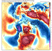
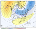
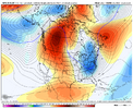
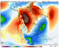
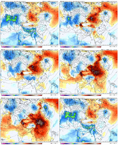
How do we claw out of that? Source region eviscerated. View attachment 180815
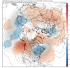
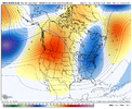
GEPS might be the best we got. Which doesn’t say a ton

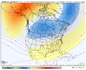
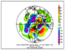
View attachment 180816
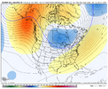
EPS was definitely the best of todays suite and it was pretty solid.

Also to note about the weeklies, those run on data from the previous day so I’d say the better trends on todays 12z suite will show up in tomorrows run
 
fcacdf7af9e177b4e23d2adf89e84913.png

a69e8b1649dbefe377b19878fb2717fe.png

8baf3d6162931ef197a2fe81095b70ae.png

12z GFS, GEFS, Euro all agree on decent stretching of the SPV around 1/13-1/15 with the coldest core over eastern NA.


Sent from my iPhone using Tapatalk
 
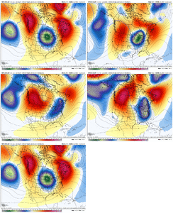
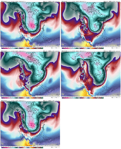
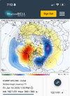
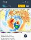
Weeklies are chillier vs last run mid Jan, warmer later in Jan then last run with a quick SnapBack of the jet. I’d be cautious of the 2nd half of the month change because it seems like we are actually trending to more jet influence earlier on, which could delay a retraction of the jet
Old IMG_1613.png
New IMG_1614.png
2nd half
Old IMG_1615.png
New

IMG_1616.png
 
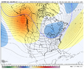
Clearly headed for a more +EPO/+PNA/-NAO type of look here. The positives is a more eastward trough axis, less chances of SE ridging
The negatives - more chances for cold/dry, a more progressive pattern especially northern stream unless you go nuclear with the west Canada ridge, western Canada getting roastedIMG_1627.gifIMG_1628.gif
 
Clearly headed for a more +EPO/+PNA/-NAO type of look here. The positives is a more eastward trough axis, less chances of SE ridging
The negatives - more chances for cold/dry, a more progressive pattern especially northern stream unless you go nuclear with the west Canada ridge, western Canada getting roastedView attachment 180824View attachment 180825
At minimum the bonus here would likely be a longer duration of a colder pattern since we have more room to retrograde
 
At minimum the bonus here would likely be a longer duration of a colder pattern since we have more room to retrograde
Yeah that’s what makes me skeptical of the quick retraction on the weeklies, it doesn’t make sense how earlier in the run it’s more extended yet it retracted the jet faster, there’s no forcing mech for retracting the jet that quick other then some weaker -EAMT showing up
 
Yeah that’s what makes me skeptical of the quick retraction on the weeklies, it doesn’t make sense how earlier in the run it’s more extended yet it retracted the jet faster, there’s no forcing mech for retracting the jet that quick other then some weaker -EAMT showing up
I feel like the weeklies have a bias to retrograde too quick seems like we do this every winter.

Another thing center the western ridge near the Yukon, nwt, BC borders in Canada and it's going to big cold the SE
 
Yeah that’s what makes me skeptical of the quick retraction on the weeklies, it doesn’t make sense how earlier in the run it’s more extended yet it retracted the jet faster, there’s no forcing mech for retracting the jet that quick other then some weaker -EAMT showing up
Yeah I don’t buy that quick of a retraction but hey who knows this winter
 
Joe Knows! As Powerstroke has quoted him. Sit tight. She's a coming.

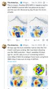
View attachment 180829
I was going to post some things from JB, but every time I do, you get these same few on here that ALWAYS know more than JB. But they are always here telling the Pro Mets where they are wrong, etc... They really amaze me with their wealth of knowledge. :rolleyes:lol
 
In 1985, Greensboro was almost 75 degrees on New Years Day. Probably warmest NYD on record. Jan 1985 Gboro recorded snow on 5 seperate occasions. Mostly all trace or half inch events. With one at 4 inches.
Feb 1985 ended up below normal temp wise and they recorded one more trace of snow that month.
Dec-Feb was way below normal precip. Lot of similarities and no 2 winters are alike. You get that western canadian ridge just right and it will send the pv down. Of course highlight will be busted pipes instead of feet of snow.
 
I was going to post some things from JB, but every time I do, you get these same few on here that ALWAYS know more than JB. But they are always here telling the Pro Mets where they are wrong, etc... They really amaze me with their wealth of knowledge. :rolleyes:lol
Joe Bastardi is someone I’ve appreciated for years. He strikes me as someone who’s very smart and he’s had a lot of experience, but sometimes IMO he comes across as a visionary in the unrealistic sense. For instance, he’s all in on January 1985 right now and that’s a bold call. I’m not saying it’s wrong either, but you’re making a bold claim when you’re talking about cold that anomalously severe. And he may not mean it translates to exactly the same results, but my point is that he seems to cherry pick shiny analogs to get his point across, and sometimes I just find that a bit hyperbole.
 
I was going to post some things from JB, but every time I do, you get these same few on here that ALWAYS know more than JB. But they are always here telling the Pro Mets where they are wrong, etc... They really amaze me with their wealth of knowledge. :rolleyes:lol
With models doing windshield wiper solutions , and credit to packfan, its because they struggle without a dominant signal, driver.
Rely on Someone who has made a living off of pattern recognition, still uses incorporates old school technigues,principals. Hes not perfect or claims to be. But he is very good at what he does.
 
Maybe Gboro gets below 0 for 13th time this year.

AI:

In
Greensboro

, North Carolina, temperatures have dropped below zero (
1767311342036.gif
0∘F0 raised to the composed with power cap F
) a total of 12 times since official record-keeping began at Piedmont Triad International Airport in 1903.

The most notable occurrences include:
  • -8°F (January 21, 1985): This is the all-time record low for Greensboro. It occurred during a historic Arctic outbreak that affected the entire eastern United States.
  • -1°F (January 19, 1994): This marks the most recent time the temperature officially dropped below zero in Greensboro.
  • Historical Context: While official airport records began in 1903, local historians note a reported temperature of -15°F on January 10, 1881, which was so severe it reportedly killed many evergreen trees in the area.


Summary of Extremes

Record Type TemperatureDate
All-Time Record Low-8°FJanuary 21, 1985
Most Recent Sub-Zero-1°FJanuary 19, 1994
Unofficial Historical Low-15°FJanuary 10, 1881


Though temperatures occasionally reach the single digits—most recently dropping to 5°F in December 2022—actual sub-zero readings remain extremely rare for the region.
 
Maybe Gboro gets below 0 for 13th time this year.

AI:

In
Greensboro

, North Carolina, temperatures have dropped below zero (
View attachment 180832
0∘F0 raised to the composed with power cap F
) a total of 12 times since official record-keeping began at Piedmont Triad International Airport in 1903.

The most notable occurrences include:
  • -8°F (January 21, 1985): This is the all-time record low for Greensboro. It occurred during a historic Arctic outbreak that affected the entire eastern United States.
  • -1°F (January 19, 1994): This marks the most recent time the temperature officially dropped below zero in Greensboro.
  • Historical Context: While official airport records began in 1903, local historians note a reported temperature of -15°F on January 10, 1881, which was so severe it reportedly killed many evergreen trees in the area.


Summary of Extremes

Record TypeTemperatureDate
All-Time Record Low-8°FJanuary 21, 1985
Most Recent Sub-Zero-1°FJanuary 19, 1994
Unofficial Historical Low-15°FJanuary 10, 1881


Though temperatures occasionally reach the single digits—most recently dropping to 5°F in December 2022—actual sub-zero readings remain extremely rare for the region.
I’m fairly certain that both GSO and CLT would have gone below zero on 12/23/89 had skies not clouded over from the Coastal blizzard. 1/21/1985 is still the most recent below zero reading for CLT and I have serious doubt as to whether it will ever happen again due to urban heat island effects.
 
Joe Bastardi is someone I’ve appreciated for years. He strikes me as someone who’s very smart and he’s had a lot of experience, but sometimes IMO he comes across as a visionary in the unrealistic sense. For instance, he’s all in on January 1985 right now and that’s a bold call. I’m not saying it’s wrong either, but you’re making a bold claim when you’re talking about cold that anomalously severe. And he may not mean it translates to exactly the same results, but my point is that he seems to cherry pick shiny analogs to get his point across, and sometimes I just find that a bit hyperbole.
Bastardi likes get the hits for more money … lol
 
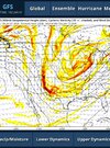
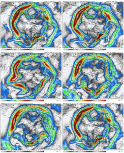
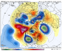
18z GFS OP has a fairly substantial positive East Asian Mtn Torque event here Jan 10-12 as seen on the sfc pressure pattern (1st loop). What we'd expect to see thereafter over the subsequent week is the Pac Jet extend, or at a minimum, the momentum in the Pac Jet being maintained. Instead, the Pac Jet collapses a bit here and retreats west (2nd loop)....and the resulting pattern is a more western ridge up thru Alaska and the Bering Strat, with the trough dumping into the western U.S.

Dec 31 GFS EAMT.gif

Dec 31 GFS Jet.gif


Dec 31 GFS 500.png


Dec 31 CAP.jpg
 
Back
Top