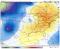
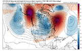
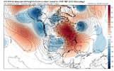
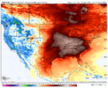
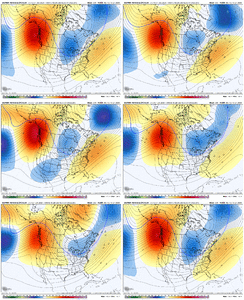
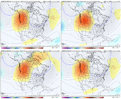
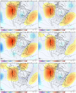
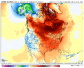
Agreed, the models dove quick from glory to doom and gloom for those who don’t want heat waves in winter. It would be nice to know what happened to show the -NAO and ridging on the West Coast for days to an abrupt change to the opposite. Right or wrong w’ell get what we get!I think this year the modeling may be off more than usual because there’s no strong signal from any of the telleconnections we use. Enso, mjo, and most of the rest are flat and not the main driver we’ve seen in previous years. I’m hoping a -NAO and +PNA can help. There’s been other hints in the pacific too that could benefit us. Unfortunately, it’s going to take a few weeks.
-
Hello, please take a minute to check out our awesome content, contributed by the wonderful members of our community. We hope you'll add your own thoughts and opinions by making a free account!
You are using an out of date browser. It may not display this or other websites correctly.
You should upgrade or use an alternative browser.
You should upgrade or use an alternative browser.
Pattern January Joke
- Thread starter SD
- Start date
MJO lock up is an issue also. It’s in the COD. Model guidance is everywhere.I think this year the modeling may be off more than usual because there’s no strong signal from any of the telleconnections we use. Enso, mjo, and most of the rest are flat and not the main driver we’ve seen in previous years. I’m hoping a -NAO and +PNA can help. There’s been other hints in the pacific too that could benefit us. Unfortunately, it’s going to take a few weeks.
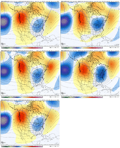
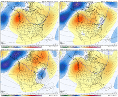
Euro AI ensemble for this am shows one of the best runs it has had yet for the pattern upcoming. Nice evolution. The AI guidance continues to be more aggressive with this pattern. I think it's a pretty big under the radar battle right now. View attachment 180766
Yeah, but horrible trend. Ridge trending off the coast and obviously some members now dropping a trough into the SW.
True but if the next three model runs flipped back do you get excited or have reserve? The 500 pattern has been drastically different over the past few runs based strictly off of duration from what I see.Yeah, but horrible trend. Ridge trending off the coast and obviously some members now dropping a trough into the SW.
Been a little bit of can kicking on the models but it always seems to take a little longer than we hoped to really shake up the pattern. A few days ago the EPS had -EPO on 9-10th......now it's 12-13th. But all the ensembles agree that at some point by mid-Jan we see EPO flip.
The red line is Jan 10th...

The red line is Jan 10th...

NBAcentel
Member
CNCsnwfan1210
Member
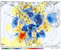
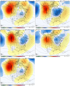
Seems like another reason we are seeing less -EPO is because the western ridge axis is trending further southeast to more of a classic +PNA look View attachment 180781
I could be wrong, but it looks like the GFS AI is correcting more toward some of the AI ensembles.
Sent from my iPhone using Tapatalk
NBAcentel
Member
Webberweather53
Meteorologist
Well that’s interesting, the AIGFS shows another +EAMT event which shifts the jet poleward mid Jan, would be no bueno View attachment 180785
+ mountain torque events flux momentum equatorward, while negative events flux it poleward.
Seems like another reason we are seeing less -EPO is because the western ridge axis is trending further southeast to more of a classic +PNA look View attachment 180781
That’s exactly what’s occurred with the EPS from 0Z yesterday to 0Z today. For the SE US, especially deep SE, that trade-off is typically a net benefit for those who want to
minimize the chance for a long torchy period fueled by a dominant SER.
- Joined
- Jan 5, 2017
- Messages
- 3,770
- Reaction score
- 5,969
IMO, next Saturday will be a gut check time. Made this post on X.
It's not a "thaw" if we never "froze". It's just a really bad winter.
I’d disagree. It’s been cold. It just didn’t snow. Same crap I’ve been hearing on socialIt's not a "thaw" if we never "froze". It's just a really bad winter.
Media post. It hit 15° at my house in December
trackersacker
Member
More +PNA and less -EPO seems January 2022 ish. We definitely had some negative EPO but I don’t remember impressive Arctic cold with that. Very cold, but never really did the subzero stuff
NBAcentel
Member
Gonna be impossible to get all the teleconnections lined up..
MJO lock up is an issue also. It’s in the COD. Model guidance is everywhere.
Based on the average of the 8 Jans over the last 50 years with 2/3+ of days inside the circle (oddly enough I decided to research this only after Joe Bastardi mentioned this in several of his posts) and though it doesn’t even come close to guaranteeing anything, I hope most days remain near/inside the circle.
In the SE US this is how Jan temps and wintry precip ended up:
1977: historic cold/RDU 2.1” plus multiple days of sleet and ZR/snow to S FL and Bahamas
1980: NN to slightly AN/RDU 2.2”
1981: BN to MBN/RDU 2.6”
1982: BN/original ATL 7” snowjam/RDU 6”
1994: BN
1996: NN to slightly BN/RDU 5.6”
2000: NN to slightly BN/RDU 25.8”/TWO major ATL icestorms
2003: BN/RDU 3.5”
RDU averaged 6” of snow, 240% of normal!
Here’s the avg, which is significantly colder than that for Jans with <20 days inside the circle:
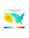
It doesn't seem like any research or analogs that are showing blue in the east are working well this year. But there's still plenty of time. Thanks for doing the research.Based on the average of the 8 Jans over the last 50 years with 2/3+ of days inside the circle (oddly enough I decided to research this only after Joe Bastardi mentioned this in several of his posts) and though it doesn’t even come close to guaranteeing anything, I hope most days remain near/inside the circle.
In the SE US this is how Jan temps and wintry precip ended up:
1977: historic cold/RDU 2.1” plus multiple days of sleet and ZR/snow to S FL and Bahamas
1980: NN to slightly AN/RDU 2.2”
1981: BN to MBN/RDU 2.6”
1982: BN/original ATL 7” snowjam/RDU 6”
1994: BN
1996: NN to slightly BN/RDU 5.6”
2000: NN to slightly BN/RDU 25.8”/TWO major ATL icestorms
2003: BN/RDU 3.5”
RDU averaged 6” of snow, 240% of normal!
Here’s the avg, which is significantly colder than that for Jans with <20 days inside the circle:
View attachment 180793
NBAcentel
Member
I mean technically the EC was largely BN this Dec and a lot of analogs have been coming to fruition it’s just the lack of snow for us with it, Virginia sure did cash out thoughIt doesn't seem like any research or analogs that are showing blue in the east are working well this year. But there's still plenty of time. Thanks for doing the research.
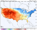
Speaking of Virginia...I mean technically the EC was largely BN this Dec and a lot of analogs have been coming to fruition it’s just the lack of snow for us with it, Virginia sure did cash out thoughView attachment 180802
Technically. A lot of the analogs that have been rolled out looked a lot different than that image...more like GaWx's image above. That said, yeah some did hit. 2nd half of Jan needs to come in strong to get close to even your image.I mean technically the EC was largely BN this Dec and a lot of analogs have been coming to fruition it’s just the lack of snow for us with it, Virginia sure did cash out thoughView attachment 180802
Twister
Member
15° what one morning?? Cause that's exactly how many days it hit 15 here at my house in northern upstate. Then we've had a few scattered mornings here and there in the 20s. I wouldn't call all that a freeze to "Thaw" out fromI’d disagree. It’s been cold. It just didn’t snow. Same crap I’ve been hearing on social
Media post. It hit 15° at my house in December
Last edited:
NBAcentel
Member
NBAcentel
Member
trackersacker
Member
I like the trend on 12z Euro ENS today to more blocking. Not terrible trends IMO
You want the GFS op showing polar opposite of your desired flavor of weather in day 10-15 range. Cause it usually ends up 180 degrees diff come verification time.
NBAcentel
Member
trackersacker
Member
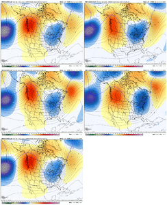
Solid runYeah noticeable uptick for blocking on the EPS/AIFS View attachment 180810
Yeah noticeable uptick for blocking on the EPS/AIFS View attachment 180810View attachment 180811
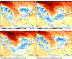
2m trend last 3 EPS runs: colder SE with increasing +PNA
NBAcentel
Member
I think we need to remember that there are periods of time when the atmosphere is more chaotic than others. The interaction of shortwaves, phasing, etc., can result in substantial run to run changes, particularly in the medium and longer ranges. We're seeing an awful lot of that right now. It results in flatter ridges, sharper ridges, ridges nudged east, ridges nudged west, NAOs weakening, NAOs strengthening, EPOs going up, EPOs going down, Pac jets extending, Pac jets retracting, etc., depending on the run.
NBAcentel
Member
Doesn’t help when we have less data assimilation then normal Going into models nowadays. Makes a huge difference. They can only do so much with less observation points and balloons in the air to give observationsI think we need to remember that there are periods of time when the atmosphere is more chaotic than others. The interaction of shortwaves, phasing, etc., can result in substantial run to run changes, particularly in the medium and longer ranges. We're seeing an awful lot of that right now. It results in flatter ridges, sharper ridges, ridges nudged east, ridges nudged west, NAOs weakening, NAOs strengthening, EPOs going up, EPOs going down, Pac jets extending, Pac jets retracting, etc., depending on the run.
Cad Wedge NC
Member
Agree ..... until this pattern change gets within the 7-day window, this windshield-wiper effect will continue. I am just amused at the wild solutions on some of these LR runs, and the run-to-run changes. It's laughable at best, and all of the global models have fallen victim to these wild swings at one point or another. Folks just need to sit back and let this play out.I think we need to remember that there are periods of time when the atmosphere is more chaotic than others. The interaction of shortwaves, phasing, etc., can result in substantial run to run changes, particularly in the medium and longer ranges. We're seeing an awful lot of that right now. It results in flatter ridges, sharper ridges, ridges nudged east, ridges nudged west, NAOs weakening, NAOs strengthening, EPOs going up, EPOs going down, Pac jets extending, Pac jets retracting, etc., depending on the run.
Cad Wedge NC
Member
High altitude passenger planes and military planes should all be equipped with sensors/monitors that relay real-time atmospheric data. That would go a long way to solve the missing data issue.Doesn’t help when we have less data assimilation then normal Going into models nowadays. Makes a huge difference. They can only do so much with less observation points and balloons in the air to give observations
Cad Wedge NC
Member
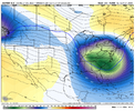
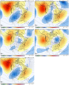
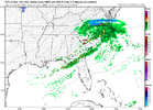
That looks like a response to the stronger -NAO ridge .... interesting.I think this trough that has showed up that's closing in on day 10 is worth watching. We've seen these trend more aggressive as we get closer.
View attachment 180814


