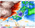
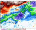
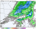
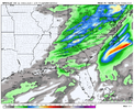
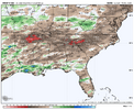
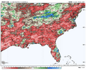
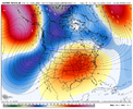
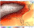
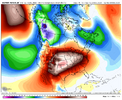
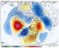
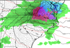
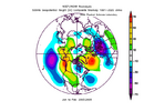
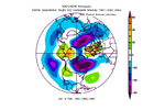
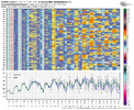
no yeah I take it over warm personally, I was just hoping it would have prettier colors closer to my house honestlyLike I said earlier, this pattern is CAD purgatory. You gotta take what you can get, because relative to the pattern we’re in, that’s probably about the best we can do
-
Hello, please take a minute to check out our awesome content, contributed by the wonderful members of our community. We hope you'll add your own thoughts and opinions by making a free account!
You are using an out of date browser. It may not display this or other websites correctly.
You should upgrade or use an alternative browser.
You should upgrade or use an alternative browser.
Pattern December Doldrums 2025 🎄 ❄️
- Thread starter SD
- Start date
29 almost midday, full sun.... I'll take a little warmup, I'm freezing my baguettes off
Model underestimating the cold.
NBAcentel
Member
WolfpackHomer91
Member
11.7 Here in Mooresville off Linwood Road this AM.
Currently - 27.3 at Noon…..in December
Sent from my iPhone using Tapatalk
Currently - 27.3 at Noon…..in December
Sent from my iPhone using Tapatalk
Webberweather53
Meteorologist
NBAcentel
Member
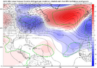
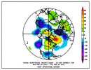
wonder what winter storms we’ve had with -PNA/-WPO/-NAO, I’m sure they are messy and likely CAD driven-NAO onset is consistently trending earlier and stronger on the models. We’re trying…
View attachment 179026
Avalanche
Member
Loved it!! Seems like things have been stale for a while so it was exciting to see the front usher inThat was a cool front passage @Avalanche
Webberweather53
Meteorologist
wonder what winter storms we’ve had with -PNA/-WPO/-NAO, I’m sure they are messy and likely CAD driven
Quick database search for -PNA/-WPO/-NAO/+EPO in Dec-Jan I pulled up a storm from Christmas Day in 1948 and the other was an ice storm in late January 1969.
Wasn’t February 2004 as well? I know it had a -PNA/-NAOQuick database search for -PNA/-WPO/-NAO/+EPO in Dec-Jan I pulled up a storm from Christmas Day in 1948 and the other was an ice storm in late January 1969.
Webberweather53
Meteorologist
Wasn’t February 2004 as well? I know it had a -PNA/-NAO
Nope it didn’t show up. Most recent event I saw from any point in the year was from March 2005
MichaelJ
Member
I must be in a cold pocket, it was 9 this morning for the low. Long range, it could be ugly for those wanting cold/snow in the SE (excluding the mountains) until mid-late January
Drizzle Snizzle
Member
Don't worry. It will get cold again in March.It’s crazy to keep logging on here and seeing no hope. This is the worst iv seen it in a while.
While this is not encouraging for the next thirty days or so if Allan's statement ends up being correct, remember 2000 and the warm weather we in North Carolina had for the first part of that January. Things changed during the second part of the month and we got the record snowstorm in the last week of January that so many of us remember.Alan Huffman, this morning said he believes we will be warm until at least Mid January.
Just thought I’d pass along some more depressing news. Have a great day everyone!
Sent from my iPhone using Tapatalk
NBAcentel
Member
Feb 2004 was more so of a cutoff traveling under a Canadian omega block/-NAO keeping a suppressed track and a 50/50 low up in the NE, more of a -NAO/-AO dominated pattern, WPO looks positive. Looked very Nino esque. Probably gotta wait a while for something like this to show upWasn’t February 2004 as well? I know it had a -PNA/-NAO
NCHighCountryWX
Member
- Joined
- Dec 28, 2016
- Messages
- 697
- Reaction score
- 1,914
iGRXY
Member
Ask Twister if I just have CAD on the brain now lol. This is like clockwork every year. Not cold enough for frozen 9/10x, but cold enough for 35-45 degree rain and cloudsJust barfed in my mouth. Here comes a wedge out the blue in the medium range View attachment 179024View attachment 179025
iGRXY
Member
Webber has said in the past that -PNA/-NAO combo is CAD, mixed bag messy storms.wonder what winter storms we’ve had with -PNA/-WPO/-NAO, I’m sure they are messy and likely CAD driven
Webberweather53
Meteorologist
The sensible weather over the holidays looks like a big roller coaster ride on most models over the Carolinas.
I’m pretty confident we won’t see much snow or ice, but daytime temperatures could waffle between the mid-upper 40s and 70s depending on the placement and timing of the 50-50 low and upstream Southern Plains ridge.
I’m pretty confident we won’t see much snow or ice, but daytime temperatures could waffle between the mid-upper 40s and 70s depending on the placement and timing of the 50-50 low and upstream Southern Plains ridge.
That does make sense when generally Miller B storms have a -PNA/-NAO combo. Miller B storms generally have a mixed bagWebber has said in the past that -PNA/-NAO combo is CAD, mixed bag messy storms.
wonder what winter storms we’ve had with -PNA/-WPO/-NAO, I’m sure they are messy and likely CAD driven
12/26/2010 was the only 6”+ storm at RDU since 1950 that qualifies as it had:
- weak -PNA (-0.3)
- -WPO (-1.4)
- moderate -NAO (-0.8)
It also had:
- +EPO (+1.2)
- strong -AO (-2.9)
- moderate MJO 5
- La Nina
Last edited:
NBAcentel
Member
Wasn’t February 2004 as well? I know it had a -PNA/-NAO
I count Feb of 2004 as neutral PNA (-0.1) as opposed to -PNA
Webberweather53
Meteorologist
Parade of cold highs come out of Canada into New England between the 22nd & 28th on the EPS 
I.e. CAD purgatory; cold enough to get on your nerves, but not cold enough to actually do anything
I.e. CAD purgatory; cold enough to get on your nerves, but not cold enough to actually do anything
Most negative PNA for 6”+ RDU storms since 1950 (based on research I did previously):
-0.8: 3/2-3/1960
-0.5: 3/9/1960
-0.3: 12/26/2010
These had -0.1 PNA, which I consider neutral PNA:
-0.1: 2/18-19/1979
-0.1: 2/26-27/2004
-0.1: 1/17/2018
-0.8: 3/2-3/1960
-0.5: 3/9/1960
-0.3: 12/26/2010
These had -0.1 PNA, which I consider neutral PNA:
-0.1: 2/18-19/1979
-0.1: 2/26-27/2004
-0.1: 1/17/2018
NBAcentel
Member
Probably very selfish but I will be here (X) from the 22nd-27th (Just south of Pennsylvania)....so I dare say bring it. For anyone who lives in this area, it's dark early. Constant clouds and CAD. Just yuck. But, if we can squeeze that out, I won't argue.
Attachments
Webberweather53
Meteorologist
That pattern just screams misery. I’ll pass
Now I’ll add GSO 6”+ storms since 1950 that weren’t also at RDU to the RDU 6”+ list that I already showed the PNAs for to list what the most negative PNA of all of these was:
6”+ storms since 1950 at GSO and/or RDU: most negative PNA (**note that only 12 of the 37 storms had PNA<0**):
-1.1: 2/12-13/2014 (moderate +NAO)
-0.8: 1/22-24/1954 (moderate +NAO)
-0.8: 3/2-3/1960 (neutral NAO)
-0.7: 1/6-7/2017 (moderate +NAO)
-0.5: 3/9/1960 (neutral NAO)
-0.3: 12/26/2010 (moderate -NAO)
-0.3: 2/24-26/2015 (strong +NAO)
-0.2: 2/27/1987 (weak -NAO)
-0.1: 2/18-19/1979 (neutral NAO)
-0.1: 1/12-14/1982 (neutral NAO)
-0.1: 2/26-27/2004 (weak -NAO)
-0.1: 1/17/2018 (strong +NAO)
Note that of these 12 big RDU/GSO storms since 1950 with PNA<0, almost half (5) had a moderate or strong +NAO, only 25% (3) had a -NAO, and none had a strong -NAO.
Last edited:
Few of the dates above thrown in...need the aleutian ridge to build poleward...that would change the sentiment.Now I’ll add GSO 6”+ storms since 1950 that weren’t also at RDU to the RDU 6”+ list that I already showed the PNAs for to list what the most negative PNA of all of these was:
6”+ storms since 1950 at GSO and/or RDU: most negative PNA:
-1.1: 2/12-13/2014 (moderate +NAO)
-0.8: 1/22-24/1954 (moderate +NAO)
-0.8: 3/2-3/1960 (neutral NAO)
-0.7: 1/6-7/2017 (moderate +NAO)
-0.5: 3/9/1960 (neutral NAO)
-0.3: 12/26/2010 (moderate -NAO)
-0.3: 2/24-26/2015 (strong +NAO)
-0.2: 2/27/1987 (weak -NAO)
-0.1: 2/18-19/1979 (neutral NAO)
-0.1: 1/12-14/1982 (neutral NAO)
-0.1: 2/26-27/2004 (weak -NAO)
-0.1: 1/17/2018 (strong +NAO)
Note that of these 12 big RDU/GSO storms since 1950 with PNA<0, almost half (5) had a moderate or strong +NAO, only 25% (3) had a -NAO, and none had a strong -NAO.
It's what I am hoping for in early/mid January. Fingers crossed...
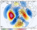
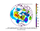
Watch this death ridge set up shop and rock everybody to sleep then we miller B into a setup with low level cold anchored by a 1042 high and drop an ice storm for the ages. We’ve been overdue for the past 15 years.
Don’t worry, winter 26/27 gonna be yalls winter! Currently 27 here, full sun, melting everywhereWatch this death ridge set up shop and rock everybody to sleep then we miller B into a setup with low level cold anchored by a 1042 high and drop an ice storm for the ages. We’ve been overdue for the past 15 years.
NBAcentel
Member
Prestige Worldwide
Member
WolfpackHomer91
Member
I wish. Yall underestimate how awesome mixed bag events are if there's enough QPF. Gimme 6-8" SN / 1" Sleet / 1/4 - 1/2" ICE on top and 5 days after at 35 and below all day over 8-12" Of pure snow and then its in the 40s -50s and gone 48hrs later. Hell even 10-12" of snow pure isnt as good as 8" / 1"IP? 1/4" iceWatch this death ridge set up shop and rock everybody to sleep then we miller B into a setup with low level cold anchored by a 1042 high and drop an ice storm for the ages. We’ve been overdue for the past 15 years.

