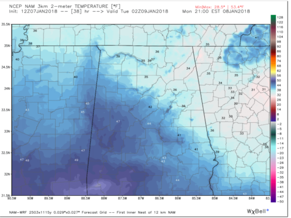
Some members of the Canadian are jumping off board now as of 12z. Threat, currently, diminishing.
SREF %s dropping to the East each run.
SREF %s dropping to the East each run.
Mostly the dry air at mid levels, so any precip will mostly evaporate as it passes through that layer.. And the total amount of moisture to too little to saturate that layerWhat again is keeping this from effecting East GA and SC?
Thanks for replying. Crazy it looks like that wont be a problem the day after. Smh lolMostly the dry air at mid levels, so any precip will mostly evaporate as it passes through that layer.. And the total amount of moisture to too little to saturate that layer
The mean has practically doubled here from .13 to .21 QPF FWIW. Seems to reflect what the other SR models are showing.Anyone around CAE wondering, SREF has near 0% of ZR around, along with less than 20% pops for plain rain. This should be confined to our West.
The mean has practically doubled here from .13 to .21 QPF FWIW. Seems to reflect what the other SR models are showing.
we will be fine in CAE I'm not worried.Remember, the last event did the same thing, kinda. NAM/SREF/RGEM was a bigger deal around here and we ended up with zilch. ZR isn't something to play with though.
we will be fine in CAE I'm not worried.
Yep. But as you said, ZR cannot be messed with. In addition, we were looking at snow, which has longer to fall than rain. Rain can form at lower levels, so there is less distance and less dry air the moisture needs to go through. Just have to monitor the 500MB level over the next 12 hours as well as moisture flow and the radar plus dewpoints.Remember, the last event did the same thing, kinda. NAM/SREF/RGEM was a bigger deal around here and we ended up with zilch. ZR isn't something to play with though.
I have to admit the warm up will be niceYep. They even note moisture is too shallow; might not even see rain! Thunderstorms possible next week, though.
The mean has practically doubled here from .13 to .21 QPF FWIW. Seems to reflect what the other SR models are showing.


0.26" in half is 0.13" ice accretion
Fwiw, the 12Z Euro has substantially more qpf for N AL to the ATL area, especially NW burbs. This is obviously a big outlier, especially for the ATL area.
How much qpf for Atlanta?
That's interesting Larry. Wonder why so much? Changes at H5?Take with a humongous grain since it is a big outlier, but it has 0.50-0.55" in your area, which would be enough for power concerns.
Corey, did you by chance do some ice dancing today?
Take with a humongous grain since it is a big outlier, but it has 0.50-0.55" in your area, which would be enough for power concerns.
Corey, did you by chance do some ice dancing today?
That's interesting Larry. Wonder why so much? Changes at H5?
I’ve seen it forecasted not to get to lagrange but many times it does... i will be cking radars for sure. Again... reason is because wedge verifies stronger than models picked up on..
