• Hello, please take a minute to check out our awesome content, contributed by the wonderful members of our community. We hope you'll add your own thoughts and opinions by making a free account!

Pattern December Doldrums 2025 🎄 ❄️

morning forecast done. a couple little blue ridge ice events possible as you'd expect with such an active, wedgey pattern. pretty remarkable comeback we've made around here!

i see the euro had some fun overnight. you'd think we'll continue to see things like that pop up every now and then as we get into next week
 
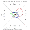
I haven’t looked in detail but apparently the GEFS made some improvements overnight. The RMM MJO progs now clearly go into phase 8 and into the COD where it starts a slow loop. The AO and NAO charts haven’t updated yet

27059418472b655db47d7b62acd8d826.jpg

This morning’s CFS AO forecast


Sent from my iPhone using Tapatalk
 
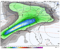
Somebody needs to wake up @Mitch and @Rain Cold/ They are going to love this. Too bad it's 10 days out. Just goes to show you what a good pattern we are heading into. You got to love snow in December.
It is the Euro rather than the GFS that is showing this ten-day threat now. The GFS had a similar storm during that time frame a couple of days ago. I know any storm shown on a model ten days out should be taken with a pound of salt but the fact that the Euro is showing something now has piqued my curiosity. December 2025 looks like a month where there will be a lot of lost sleep for many of us watching model runs knowing that so many of the parameters are in place for the Southeast to get some winter weather.
 
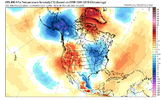
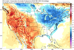
The ensembles are showing a warm-up mid-month. It'll be interesting over the next week to see if and when they flip to cold in the east, as has been the practice of late.
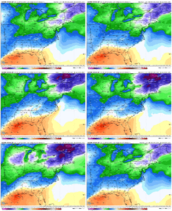
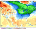
This doesn't look all that warm. Now, if you're talking about the terrible, horrible, no good, very bad GFS ensembles, you have a point.

eps_T850a_namer_57.png
 
6c96895e566ad54da3ec20afdf54dbbb.jpg

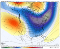
I do like how the EPS has a Baja low signal, these can be a pain sometimes counting on this feature dislodging or not, but the Euro showed us how it can produce. Cold shots do look repetitive during the period, so we’ll see how this evolves.


Sent from my iPhone using Tapatalk
 
I haven’t looked in detail but apparently the GEFS made some improvements overnight. The RMM MJO progs now clearly go into phase 8 and into the COD where it starts a slow loop. The AO and NAO charts haven’t updated yet

59b06f6b02ebcf9167826f7363e64369.jpg

Yep GEFS looks better for the MJO


Sent from my iPhone using Tapatalk
 
These 11 day long phase 8s of today’s 2 week EPS/GEFS would be tied for longest winter ph 8 since 2/7-17/2010!
IF plots like these verify it’s gonna be fun times around here soon as far as model watching. My only concern is we aren’t into the depths of climo yet, but we are already seeing looks that could work for CAD regions, they are just ill timed or not quite set up right. Get the ingredients first before you can bake!
 
Last edited:
My stepdaughter who loves winter weather will love this! She was born on December 10th 1989 during an ice storm which hit Eastern North Carolina on that day.
My little brother was born on the 9th of that year in the western part of the state. Had the ice here as well. That was a very cold December. Xmas morning was frigid.
 
We about to start loading up the timeframe to watch. ICE UP SON.


View attachment 177480
Ice on the Canadian? I’m shocked

You know, I can’t think of a time where an ice event didn’t follow the climatology I-85 line unless there was some onset accumulating snow — at least since I started following the weather in 2016. Being in Raleigh, I look at that and say skip
 
Ice on the Canadian? I’m shocked

You know, I can’t think of a time where an ice event didn’t follow the climatology I-85 line unless there was some onset accumulating snow — at least since I started following the weather in 2016. Being in Raleigh, I look at that and say skip
Yeh man I was mainly meaning timeframes in general, not necessarily that timeframe.
 
This doesn't look all that warm. Now, if you're talking about the terrible, horrible, no good, very bad GFS ensembles, you have a point.

View attachment 177466
Oh, I totally agree. No torch in sight, but a warm-up nevertheless.

Again, I think it corrects to colder as the long-range becomes mid-range guidance as has been the case lately.
1764437391556.png
 
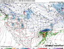
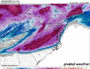
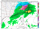
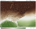
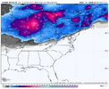
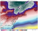
EC AI getting close to another CAD event next week View attachment 177482View attachment 177483

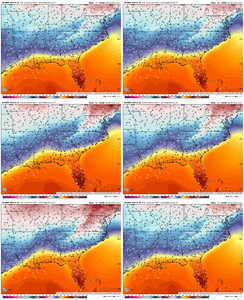
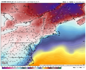
This one might be worth paying attention to for any colder trends, the cold air present in the NE when this system is nearby is far more impressive then the upcoming one with single digit/below 0 temps and below 0 dews in the interior NE, and there’s also gonna be fresh snowpack in place. If any changes happen with the trough associated for the cold feed slowing/amping, then this could
Get interesting fast
IMG_0146.pngIMG_0145.pngIMG_0144.gif
 
Back
Top