Like or don’t like J Cohen and his work, but he’s not a cold hype-ster. He’ll call it warm when appropriate.
As a supplement to a tweet from Nov 23, here is what he stated yesterday in a USA Today article…
"My thinking is that the cold the first week of December is the appetizer and the main course will be in mid-December," said
climatologist Judah Cohen, a research scientist at MIT, in an email to USA TODAY.
Indeed, according to Cohen's computer model, "which I can credibly claim as the world's best – is predicting that the most expansive region of most likely extreme cold on Earth stretches from the Canadian Plains to the U.S. East Coast in the 3rd week of December."
Note: him saying the model is the world’s best is “hypey” I’d say though
But he’s seeing a textbook reflection of wave energy with troposphere / stratosphere interactions
View attachment 177428
This is associated with a stretched SPV in the configuration in “P3” in this diagram
Source:
https://www.science.org/doi/10.1126/sciadv.adq9557
See “C” within “P3”. H10 here is 10 hPa (10mb) in the stratosphere.
View attachment 177429
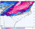
“C” in the diagram matches well with what the Euro is currently showing for Dec 13th. Long way off but hopefully that holds
View attachment 177430
But high values of the Reflectivity Index and this type of SPV configuration are associated with P3-H (500mb) and P3-M (Surface Temperatures)…i.e. AK ridge and weak Greenland ridge with trough and cold temperatures east of the Rockies
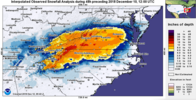
View attachment 177431


 Has another one brewing in the Gulf around D15 also.
