Brent
Member
That helps narrow it down
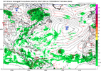
Right but that signal is pretty crazy
Im just waiting for the NHC to put it in the outlook
That helps narrow it down


.png")


JB says it. Watch the eastern GOM. Very often when a major cane threatens the US a weak storm forms ahead of it
Yeah and the 6z went from hatteras to Texas at the 12z. It’s comical at this point! Let the storm form first then worry about tracking! Especially with the GFS.


Yep. The ridging this run looks crazy.0z GFS is noticeably south of 18z by day 6. Will probably have a CONUS hit somewhere this run


Exactly what happened..945mb lurking east of the Bahamas at 240. Last few frames it was turning NNW but looks like the ridge is starting to build back in over the east coast so wonder if we will see a move back towards the SE coastline
View attachment 174034

Yeah wasn’t a crazy bend back northwest but it was enough to get a NC landfall.Exactly what happened..


AI is also a non-entity. At least the AI has something more interesting at the end of the run6z GFS is a miss. It stays well offshore.


Looking very good on satellite code orange in the outlook alreadyView attachment 174041
CFS has lots of very cool dry air for AUG-Sept/I'm more of a cool weather lover, so what the GFS is showing the last couple of runs. The 0z has a tropical storm quickly becoming extra-tropical as it hits the NC coast (as shown above). Because of the transition it's able to pull down cool/dry temps. 0z GFS day 13 dewpoints:
View attachment 174044
The 6z run keeps the storm farther off the coast but still helps pull down cool/dry air. You can guess what outcome I'm pulling for...
Im hoping it intensifies quickly so it can move out and get out of the way.Makes it more likely it stays OTS based off the models I believe, which would be for the better, but if it doesn't, there's Irma and Florence, with both having been problematic.
Aka. 1954 pattern JB was showing