Makeitsnow
Member
I suppose he's got the rgem on his so I can't say "no guidance" but the vast majority shows these areas doing quite well with at least 2 to 4Yeah, who is this guy?
I suppose he's got the rgem on his so I can't say "no guidance" but the vast majority shows these areas doing quite well with at least 2 to 4Yeah, who is this guy?
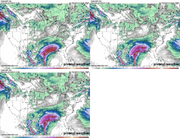
Seems to have an earlier onset for us too. If that’s right then you and I should have 1-2” on the ground by early evening FridayIt’s the coldest model atm View attachment 161200View attachment 161201View attachment 161202View attachment 161203
RGEM and Canadian overdue freezing rain big timeNot gonna lie, this is concerning. This is getting into the RGEM’s wheel house.
View attachment 161206
RGEM and Canadian overdue freezing rain big time
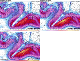
I really think this is what the Carolinas need to focus on here going forward. I hope that the models are doing the typical bias of underestimating the lift and QPF this can generateFairly typical overrunning event here in the SE US on Friday.
Mid-level warm advection and isentropic upglide are the main forcing mechanisms for generating precip here.
Both are staples of southern slider events like this.
View attachment 161208
View attachment 161209


What's odd is the Euro/ICON/Euro AI don't have the warm nose at 700mb for the upstate. they're all -2 to -3C for the whole event.
The GFS/NAM/RGEM are al locked in on a 1 or 2C warm nose poking in there around 5-7pm.
Yea I'm counting on a flip to sleet late Friday afternoon here. Just hoping it's only after the best rates are finishing up.Some of that is the pattern looks a little different on those other models, but the euro is just dog water with warm noses and CAD in general. Tried to keep most of central VA snow during this last winter storm and that obviously didn’t pan out.
Yea I'm counting on a flip to sleet late Friday afternoon here. Just hoping it's only after the best rates are finishing up.
I really think this is what the Carolinas need to focus on here going forward. I hope that the models are doing the typical bias of underestimating the lift and QPF this can generate
Yeah I wouldn’t worry about that here given what’s forcing this precip.

Hey Eric, will you be putting out a guess map for the Carolinas?
Sent from my iPhone using Tapatalk
I really think with the soil temperatures that we have now and the fact that we’ve still get two nights with temperatures down in the upper teens to lower 20s, that snow will start sticking basically from the start. Also that sun angle is still low as wellEuro AI continues to be the fastest with precip arrival too. It hasn't waivered from that. Has snow starting in Clemson,SC at 7am Friday and has a couple inches on the ground by 1pm.
Most other models don't start until 10am-noon and accumulations not starting until around 1pm or so.
Maybe 4 am Friday?What time is this supposed to arrive in ATL im trying to miss work
It varies by model but basically early 4-8am FridayWhat time is this supposed to arrive in ATL im trying to miss work
That 8-10” stripe creeping into WGA is intriguing6z AI...been rock solid for places west of NC...for Raleigh the writing on the wall.
View attachment 161224View attachment 161225
I agree if we're focusing on the higher ratios (bigger storm), but I did like how the 2" mark stabilized in S. Virginia. 2-3" of snow would be a win in my book.6z AI...been rock solid for places west of NC...for Raleigh the writing on the wall.
View attachment 161224View attachment 161225
That’s early enough to miss work, nice!It varies by model but basically early 4-8am Friday
It always seems too due to multitude of factors timing, elevation, frontogenesis in big storms a small stretch on the west side always gets a surprise bump in snow.They 8-10” stripe creeping into WGA is intriguing
Trending south and colder with the west to east slider look while others are blasting the warm nose north and east. Take a blend I guess or maybe the new kid on the block scores???6z AI...been rock solid for places west of NC...for Raleigh the writing on the wall.
View attachment 161224View attachment 161225
