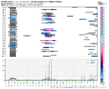
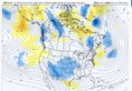
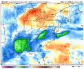
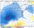
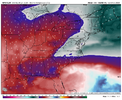
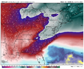
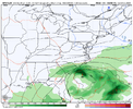
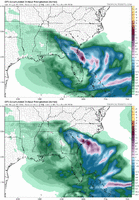
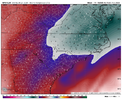
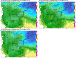
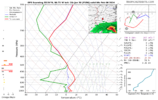
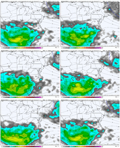
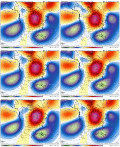
Since the 2nd half of Feb is coming into view on the models breaking this out into its own thread. Hopefully this changes our luck or we can write a nice eulogy for it at least
-
Hello, please take a minute to check out our awesome content, contributed by the wonderful members of our community. We hope you'll add your own thoughts and opinions by making a free account!
You are using an out of date browser. It may not display this or other websites correctly.
You should upgrade or use an alternative browser.
You should upgrade or use an alternative browser.
Pattern FEB 3-6 2024 System
- Thread starter SD
- Start date
- Status
- Not open for further replies.
iGRXY
Member
CltNative90
Member
I’ll be about 30 miles north of there as the crow flies at about 3500 feet, so hoping I chose the right weekend when I scheduled back in December.EPS fairly bullish for AVL still...I do think someone sees snow from this day 6 deal
View attachment 144380
Still think we have a long ways to go with this one and interested to see which model wins the battle. Even though I’ll be in the mountains, I’ll still take it as a win if areas to the east see their first flakes in two years and I’m stuck high and dry.
Last edited:
RAH afternoon comments:
It still looks like the ridge may hold over much of central NC as the low
skirts to the south. The best chance for precipitation will be as
the low moves through the Southeast and along the Southeast US Coast
Sun night through Mon night. For now, will keep all precipitation
liquid. However, changes to the track/timing of the low or strength
of the ridge could impact the chances, amounts, and types of
precipitation with this system. As such, while not ruled out
completely, confidence remains too low to include wintry precip at
this time. Highest amounts/chances expected along the SC/NC border,
with the possibility that much of the area could stay dry if the
track of the low continues to trend southward.
severestorm
Member
Asheville will be too warm IMO. Will need to gain elevation to see some flakes.EPS fairly bullish for AVL still...I do think someone sees snow from this day 6 deal
View attachment 144380
Been watching the models. Don't think this is the one. Crossing fingers for later in the month.
NCSNOW
Member
You are sitting good for the 3rd week of Feb holly Grail pattern. It will mimick what we saw just a couple weeks back.Been watching the models. Don't think this is the one. Crossing fingers for later in the month.
GoDuke
Member
Would you mind posting this for Boone?EPS fairly bullish for AVL still...I do think someone sees snow from this day 6 deal
View attachment 144380
severestorm
Member
Weaker and 540 line is gone.
You talking about the ss low? It's a tad weaker but I wouldn't focus too much on that right now.Weaker and 540 line is gone.
severestorm
Member
Where the cold air with the 540 line in Maine and Canada.You talking about the ss low? It's a tad weaker but I wouldn't focus too much on that right now.
We're all looking for the cold air. I don't think anyone has found it yet. But I promise you it won't be from the southern stream. We need to be looking at the evolution of the ridge and the energy around the northeast low. You need a handshake, merger, integration (whatever you want to call it) between the 50ish/50ish and the southern low in order to draw cold air into the system and the area.Where the cold air with the 540 line in Maine and Canada.
Losing the deeper southern wave is actually good here the icon and cmc were the most wound up and northWe're all looking for the cold air. I don't think anyone has found it yet. But I promise you it won't be from the southern stream. We need to be looking at the evolution of the ridge and the energy around the northeast low. You need a handshake, merger, integration (whatever you want to call it) between the 50ish/50ish and the southern low in order to draw cold air into the system and the area.
rburrel2
Member
GFS actually is colder aloft especially with the CAA on the backside closer to the CMC at least
Blue_Ridge_Escarpment
Member
850s much colder this run!
Blue_Ridge_Escarpment
Member
Precip further north this run and with the 500mb setup, there would be more precip on the NW side. Just get the cold aloft locked in.
rburrel2
Member
It's far from settled but the 12z/18z Modeling seem to really like the Southern east-facing mountains in NC/SC. Up-side potential there is huge if they get mostly snow and jackpot on the pivot.
WNC would have had a nice hit there had it thrown moisture back westthis is why I can’t just let go of this one View attachment 144393View attachment 144394View attachment 144395View attachment 144396View attachment 144397
Are we thinking we can’t get a shift NW with this…this is why I can’t just let go of this one View attachment 144393View attachment 144394View attachment 144395View attachment 144396View attachment 144397
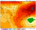
The gfs made a pretty big northward adjustment with precip. And the euro ensembles had more hits as well at 12z..models have changed so much with this threat but would not suprise me to see southern stream trend better up until 0 hour. Pretty potent southern stream. Just keep the NE vortex and we might be cooking.Precip further north this run and with the 500mb setup, there would be more precip on the NW side. Just get the cold aloft locked in.
Sent from my SM-A236U using Tapatalk
There will certainly be the typical “precip shield underdone” discussions if this general look holds for a few more days
Just not gonna be cold enough in our neck of the woods Jimmy. Or atleast not mine.There will certainly be the typical “precip shield underdone” discussions if this general look holds for a few more days
No. GEFS won’t let go of those 15-20% big dog members in the upstate which is keeping me here I guess. I wish they’d fall off the table when the ensemble means come out at 18z so I could just be doneJust not gonna be cold enough in our neck of the woods Jimmy. Or atleast not mine.
The 500mb set up screams there to be more precip further north and west with that look. This is why we say the most important piece to nail down right now is the cold source. With the strong STJ, any system should amp up a good bit.this is why I can’t just let go of this one View attachment 144393View attachment 144394View attachment 144395View attachment 144396View attachment 144397
I like this but for some reason don't believe it.I mean come on this is stupid close this is a epic tease off a viagra or gas station rhino pill View attachment 144401View attachment 144402
Look at the height field orienting straight north to south now above the southern ULL. This is what we want to see.Come on just touch and make love already View attachment 144404
Snow mean is down a little more on the gefs, but everything else looked better, even colder aloft
ull path ticked south and weaker a hair, does not surprise meSnow mean is down a little more on the gefs, but everything else looked better, even colder aloft
From what I could tell, the 18z GDPS was a touch better verbatim. Would've had a slightly stronger cold push but a weaker ULL. It only goes out to 84hrs but looked better compared to the 12z.
- Status
- Not open for further replies.

