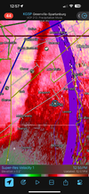
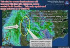
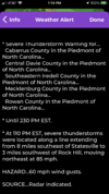
Just got really calm behind that line
-
Hello, please take a minute to check out our awesome content, contributed by the wonderful members of our community. We hope you'll add your own thoughts and opinions by making a free account!
You are using an out of date browser. It may not display this or other websites correctly.
You should upgrade or use an alternative browser.
You should upgrade or use an alternative browser.
Severe Jan 8-11 2024 System Severe
- Thread starter SD
- Start date
Forevertothee
Member
Its above 60 in Greenwood and right at 60 in Clinton. The warm front is lifting N.Still at 38 here. Solid breeze but it's still coming out of the NNE right now so the wedge is winning. Tons of rain that hasn't slacked up since I've been awake
Downeastnc
Member
When the warm front passes you gonna know it. Just hit Kinston,NC temp jumped 10 degrees and winds gusting to 40 after calm and cool in the wedge.....
Yeah. I'm in greenwood. Severe thunderstorm warning right now. I want this thing to hit and pass already.Its above 60 in Greenwood and right at 60 in Clinton. The warm front is lifting N.
Already lost power in Hillsborough. And it's just now starting to get windy. Doesn't boad well for later.
RisingFawnGA
Member
rusrius
Member
Just heard 2 transformers blow out near me from the wind.
RisingFawnGA
Member
I have multiple trees down or leaning heavily at my house. Wind was definitely a problem overnight
Concerning from rah
The more unstable air mass has developed and moved inland a little
faster than expected across the southern and eastern Carolinas with
the dew point up to 62 at Clinton and 63 at Marion SC. With a bigger
lull in the precipitation than expected, the air mass to the
southeast of Raleigh is a bit more primed for stronger convection
than perhaps previously thought and it is a bit worrisome. The
recent HRRR brings a forecast Sig Tor parameter of 2-4 across the
southern Sandhills and southern Coastal Plain between 4 and 8pm.
Will need to monitor this closely.
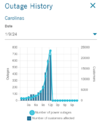
Near the border of NC/SC power outages climbing quickly. https://poweroutage.us/area/state/south carolina
Forevertothee
Member
Tornado watch for southern Upstate to the coast.
iGRXY
Member
Well I've been stuck in the low 40's and the front just passed so the winds will be flipping from the west with more cold air. Wedge won in CAD prone areas of the northern upstateIts above 60 in Greenwood and right at 60 in Clinton. The warm front is lifting N.
Max gust of 35.5 mph in the southern foothills as the line passed by.
Nothing here right now. No wind, no rain. Just cloudy.
- Joined
- Jan 23, 2021
- Messages
- 4,602
- Reaction score
- 15,197
- Location
- Lebanon Township, Durham County NC
Are you the hospital side or closer to downtown?Already lost power in Hillsborough. And it's just now starting to get windy. Doesn't boad well for later.
NBAcentel
Member
60F and rising
- Joined
- Jan 23, 2021
- Messages
- 4,602
- Reaction score
- 15,197
- Location
- Lebanon Township, Durham County NC
That sig tornado parameter was up around ten in the pee deeConcerning from rah
The more unstable air mass has developed and moved inland a little
faster than expected across the southern and eastern Carolinas with
the dew point up to 62 at Clinton and 63 at Marion SC. With a bigger
lull in the precipitation than expected, the air mass to the
southeast of Raleigh is a bit more primed for stronger convection
than perhaps previously thought and it is a bit worrisome. The
recent HRRR brings a forecast Sig Tor parameter of 2-4 across the
southern Sandhills and southern Coastal Plain between 4 and 8pm.
Will need to monitor this closely.
80 mph winds in the Raleigh radar at 3k ft
I'm very close to the hospital.Are you the hospital side or closer to downtown?
Rain and wind have basically stopped here in Athens.
We received 4.74" of rainfall total with a max wind gust of only 14mph.
We received 4.74" of rainfall total with a max wind gust of only 14mph.
NoSnowATL
Member
106mph is the highest gust I can find for my area.
EastmanGAWX
Member
There was a confirmed 92 mph wind gust in Lee County, GA and a 68 mph gust in Warner Robins.
Downeastnc
Member
The WF definitely announces its arrival View attachment 140864
Any sun the next several hrs would be bad...
ENCSnowdawg
Member
Had a few peaks of sun before this heavy rain coming in from our southAny sun the next several hrs would be bad...
Front just swung through my area with some fog and a quick wind shift.
46.9F
3.7" total rain
46.9F
3.7" total rain
iGRXY
Member
Serious flooding near me right now. several creeks are running high and standing wanting on a lot of back roads.
severestorm
Member
Just saw this from our local News in B'ham;
"Panama City Beach tornado causes heavy damage, demolishes buildings"
"Panama City Beach tornado causes heavy damage, demolishes buildings"
Business starting to pick up here. Now into the 60s and winds are whipping.
Shaggy
Member
Wind has really started cranking here the last 30 minutes.
56 and rain here. A little windy.
MichaelAndrews
Member
Working in Gaston SC
(About 12 miles SW of CAE) and things are starting to really deteriorate now
That nasty red line on the radar is closing in
(About 12 miles SW of CAE) and things are starting to really deteriorate now
That nasty red line on the radar is closing in
I think the rainfall totals are going to be underestimated from this storm in the RDU area. My rain gauge is already at 1.29 inches and and the squall line with the heaviest rain is still hours away. These straight line winds are some of the strongest I have ever witnessed behind a warm front.
severestorm
Member


