Shaggy
Member
64?When the guys who build roads use the sun as their direction survey. This road sucks in the evenings.
Nope 13 between greenville and farmville
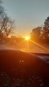
Back when I had cable (and access to The Weather Channel) I used to record the Local on the 8s during major weather events that happened here. This was one of those weather events I archived a lot of clips of hours before, during, and right after. Ironically, TWC was the most accurate on snowfall totals in my area. At one point the morning of this event they were forecasting 5-9 inches. I got 6.5 inches (with a glaze of ice on top). NWS and most of the local mets were calling for 2-4 inches. I think the southside where the airport is only got about 3-4 inches, but they got screwed by that warm nose from the changeover to sleet/freezing rain. This winterstorm is a perfect example of why I'm glad I live inside the perimeter NORTH of I-20.?12 years ago..my all time favorite snowstorm View attachment 129882View attachment 129883
It’s possible but I’ve always been disappointed. They’ll shut down the park roads but you can always take the tram to Ober.didnt want to clutter jan thread but think gatlinbufg itself "not a cabin with elevation "gonna be worth going to??
The jet in the E Pac is going to collapse over the next 5-6 days. Meanwhile, there will be a new jet extension in the W Pac that kicks out off E Asia beginning on day 3 (Jan 14).
As we go out in time into the last 10 days of Jan, there are going to be competing forces that will likely play a role in determining how much this next jet extension pushes east.
The MJO tropical forcing is likely to become active in the Indian Ocean (Phase 2-3) which is a setup that favors limited jet extension, leading to a -PNA pattern.
In contrast, the developing height anomaly pattern over Asia of ridge in west & central Asia and trough in E Asia is one that will favor surface high pressure systems dropping down into E Asia, which typically leads to momentum being added into the Pac Jet as low pressure systems exit E Asia and head toward the Aleutian Islands, leading to a -EPO and/or +PNA pattern.
I'd say I'm 50/50 on it at the moment in terms of how this will lean for the last week of Jan into the beginning of Feb.

Back when I had cable (and access to The Weather Channel) I used to record the Local on the 8s during major weather events that happened here. This was one of those weather events I archived a lot of clips of hours before, during, and right after. Ironically, TWC was the most accurate on snowfall totals in my area. At one point the morning of this event they were forecasting 5-9 inches. I got 6.5 inches (with a glaze of ice on top). NWS and most of the local mets were calling for 2-4 inches. I think the southside where the airport is only got about 3-4 inches, but they got screwed by that warm nose from the changeover to sleet/freezing rain. This winterstorm is a perfect example of why I'm glad I live inside the perimeter NORTH of I-20.?
A good benchmark for us for cold is for the ridge axis to run right up the W Canada / British Columbia coast…but it also depends on ridge tilt / ridge orientationJust trying to learn a bit more but based off of the latest models wouldnt we want the peak of the ridge on the west coast to be more towards CONUS?


More severe in Atlanta. Yay...I have a work trip scheduled to Chicago on 1/23 flying back on the 24th. Just jinxed this look:
We are the biggest suckers for a snow map...atleast I am.Lol don't fall for it boys. It ain't happening.
Jk. You guys can ? this thing west.

I'm already waiting for 18z nam
Fortunately we get the 18z HRRRRRRRRRRRRRRRRRRRRRRRRR before that.... wooohooo, let's do thisI'm already waiting for 18z nam
When is the WRF-ARW283 out? That thing likes to throw a bone or 2Fortunately we get the 18z HRRRRRRRRRRRRRRRRRRRRRRRRR before that.... wooohooo, let's do this
Nice, good luck! I am assuming you are staying near Ober Gatlinburg with that elevation?Booked a condo at 2900 feet till Saturday morning near Gatlinburg. I know it’s not a slam dunk set up but this is one of the only weekends I could do a trip work wise. Hoping for 4-5 inches but I’ll take whatever! We will see y’all send some mojo ??
Yep! Right up the street from itNice, good luck! I am assuming you are staying near Ober Gatlinburg with that elevation?
It’s out and it says you’re f*cked. Drive to north Myrtle ?When is the WRF-ARW283 out? That thing likes to throw a bone or 2

If it doesn’t snow there take the gondola up to Ober and stay with @Parker ?Booked a condo at 2900 feet till Saturday morning near Gatlinburg. I know it’s not a slam dunk set up but this is one of the only weekends I could do a trip work wise. Hoping for 4-5 inches but I’ll take whatever! We will see y’all send some mojo ??
I'd say it's a pretty safe bet you will see at least 2-3" but 6-8" does not seem out of the question.Yep! Right up the street from it


RIP to my flagpole ?View attachment 129976

Arctic front a couple weeks ago got mine. We will rebuild!