• Hello, please take a minute to check out our awesome content, contributed by the wonderful members of our community. We hope you'll add your own thoughts and opinions by making a free account!

Pattern Dazzling December

This is nothing like 2021. Not even close.


Sent from my iPhone using Tapatalk
Actually if we flood Alaska with low pressure then it’s pretty similar progression to jan 2021, but options are on the table
1. We either dump a piece of energy cleanly into the pacific and flex the western ridge, get minimal interaction between that energy that enters AK and the Canadian TPV and we get a big chunk of the TPV under the block successfully, and we get rockin and rolling
2. There some interaction between the Canadian TPV and the energy diving in AK, but not enough interaction so we get a solid piece of the TPV but not the whole thing, it’s a bit murky out west but energy rounding the NPAC ridge eventually rexes the pacific and heights are raised out west. still a solid option
3. We get a ---- ton of interaction between the Alaskan energy and Canadian TPV, so the Alaskan energy pulls the TPV out of Canada, and nothing gets under the block, energy dumps out west as the energy dives out of Alaska and the energy rounding the NPAC ridge feels the less backed up/retrogressive flow. At best we get cutoff lows. That’s pretty similar to 2021
I’d go with option 2 to in between 1-2 for now, that EPS run was glorious so I’m not to worried
One big difference between right now and Feb 2021 is the MJO. I remember back then, we were very concerned before hand that it was starting to amp up and not in a good phase and it ended up flexing the SER. Now we’re seeing the MJO low amp and in good phases headed for COD
 
I'm gonna chime in right quick and say that the GFS and the ensembles have been inconsistent as of late. The Euro suite, although not perfect, has been fairly consistent and is known for a better track record and verification skill scores prove it. The pattern ahead is complex and it will take awhile for the models to settle down imo.

Sent from my SM-A136U1 using Tapatalk
 
If you thought we were going to get perfect model runs over and over you haven’t been doing this long enough. Models during normal times are wonky and inconsistent but during a pattern change with a -NAO block like we are going to see just makes that worse and worse. The MJO going low amped and COD phases is a huge plus and advantage that we see more downstream ridging along the west coast. I think we get enough relaxation out west to even get just a neutral PNA. Don’t live and die by every run. We have cold air availability right on our doorstep and it’s not going to take much to dislodge pieces or all of it towards the US.
 
I think we need to take a step back and take a breather. We’ve had positive trends for like a week straight .. I don’t think a small step back from some 18z runs is that big of a deal. Also the down stream effects still really shouldn’t be expected until mid to late December. Let’s get a consistent day or so of these “negative” trends before we start throwing the towel in after we don’t see a snowstorm on every run ?
 
It’s crazy how the models, and even the ensemble versions, can go from absolutely dreamy to disastrous in one 24 hour period, and even from one run to the next.
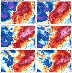
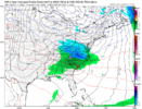
Below is the GEFS Dec 9-14 from yesterday’s 18z run compared to today’s 18z run for the same time frame. Nevertheless, the Euro and EPS midday today looked solid… it will be interesting to see if the Euro deterministic model will follow today’s 18z GFS’s and GEFS resolution.

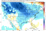
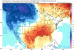
Bad news bears from the GFS ensm below. Memphis, Tennessee had a 10° F change between the two images for the same 5 Day Timeframe. As everyone is saying, it will really come down to whether the -PNA digs southwest, pumping the ridge over the East US, even with a -NAO signature still in place. One major factor that has been discussed more infrequently is the plume of warm waters across the North Pacific, or to the south and west of the Aleutian Islands, Alaska. Such a strong SST anomaly earlier this Summer, Fall and now winter has led to a very persistent top to bottom high pressure system there, and this has allowed a strong negative EPO underneath. What would help dissolve the -PNA is if this high pressure mass migrated to the north and east, more towards the Gulf of Alaska & Alaska itself, with the -EPO backing off to the west slightly and combining with low pressure off Asia (which would be a good thing for us). If the high pressure system off the Aleutians eventually migrated north and east, that would be a Golden Setup for the Eastern US. The CFS has that resolution for Dec 15-21. Will link the image next.

DEA6B08D-6B78-45F2-A37B-95E2B4F3B575.pngDBA7BF73-2DE2-4252-965A-E1AA3CF00D0E.png
 
Last edited:
B8803964-D785-4D66-9326-B0149E1304EC.jpeg
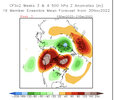
Week 3 December 15th - December 21st CFSv2 looking solid with the ridge currently over the Aluetian Islands migrating to the East and North to Alaska with the -NAO still persistent. CFS says goodbye to the -PNA in this resolution. This would be a best case scenario; wouldn’t get my hopes up considering how volatile models have been.
 
Back
Top