They had a hotdog cannon, that shot hotdogs into the crowd! Think I found heaven! Currently 78
-
Hello, please take a minute to check out our awesome content, contributed by the wonderful members of our community. We hope you'll add your own thoughts and opinions by making a free account!
You are using an out of date browser. It may not display this or other websites correctly.
You should upgrade or use an alternative browser.
You should upgrade or use an alternative browser.
Pattern August '22
- Thread starter Detective WX
- Start date
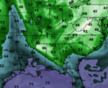
Someone find me some smelling salts both 0z GFS and Euro showing major cracks in summer for the East in the mid to long range.
Winter storm Warning for NE Alaska.
1Weather
A Winter Storm warning is in place for northeastern parts of the Brooks Range, Alaska, through Sunday morning. A storm system, cool air and plenty of moisture will result in the region's first significant snowfall of the season. Over 8 inches of snowfall is likely at higher elevations and this could cause travel difficulties in the Dalton Highway.
1Weather: Forecast and Radar
The all new 1Weather experience is here, get live weather forecast & alerts, health centre to monitor air quality, down-to-the minute forecasts & 25+ Radar Maps. Trusted by 50M+ users in USA, get the most accurate weather data with our iOS app
View storm tracker, tornado warning, today’s &...
1weather.onelink.me
BHS1975
Member
August cool spell. Happens every year.Someone find me some smelling salts both 0z GFS and Euro showing major cracks in summer for the East in the mid to long range.
See no reason to think rain is realistic around here through day 16. Maybe a few storms today likely west of US1. Maybe a few storms on Wed Thursday with the front but based on history they usually under perform and its looking less impressive on the models to me. Once the front passes you can forget rain chances for 5-7 days. Think less than .5 of rain here for the month is a slam dunk. Really hoping for less than .13 to finish the summer at a pathetic 6
Could be but if that big ridge gets anchored over the west coast, summers days are numbered.August cool spell. Happens every year.
Me too. Not mowing has been awesome.See no reason to think rain is realistic around here through day 16. Maybe a few storms today likely west of US1. Maybe a few storms on Wed Thursday with the front but based on history they usually under perform and its looking less impressive on the models to me. Once the front passes you can forget rain chances for 5-7 days. Think less than .5 of rain here for the month is a slam dunk. Really hoping for less than .13 to finish the summer at a pathetic 6
I think there will be a few days scattered in there with more convective activity due to factors that the models can't resolve well. But widespread soaking rains look unrealistic for the foreseeable future.
RAH is pumped about the drier forcast next weekend must be nice to live somewhere that gets rain and can say that.Me too. Not mowing has been awesome.
I think there will be a few days scattered in there with more convective activity due to factors that the models can't resolve well. But widespread soaking rains look unrealistic for the foreseeable future.
Given their record lately, I'd expect rain chances to ramp up as we head toward the weekend. Whenever they're bullish on rain, rain chances always ramp down as we move in.RAH is pumped about the drier forcast next weekend must be nice to live somewhere that gets rain and can say that.
I got VERY luck last night and got under a cell that gave us 3" in about an hour. Just to the east and north of me was nothing, I was right on the edge. Just west of me should have done even better.
Last edited:
Detective WX
Member
Mowed the yard last evening; not even 20 minutes after I got done, the heavens opened up. I guesstimate 2" in my neighborhood. This summer is reminiscent of 1994, 2003, 1992, 2005 and 2013.
Although we have an unfortunately drier than average forecast I’ve r the next few days area wide.. I do see chances of rain not disappearing over the next couple weeks. In fact there seems to be many different pieces of energy moving in to keep rain chances up after this dry period which should help keep significant drought concerns at bay.. other than at @SD house where there will always be a perma drought.
whatalife
Moderator
Nice 1.75” of rain over the last two days. Wasn’t really expecting that.
smast16
Member
smast16
Member
I have to be cursed. Still sitting in full su
View attachment 120516
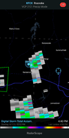
Less than a mile away 0.75"+ or grater.
95
0.00 same ---- different day
0.00 same ---- different day
smast16
Member
Tropical or bust.95
0.00 same ---- different day
And I typically hate them. But a CAD rain has never sounded so good.
I'd take 33/rain right now. So tired of summerTropical or bust.
And I typically hate them. But a CAD rain has never sounded so good.
looking good:
From RAH:
Wednesday appears likely to be the hottest day of the week, with
most locations rising into the low to mid 90s. Heat indices should
approach, but fall short of heat advisory criteria of 105. Thursday
should be a transition day with temperatures, but by the weekend,
high temperatures in the 90s should be very isolated with most
locations in the 80s. After one more night of lows in the 70s
Wednesday night, temperatures will be cooler Thursday night, and by
Saturday morning, locations near the Virginia border could drop into
the upper 50s with 60s elsewhere.
My Grid forecast:
Friday
Sunny, with a high near 83.
Friday Night
Mostly clear, with a low around 62.
Saturday
Sunny, with a high near 82.
Saturday Night
Mostly clear, with a low around 60.
Sunday
Sunny, with a high near 85.
**Not cool and crisp, but this will still feel wonderful.
0z and 6z GFS and the 0z Euro both support heat and humidity through mid-week before a front moves through the area, bringing a greater chance for showers and storms and lower temps and humidity for late week. Both show a general troughing in the east through days 10-12 before hints of ridging returns (on the GFS) days 14-16. 6z also shows a couple of SE tropical threats, though the systems remain offshore.
All in all, we should get a nice taste of fall with highs on a couple of days maybe struggling to get to 80.
Looks
All in all, we should get a nice taste of fall with highs on a couple of days maybe struggling to get to 80.
Looks
What a look.0z and 6z GFS and the 0z Euro both support heat and humidity through mid-week before a front moves through the area, bringing a greater chance for showers and storms and lower temps and humidity for late week. Both show a general troughing in the east through days 10-12 before hints of ridging returns (on the GFS) days 14-16. 6z also shows a couple of SE tropical threats, though the systems remain offshore.
All in all, we should get a nice taste of fall with highs on a couple of days maybe struggling to get to 80.
Looks
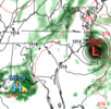
Bring it over my and @SD 's area. Although with our luck, we would just sit in the eye the whole time.6z GFS for Sunday the 21st. I'm supposed to leave for Hatteras the next day...Thank goodness this is still out in la la land.
View attachment 120525
StormDrain
Member
Thank god for the mid-level troughing to the W preventing landfall in that run
smast16
Member
These low dews that others are drooling over aren't about help either.I'd take 33/rain right now. So tired of summer
iGRXY
Member
GFS is heat happy in the LR so that remains to be seen. And as we get deeper into the month it’s going to be harder and harder for big time heat to happen. Hot days by the end of August is usually the upper 80’s around here vs 100’s. And by the time you get into early September, those averages start to drop like a rock. Summer in my opinion really has only a couple weeks left to get big time heat this way and only about a month left of summer time type weather - 80’s and humidity.
I wanted to say it but glad someone else did. I think I've made my thoughts on summer cold fronts well knownThese low dews that others are drooling over aren't about help either.
StormDrain
Member
Give me heat and storms over boring ass cold fronts in summer, unless they give way to epic heat waves
BHS1975
Member
It's been humid well into October the last several years making going to the state fair miserable. Dew points have also been in the mid 70s for months when that was usually more common near the coast.GFS is heat happy in the LR so that remains to be seen. And as we get deeper into the month it’s going to be harder and harder for big time heat to happen. Hot days by the end of August is usually the upper 80’s around here vs 100’s. And by the time you get into early September, those averages start to drop like a rock. Summer in my opinion really has only a couple weeks left to get big time heat this way and only about a month left of summer time type weather - 80’s and humidity.
Drizzle Snizzle
Member
It can certainly be humid in October, but the later in the year it gets, the more difficult it is to have consistent dewpoints in the 70s.It's been humid well into October the last several years making going to the state fair miserable. Dew points have also been in the mid 70s for months when that was usually more common near the coast.
Avalanche
Member
All this moisture and I still can't get a damn thunderstorm.It's been humid well into October the last several years making going to the state fair miserable. Dew points have also been in the mid 70s for months when that was usually more common near the coast.
LickWx
Member
Sea ice is high and no records were broken . Sorry man. October looks about the same as it always has . There were some hot octobers in the 1940s.It's been humid well into October the last several years making going to the state fair miserable. Dew points have also been in the mid 70s for months when that was usually more common near the coast.
Drizzle Snizzle
Member
LOL, Same here. I finally got a decent shower yesterday for the first time in a month. What good is having all this humidity if its not even going to rain ?All this moisture and I still can't get a damn thunderstorm.
Been consistently mixing into the 65-68 range in the afternoons pwats have also been fairly normal. We aren't exactly in a big tropical airmass
smast16
Member
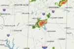
I won't bother you all with a screenshot, but another storm within 4 miles just to my south east moving NE. 
Avalanche
Member
Screenshot!!!!I won't bother you all with a screenshot, but another storm within 4 miles just to my south east moving NE.
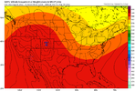
12z gfs is trying to retrograde the heat ridge all the way to the 4 corners. Not entirely sure I'd buy pushing it that far west but I'd love to see it.
In the meantime a few things to look forward to. The front and trough axis look slow enough we have 2 days of decent storm chances this week, I'd favor Wednesday to be more widespread. It also seems more likely quite a few folks in NC will make a run at a sub 60 degree low this weekend. Finally early to mid next week gets a little messy with the ridge anchored to the west and a number of small disturbances and mcvs riding in the flow. I still think this trough cuts off at some point
In the meantime a few things to look forward to. The front and trough axis look slow enough we have 2 days of decent storm chances this week, I'd favor Wednesday to be more widespread. It also seems more likely quite a few folks in NC will make a run at a sub 60 degree low this weekend. Finally early to mid next week gets a little messy with the ridge anchored to the west and a number of small disturbances and mcvs riding in the flow. I still think this trough cuts off at some point

