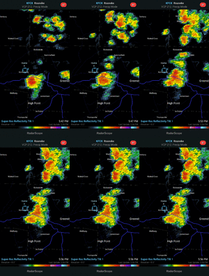
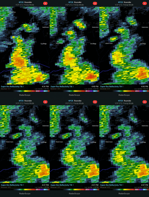
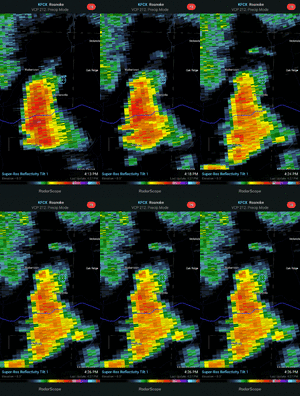
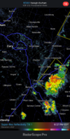
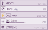
Virginia racking up on storms. Just saw one blowing up headed NE. Someone drops a match in the neighborhood, watch out. Fescue has gone back full blown dormant. No match for low 90s, espeacilly without rain.
-
Hello, please take a minute to check out our awesome content, contributed by the wonderful members of our community. We hope you'll add your own thoughts and opinions by making a free account!
You are using an out of date browser. It may not display this or other websites correctly.
You should upgrade or use an alternative browser.
You should upgrade or use an alternative browser.
Pattern August '22
- Thread starter Detective WX
- Start date
smast16
Member
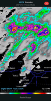
Yeah Va has been getting hammered, lots of radar estimates of 3-5"Virginia racking up on storms. Just saw one blowing up headed NE. Someone drops a match in the neighborhood, watch out. Fescue has gone back full blown dormant. No match for low 90s, espeacilly without rain.
Avalanche
Member
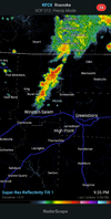
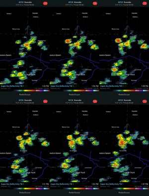
She's a beauty Clark!!!Can't catch a storm for anything.View attachment 120451
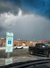
So close. I can see and smell the rain while I'm sitting in full sun
View attachment 120453
Brent
Member
Winter Storm Warning in Alaska
Soon summer will be over...
Soon summer will be over...
smast16
Member
Outside of a couple days late next week, blistering heat as far as the eye can see on the 0z GFS, as the ridge dominates over the entire southern US. 6z is much different in that it moves to and keeps general troughing in the east. Bone dry outside of TN through 300 hrs, though. Hard to bet on that solution and go against the persistent ridge. If I were forecasting, I'd go with a 3 day break before returning back to big ridging and heat. Looking forward to late September.
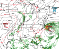
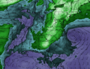
Yep, it shows an extratropical storm off our coast that helps pull down dewpoint in the 40s and 50s nearly down to Florida. Would be nice, but we'll see if it shows up in future runs.Outside of a couple days late next week, blistering heat as far as the eye can see on the 0z GFS, as the ridge dominates over the entire southern US. 6z is much different in that it moves to and keeps general troughing in the east. Bone dry outside of TN through 300 hrs, though. Hard to bet on that solution and go against the persistent ridge. If I were forecasting, I'd go with a 3 day break before returning back to big ridging and heat. Looking forward to late September.
6z GFS hour 228:
Dew point:
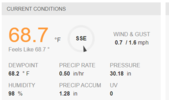
I feel ya, I got a trace (Summerfield) but literally heard thunder for 5 straight hoursLast 1" storm was 2 days in Early July, the 5th and 9th. Before that it was May.
View attachment 120463
10 miles away are sitting in 2+ rainfall, and 30 miles away in 4+.
View attachment 120462
Drizzle Snizzle
Member
Are you going to the Field of Dreams Game ?In Des Moines today for Iowa Cubs game! It was nice knowing y’all! ? View attachment 120468
I've just done the math and DFW has had 13.14" rain this year, not a lot.Obviously there's still August to get through, but for Dallas, the May-June-July 2022 period was the hottest on record, tying with 1998.
Been like that all summer here. I've been under 5 severe thunderstorm warnings over a 10 day stretch, featuring probably 15 hours of thunder, and I picked up a whopping .12" of rain.I feel ya, I got a trace (Summerfield) but literally heard thunder for 5 straight hours
NAH, they have a lottery for a chance to buy tickets, I entered, but didn’t get selected! I live 30 minutes from the field thoAre you going to the Field of Dreams Game ?
Iceagewhereartthou
Member
Today
88°/69°Scattered Thunderstorms
40%
S 4 mph
Sun 07
86°/69°Scattered Thunderstorms
50%
SE 4 mph
Mon 08
87°/69°Scattered Thunderstorms
52%
SW 5 mph
Tue 09
88°/69°PM Thunderstorms
43%
SW 8 mph
Wed 10
88°/69°Scattered Thunderstorms
43%
WSW 10 mph
Thu 11
84°/65°Scattered Thunderstorms
58%
WSW 7 mph
Fri 12
85°/65°Partly Cloudy
20%
NE 6 mph
Sat 13
84°/65°Mostly Sunny
16%
ENE 7 mph
Sun 14
85°/65°Partly Cloudy
19%
E 7 mph
Mon 15
86°/65°Mostly Sunny
19%
E 7 mph
Tue 16
88°/66°Mostly Sunny
19%
WSW 6 mph
Wed 17
89°/67°Isolated Thunderstorms
33%
WSW 7 mph
Thu 18
88°/67°Scattered Thunderstorms
52%
W 6 mph
Fri 19
88°/67°PM Thunderstorms
57%
WSW 6 mph
Sat 20
89°/68°Overall, I'd take this any August! Starting to see the light at the end of the torture summer tunnel; Fall stuff in stores... its coming guys!! ?
? ?
I'm not that far above thatI've just done the math and DFW has had 13.14" rain this year, not a lot.
My new favorite is being under a FFW and it not rainingBeen like that all summer here. I've been under 5 severe thunderstorm warnings over a 10 day stretch, featuring probably 15 hours of thunder, and I picked up a whopping .12" of rain.
Drizzle Snizzle
Member
To be fair, fall stuff was in stores in June lol.Today
88°/69°
Scattered Thunderstorms
40%
S 4 mph
Sun 07
86°/69°
Scattered Thunderstorms
50%
SE 4 mph
Mon 08
87°/69°
Scattered Thunderstorms
52%
SW 5 mph
Tue 09
88°/69°
PM Thunderstorms
43%
SW 8 mph
Wed 10
88°/69°
Scattered Thunderstorms
43%
WSW 10 mph
Thu 11
84°/65°
Scattered Thunderstorms
58%
WSW 7 mph
Fri 12
85°/65°
Partly Cloudy
20%
NE 6 mph
Sat 13
84°/65°
Mostly Sunny
16%
ENE 7 mph
Sun 14
85°/65°
Partly Cloudy
19%
E 7 mph
Mon 15
86°/65°
Mostly Sunny
19%
E 7 mph
Tue 16
88°/66°
Mostly Sunny
19%
WSW 6 mph
Wed 17
89°/67°
Isolated Thunderstorms
33%
WSW 7 mph
Thu 18
88°/67°
Scattered Thunderstorms
52%
W 6 mph
Fri 19
88°/67°
PM Thunderstorms
57%
WSW 6 mph
Sat 20
89°/68°
Overall, I'd take this any August! Starting to see the light at the end of the torture summer tunnel; Fall stuff in stores... its coming guys!! ?
? ?
smast16
Member
smast16
Member
Different day, same result.
View attachment 120479
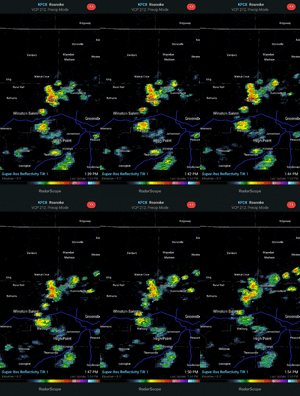
If you live in NC I wouldn’t be expecting any type of good rainfall for the next 3 or so days like the past few days. Maybe close to the mountains have better odds but other than that we need better forcing you get things more organized for more people. If you happen to get a thundershower you’re one of the lucky ones!
smast16
Member
smast16
Member
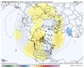
Let me guess, January and February are a blowtorch?What’s a time to be alive for the euro weeklies… a December to remember!!! That PNA coming back to give all the good girls and boys more presents for having to deal with this heat! View attachment 120464
Only 95 today big W
BHS1975
Member
Had a split. But got another to wet things pretty good for about an hour. Like most everyone else, we need days and days of this to balance everything back out. These 90 degree plus days, day after day show no mercy to anything AG related.
2.4 today. 17.7 since June 1st. Didn't figure I'd come close to last summers 18.2 after only getting 2.6 in June. The last 2 summers I now know what's it's like to live in Concord NC or Buford GA in summer! @Myfrotho704_ @BufordWX
JHS
Member
Looks like the desert has come back here for now. Storms getting close by, but missing me the last few days.
nice deluge this evening. CHA picked up about 1.5", with 0.35" of that coming in 5 minutes (rain rate of 4.20"/hour). 
The 18z GFS is still hot but that 500mb pattern……
GeorgiaGirl
Member
Finally getting the first good rain I've had in a while right now...

