-
Hello, please take a minute to check out our awesome content, contributed by the wonderful members of our community. We hope you'll add your own thoughts and opinions by making a free account!
You are using an out of date browser. It may not display this or other websites correctly.
You should upgrade or use an alternative browser.
You should upgrade or use an alternative browser.
Pattern July '22
- Thread starter Detective WX
- Start date
Yeah a few folks gonna get smoked tonightMe reading the rah disco View attachment 119808
5.1" of rain here last night. Compared with a neighbor to be sure and he had the same thing.
BHS1975
Member
Juicy.

3k has some near 10 inch bullseye around the area through Sunday am. Wow
lol at the 12z GFS. "Cold front" cancel here for next week.
15Z HRRR has tonight's rain a bit further south for SE NC
Already 98*F at noon. May be the hottest day of the year.
I try to like summer but just can't! The storms are nice when they come, but this humidity is just disrespectful! I don't know how you guys that live in areas where dews push 80 stand it. My dews are in the low 70s and it's just absolutely oppressive.
iGRXY
Member
Easily the worst season of them all. That's why I never understood why people were rooting for heat and humidity back in spring when it was still cool to cold outside for that time of year. Heat, humidity, and begging for pop up afternoon storms to suppress potential drought conditions every year just isn't enjoyable to me. And I've been lucky enough to escape the extreme heat that others towards the coast and midlands got for 2 weeks and this week. Hottest day was 98 here during that heat wave a few weeks ago. This week's heat wave has been limited due to the storms and generally cloudy to mostly cloudy conditions here. But it's still awful outside. Ready for fall. Counting down the days to September and October.I try to like summer but just can't! The storms are nice when they come, but this humidity is just disrespectful! I don't know how you guys that live in areas where dews push 80 stand it. My dews are in the low 70s and it's just absolutely oppressive.
Brent
Member
Ventusky is showing widespread highs of 115°F to 120°F across the Central/Southern Plains on 7/21, which would shattered any all-time highs.
I'm sorry but nobody here is remotely excited about that. The TV mets have said on air they are hoping we are not headed for a 2011 repeat
The good news is the long range models have been too hot so far. Yeah this has been hot but we haven't approached the all time records like some runs had
GarnerNC
Member
Goes to show that complaining can pay off.

Good & Great rains here around Topsail yesterday & Today..
More incoming as I type..
Current Obs..
Rain & Thunder..
78F
Pressure 29.99 in
Visibility (Limited)
Clouds : Cloudy /T-storms
Dew Point 78 F
Humidity 82 %
Today=.05" precip.
Precip 5.1" and counting for these past 2 DAYS, ..
@Downeastnc & @Shaggy ya'll should be getting some of this Precipitation, Though, it won't save the corn crop, there's Soy Beans still..
GREEN SHOOTS!
Attachments

LickWx
Member
No, we were only hoping it would not be below average in spring which is cold and unpleasant. It ruins the only time of the year that is pleasant for outdoor activity. Also, not once was it hot or humid this spring. Spring warmup are at best , outside of May, mostly June like at very hottest. Would you rather 70/50 or 55/30 in spring... and if its warmer than normal its more like 85/58 with low dews and pleasant still.Easily the worst season of them all. That's why I never understood why people were rooting for heat and humidity back in spring when it was still cool to cold outside for that time of year. Heat, humidity, and begging for pop up afternoon storms to suppress potential drought conditions every year just isn't enjoyable to me. And I've been lucky enough to escape the extreme heat that others towards the coast and midlands got for 2 weeks and this week. Hottest day was 98 here during that heat wave a few weeks ago. This week's heat wave has been limited due to the storms and generally cloudy to mostly cloudy conditions here. But it's still awful outside. Ready for fall. Counting down the days to September and October.
Give me the high dew points in summer. Sure it's uncomfortable but look at the pattern the last 7 days vs the dead ass low dew point summer cold front rapidly developing drought we had in June. Can't have rain around here in summer without the high dews and high temps given the general lack of forcing we seeNo, we were only hoping it would not be below average in spring which is cold and unpleasant. It ruins the only time of the year that is pleasant for outdoor activity. Also, not once was it hot or humid this spring. Spring warmup are at best , outside of May, mostly June like at very hottest. Would you rather 70/50 or 55/30 in spring... and if its warmer than normal its more like 85/58 with low dews and pleasant still.
Just noticed, Models have been hinting at a slightly stronger cold front passage tomorrow / Sunday. Could end our 100*F+ streak early with just enough CAA.
Last edited:
smast16
Member
I see after a big storm to start the week, i'm back to Normal Operations.

It is officially the hottest day of the year, with a 4pm temp of 105°F at DFW.
Bannerdude
Member

This frame captures my local sink zone well


BHS1975
Member
That area just north of 540 must have 10" by now for that last few days.
Shaggy
Member
Yeah stuck under the weaker side of a thunderstorm now and getting some decent rain. The core is just a couple miles west and I'm sure they are getting a toadstranglerGood & Great rains here around Topsail yesterday & Today..
More incoming as I type..
Current Obs..
Rain & Thunder..
78F
Pressure 29.99 in
Visibility (Limited)
Clouds : Cloudy /T-storms
Dew Point 78 F
Humidity 82 %
Today=.05" precip.
Precip 5.1" and counting for these past 2 DAYS, ..
@Downeastnc & @Shaggy ya'll should be getting some of this Precipitation, Though, it won't save the corn crop, there's Soy Beans still..
GREEN SHOOTS!
D
Deleted member 609
Guest
Monster storm again

Some of the worst lightning I’ve seen in a long time coming through right now. Along with what appears to be a liquid falling from the sky, haven’t seen it in so long, unable to identify.
Sent from my iPhone using Tapatalk
This has definitely been our week… I’m gonna double the 6/1-7/4 rainfall amount in just 4 daysMonster storm again
Scared to post

.02
Stormsfury
Member
As up close and personal as you'll get to a lightning strike
30 day running total 1.04
Bannerdude
Member
1.24" in the past hour
I'll shut up now
I'll shut up now
J1C1111
Member
55/30 would be my dream spring.No, we were only hoping it would not be below average in spring which is cold and unpleasant. It ruins the only time of the year that is pleasant for outdoor activity. Also, not once was it hot or humid this spring. Spring warmup are at best , outside of May, mostly June like at very hottest. Would you rather 70/50 or 55/30 in spring... and if its warmer than normal its more like 85/58 with low dews and pleasant still.
JHS
Member
That was a lightning maker for sure. Had at least 5 very close strikes and plenty of other strikes nearby. Got .50 out of it. Me and you may not be done either since there is another line now coming out of the mountains.Scared to post
View attachment 119823
JHS
Member
Both Union counties are being hit this week. I am up to 1.90 with more possibly on the way.This has definitely been our week… I’m gonna double the 6/1-7/4 rainfall amount in just 4 days
SnowwxAtl
Member
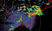
Severe Thunderstorm Warning for Fulton County, GA

Record high tomorrow for DFW is 106*F, which may be attainable.
Here's the 00z NAM (before convection develops):


Here's the 00z NAM (before convection develops):
Tornadocane
Member
This is the most boring July I've ever experienced in S. Florida, and the only weather events are the two Daily Record High Minimum temperatures that we broke over the last week. If it wasn't for a pesky sun-shower cooling us down to a still uncomfortable 79 temperature and dew point, I'd be slightly more entertained. Monthly Record High Minimums almost always result in a big nighttime thunderstorm. It's just Mother Nature's way of telling the rising nighttime heat to back the F off.
I do think it's interesting that the North Pacific and NE Atlantic are extremely warm, but 2022 has the 13rd lowest Arctic Ice Extent in history. Also, looks like the gradient between the high over the Atlantic and Low in West Europe/Africa will relax over the next week, and warm the Eastern Atlantic. Should see some tropical waves attempting to breath a little in about a week, as the high relaxes and western trades creates opportunity for organized Convection.

I do think it's interesting that the North Pacific and NE Atlantic are extremely warm, but 2022 has the 13rd lowest Arctic Ice Extent in history. Also, looks like the gradient between the high over the Atlantic and Low in West Europe/Africa will relax over the next week, and warm the Eastern Atlantic. Should see some tropical waves attempting to breath a little in about a week, as the high relaxes and western trades creates opportunity for organized Convection.
Sky86
Member
Massive lighting strike a few minutes ago
Got more rain today. Didn't have any thunder or lightning at my house, but a house in town got struck by lightning. Looks like more storms tomorrow.
This evening has definitely the best one so far for me this week. After only 1.65” from 6/1-7/4, I had gotten 1.96” the previous 3 days. So far this evening I’m at 2.12” and it looks like it’s not done yet.Both Union counties are being hit this week. I am up to 1.90 with more possibly on the way.
Welp, the 90s that were in the forecast beyond Tuesday are now gone. The lowest forecast high now is 100°F on Wednesday.