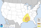
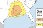
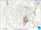
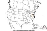
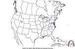
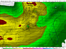
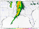
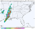
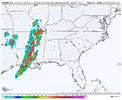
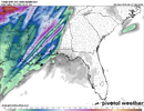
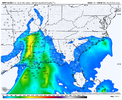
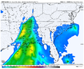
The SREF just only 1 day away from being able to show the STP (Significant Tornado Parameter) for Dixie Alley, it's now in range for Tuesday's Event for the Southern Plains
-
Hello, please take a minute to check out our awesome content, contributed by the wonderful members of our community. We hope you'll add your own thoughts and opinions by making a free account!
You are using an out of date browser. It may not display this or other websites correctly.
You should upgrade or use an alternative browser.
You should upgrade or use an alternative browser.
Severe 3/30-4/2 Severe Weather
- Thread starter SD
- Start date
Z
Zander98al
Guest
Definetly a higher tornado cap with this event.
Z
Zander98al
Guest
Kinda looks like this will be a bit messy though, no dry layer to prevent widespread precip.
Also note that the system sped up and is becoming a bigger threat for Alabama. Thought it would happen for some reason it always goes like that...
Also note that the system sped up and is becoming a bigger threat for Alabama. Thought it would happen for some reason it always goes like that...
Z
Zander98al
Guest
This reminds me a bit of April 28th 2014 setup. With the low all the way up near Iowa/Nebraska/Kansas area. And a semi broken line look with it being more discreet near the begging of it's lifespan and then congealing to a line. Lapse rates are incredible into MS/AL based on soundings. Saw lapse rates from surface to 3km of 8.2
Z
Zander98al
Guest
My goodness, this is one of the largest D4 Enhanced Risks I've seen in a while.Bingo. View attachment 116302
"Regional tornado outbreak possible"
This is the SPC Discussion
...SEVERE WEATHER OUTBREAK POSSIBLE ON D4/WED...
...DISCUSSION...
An appreciable severe-weather risk appears increasingly likely
across the Lower Mississippi Valley and Middle Gulf Coast region on
Wednesday/Day 4. This includes the potential for widespread damaging
winds and tornadoes, including the possibility of a regional tornado
outbreak including strong (EF2+) tornadoes.
Z
Zander98al
Guest
I may be wrong but as you get a bigger enchaned area within the time frame were all you can put is enchanced means there likely is area already ready to be outlined within that huge enchaned area. There's probably a moderate that will be issued tommorow somewhere in the enchaned.My goodness, this is one of the largest D4 Enhanced Risks I've seen in a while.
This is the SPC Discussion
Z
Zander98al
Guest
First SREF run to have the Enhanced Risk on D4 in Mississippi, it's already at a 60% STP
Z
Zander98al
Guest
Can you post pleaseFirst SREF run to have the Enhanced Risk on D4 in Mississippi, it's already at a 60% STP
Yeah most of the overnight guidance is pretty concerning for a good part of Ms, La, west AL, west TN and eastern AR. Seems like forcing this go around might be a little less which may lead to more cellular versus linear but there is a good amount of divergence aloft which may create a crowded environmentFirst SREF run to have the Enhanced Risk on D4 in Mississippi, it's already at a 60% STP
NWMSGuy
Member
Imagine that Enhanced is going to be expanded North some?Yeah most of the overnight guidance is pretty concerning for a good part of Ms, La, west AL, west TN and eastern AR. Seems like forcing this go around might be a little less which may lead to more cellular versus linear but there is a good amount of divergence aloft which may create a crowded environment
tennessee storm
Member
What seems reasonable is the large area of enhanced will upgrade portions least to moderate , then yess possible enhanced inches north someImagine that Enhanced is going to be expanded North some?
It wouldn't surprise me at all. I think the big question marks for your area are WAA and divergence early in the day which may act to kick off some rain/clouds and hold back on instability. The thing is though most models have been dry for your area and rocket afternoon temps well into the 70s with a ribbon of 62+ dews surging northward. I would certainly be concerned for the potential for a few well defined bows and spin ups in your area if not a supercell or 2 embedded, assuming it's not cloudy/drizzly/rainy all morningImagine that Enhanced is going to be expanded North some?
NWMSGuy
Member
Z
Zander98al
Guest
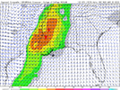
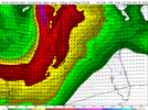
Check the 12z nam it's crazy stupid on those parameters
Z
Zander98al
Guest
Yeah your looking at a widespread regional outbreak. NAM just confirms it, usually when you start seeing bright pink in the supercell composite like the NAM is doing means your going to see a nasty tornado day.
NBAcentel
Member
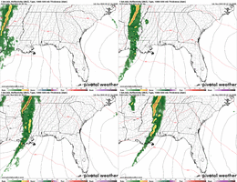
It's interesting looking at the 1km reflectivity you can see the initial cellular development start congealing in later frames but it's still hinting at a few discrete cells at the end of the run. Regardless though at minimum the initial few hours of storm development look problematic even if the forcing catches up
tennessee storm
Member
Screams serious potential for a serial derecho also with wind fields present
Z
Zander98al
Guest
April 28, 2014.It's interesting looking at the 1km reflectivity you can see the initial cellular development start congealing in later frames but it's still hinting at a few discrete cells at the end of the run. Regardless though at minimum the initial few hours of storm development look problematic even if the forcing catches upView attachment 116317
Z
Zander98al
Guest
Need more cape for a serious derecho.Screams serious potential for a serial derecho also with wind fields present
tennessee storm
Member
Latest runs have increased cape. Something to watch …Need more cape for a serious derecho.
Maybe similar in evolution but likely not as much aerial coverage. It's really a good thing we have had the recent pattern in mid to late March instead of mid to late April, the additional seasonal warming probably would have made these much worseApril 28, 2014.
Z
Zander98al
Guest
Thermodynamics are probably a bit higher then forecast, really have a hard to buying the idea of under 500 cape for a open warm sector like the NAM is showing, youll probably have a considerable jump once we move into the CAMS range And then it'll bump down a.bit and then even out.Maybe similar in evolution but likely not as much aerial coverage. It's really a good thing we have had the recent pattern in mid to late March instead of mid to late April, the additional seasonal warming probably would have made these much worse
Z
Zander98al
Guest
NWMSGuy
Member
HSVweather
Member
Z
Zander98al
Guest
Disagree with his derecho statement lol. Most you'll see out of this would be Bowing line segments.
tennessee storm
Member
Going respectfully towards u disagree with u there. Like I posted earlier , seems very plausible with models keep inching up cape , plus u won’t get idea on this stuff till two more days least sometime s day of the eventDisagree with his derecho statement lol. Most you'll see out of this would be Bowing line segments.
Z
Zander98al
Guest
Wow 18z nam run really takes a shot at the "linear talk". More bowing segemtns and disjointed broken segments.
Z
Zander98al
Guest
Z
Zander98al
Guest
?, Good to always have different opinions, totally agree with storm mode idea til right up till the event. Almost crazy how short of time your given before models determine what happens lolGoing respectfully towards u disagree with u there. Like I posted earlier , seems very plausible with models keep inching up cape , plus u won’t get idea on this stuff till two more days least sometime s day of the event
tennessee storm
Member
Instability can mostly be the main thing models tend to under do, just saying . Last 24 hour period sometime seen time and time were models play catch up some certain meso things?, Good to always have different opinions, totally agree with storm mode idea til right up till the event. Almost crazy how short of time your given before models determine what happens lol
Important to understand the general meteorology going on with the shear amount of divergence aloft. Will almost always bring out more widespread precip ahead of possible thunderstorms putting a limiting factor on extensive tornadic events. Certainly this set up can produce some significant tornados but it’s premature to look at every run of any short range model as gospel especially when it comes to something as sensitive as a tornado outbreak where real time observations the day of are way more important than a model depiction still days away from the event. QLSC seems the plausible scenario with some embedded tornados in the line. Have to watch potential for discrete cells as always out ahead of the line. If they are able to get going. But as we saw last week the plethora of discrete cells never really materialized as models showed even a day out. Good to be cautious with these set ups especially when overall divergent flow aloft would support too much competition between cellsWow 18z nam run really takes a shot at the "linear talk". More bowing segemtns and disjointed broken segments.
Z
Zander98al
Guest
I mean what do we have to really do right now other than look at short range models lol, everybody is trying to get a idea of what models hint at for a event. I've always preached mesoscale details of the day should be a focus point. Models did a decent job on the plethora of cells, sure, wasn't violent long track tornadoes but you had in terms of tornado counts a pretty hefty amount from the last event along with some deadly tornadoes across the discreet cell zone.Important to understand the general meteorology going on with the shear amount of divergence aloft. Will almost always bring out more widespread precip ahead of possible thunderstorms putting a limiting factor on extensive tornadic events. Certainly this set up can produce some significant tornados but it’s premature to look at every run of any short range model as gospel especially when it comes to something as sensitive as a tornado outbreak where real time observations the day of are way more important than a model depiction still days away from the event. QLSC seems the plausible scenario with some embedded tornados in the line. Have to watch potential for discrete cells as always out ahead of the line. If they are able to get going. But as we saw last week the plethora of discrete cells never really materialized as models showed even a day out. Good to be cautious with these set ups especially when overall divergent flow aloft would support too much competition between cells
Z
Zander98al
Guest
NWMSGuy
Member

