MotoWeatherman
Meteorologist
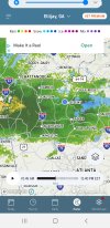
In this situation I'm my interested in how warm we get today. The strong CAD doesn't arrive until later tonight so if we get into the upper 40s then it will take longer to switch to snow if we ever do. Thankfully we are covered in clouds and precip is streaming in from the west cooling the upper levels. So right now it looks good. Inside 12 hours my go to is the HRRR which does great at capturing precip types from my experience. I've rarely seen it stay snow when it shows the warm nose invading.Is there a certain temp/dew at a certain time you would like to see for DAH to really get in on all that HRRR snow? Or does surface temp matter less still cause of WAA? I’m wondering how you will be tracking this in real time?