• Hello, please take a minute to check out our awesome content, contributed by the wonderful members of our community. We hope you'll add your own thoughts and opinions by making a free account!

Tropical Hurricane Nate

Well just wanted everyone on here to know that i called the NWS Morristown and basically was disrespected, and they actually made fun of the weather forum and claimed we all sit on here and talk about all the different offices and rant and ramble. I simply asked why they had not issued even a SPS special weather statement or tropical product when NE AL and ALL of N GA to the state lines are update one. They went off on me and told me to leave them alone they had alot of work to do. I refuse to even follow my own local office now knowing they have a NWS meterologist there that RUDE, & very hateful! He even made fun of my job im guessing he saw it on my facebook.

Question is it illegal or wrong for a spotter to call or ask a question on a NWS website? Im very upset. And need you guys opinion on this situation
The ole douche bag degree mentality. Not surprised . Check your pm

Sent from my SM-J320VPP using Tapatalk
 
55645ca573107aff74ee0ec64c4ae5f5a82d705ef66b85e6c9e6a16ac85d0ed3.gif
 
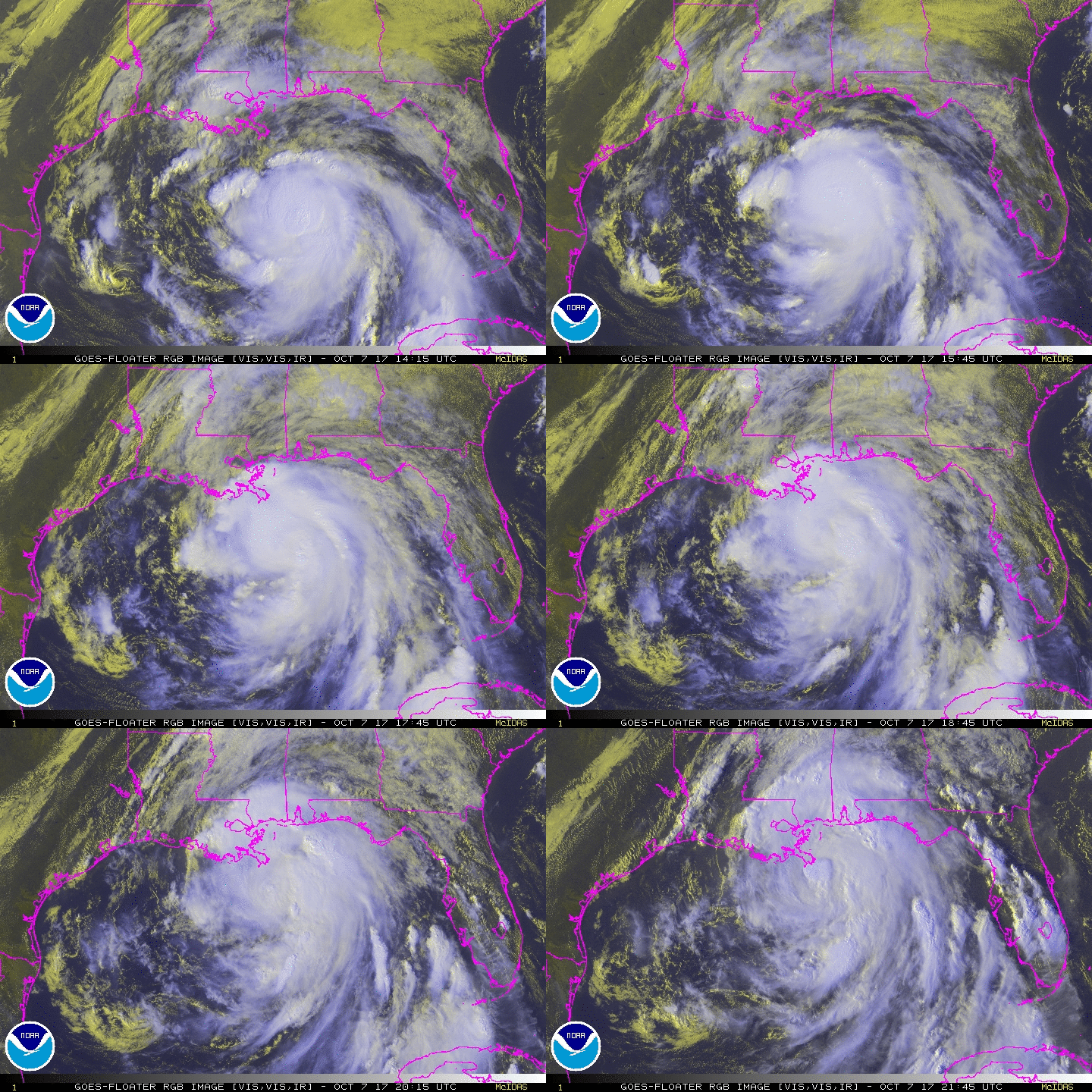
Also seems like Nate is taking a north movement now
 
Isn't it supposed to start taking a slight northeast turn approaching landfall? (According to the forecast track anyways) It looks pretty spot on to make landfall in the center of the cone.

I think just west of the MS state line, Biloxi or Gulfport.
 
4:00 PM CDT Sat Oct 7
Location: 28.4°N 89.1°W
Moving: NNW at 23 mph
Min pressure: 981 mb
Max sustained: 90 mph

Forward speed went down slightly. (from 25mph 3 hrs ago)
 
Starting to move due north now, then within the next hr or 2 he should be moving NNE . Still thinking is "SE" MS landfall.
 
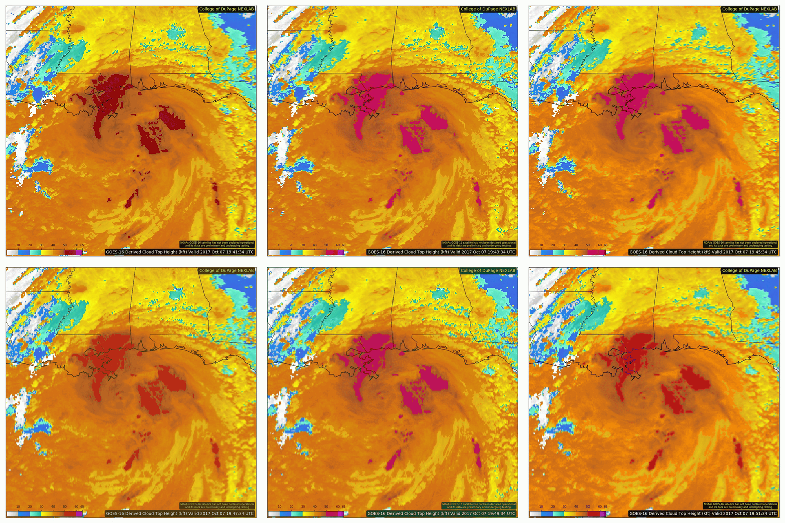
IIRC, it was modeled for Nate to slow down just a bit as it got closer to making landfall. It doesn't really change much at this point. Also there's cooler cloud tops popping up on the NE side of Nate's eye.
 
Confusing to me. Anyone care to explain ?

A Tropical Storm Warning means Tropical storm wind conditions are
expected somewhere within this area and within the next 36 hours

* LOCATIONS AFFECTED
- Rome

* WIND
- LATEST LOCAL FORECAST: Tropical storm force winds remain
possible
- Peak Wind Forecast: 15-25 mph with gusts to 40 mph
 
For some reason I was thinking that winds had to be sustained at 39mph for there to be a TS Warning but I guess all you need is a 40 mph wind gust.
 
Looks like most of the impact will be the coast and MS/AL. I am doubtful we see the 3+" of rain forecast here in Cherokee.


Sent from my iPhone using Tapatalk
 
Confusing to me. Anyone care to explain ?

A Tropical Storm Warning means Tropical storm wind conditions are
expected somewhere within this area and within the next 36 hours

* LOCATIONS AFFECTED
- Rome

* WIND
- LATEST LOCAL FORECAST: Tropical storm force winds remain
possible
- Peak Wind Forecast: 15-25 mph with gusts to 40 mph
The thought is since it is tropical related, that the procedure would be to use the tropical suite of products to avoid confusing the public (ala Sandy), however I also think FFC is using the conservative side of guidance
 
The county to my west ( Cleburne County, AL) is under a TS Warning. I'm under a TS Watch. The county to my southeast ( Coweta County, GA) is not under a watch or warning. So it goes from a TS Warning to no watch or warning in just about 30 miles or so.
 
Looks like most of the impact will be the coast and MS/AL. I am doubtful we see the 3+" of rain forecast here in Cherokee.


Sent from my iPhone using Tapatalk

We are forecast to receive several inches of rain well inland in Alabama. I haven't followed the other states, but a good chunk of Alabama should get some good rain from Nate.
 
Nate's overall appearance has degraded the past few hours due to the combination increasing southwesterly wind shear and cooler, shallow shelf waters immediately adjacent to the Gulf coast and consequently the most recent dropsonde into the eastern semi circle of the circulation revealed no instantaneous winds above 78 kt from 850 hPa to the surface....
 
Even tho Nate is 50 miles or so away from landfall, theres a nice blowup around the center. If that continues, it may slightly gain little strength at landfall.
 
Looks like it's taking a quick NE turn already on radar! May miss LA all together ( the eye)
 
I suspect it's gonna ride the eastern part of the " cone"
 
Back
Top