• Hello, please take a minute to check out our awesome content, contributed by the wonderful members of our community. We hope you'll add your own thoughts and opinions by making a free account!

Pattern December to Remember

I was hopeful that we could muddy up the pattern enough that we landed cool to cold in Christmas day even with the overall background of warm but that's looking less likely unless we catch a break. Certainly like where the 2nd half of the 12z gefs and 0z eps went
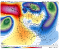
Still might. The Canadian keeps a low off our coast up to Christmas. This keeps us from getting too warm. The Euro had the low but just weaker. We're at 10 days out so we could still luck out with a cool anomaly setup.

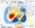
GDPS Christmas Eve morning:
aaaa1.jpg
 
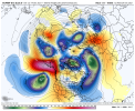
12Z EPS significantly better at H5/2 meter temperatures vs last few runs after day 10. These maps look even better than the 0Z EPS late in its run yesterday that were what the colder weeklies were based on.
These maps aren’t BN in the SE but they are cooler than recent runs days 12+ with close to normal late instead of solid AN. And they then lead to a potentially better period when we finally get into phase 8.
 
Last edited:
No winter weather, brief torch and then mild, nothing unheard of around here in December. Could be much worse, definitely not top 3 warmest material
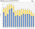
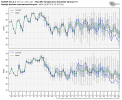
Yeah I'm guessing that the mean ticks up around Christmas looking at the plumes most of the members are near/above the mean but we will see there. Overall though if we verified close to the mean no complaints from me
 
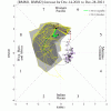
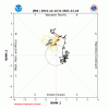
I’d love for either of these MJO paths to verify for the end of the month with my favorite of low amp 8 and then headed toward low amp 1 and 2 as that’s near the path of some memorable SE cold periods, including some with major winter storms, especially when there’s also -NAO/-AO

6E2D0272-57AE-4F49-9619-0DE7FE587256.gif1F9B6415-7024-4F5C-B96E-8AB8798A1F51.gif
 
I still think the EPS is a little too warm, GEFS looks just about right to me in the extended.
compday-7lvvmbg4wn-gif.97860


1640865600-Uks4ygr0b94.png
 
I still think the EPS is a little too warm, GEFS looks just about right to me in the extended.
compday-7lvvmbg4wn-gif.97860


1640865600-Uks4ygr0b94.png

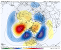
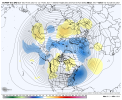
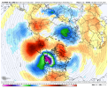
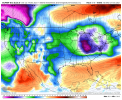
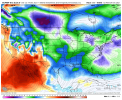
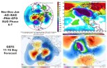
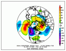
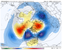
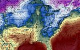
Here's the comparison of NDJ -AO/-NAO/-EPO/-PNA days in MJO phase 6-7 (n = ~ 30) w/ GEFS 500mb and surface temp forecast in collage form. There's an argument to be made that our pattern might turn out as cool or colder overall because the trough is deeper off New England

Capture.JPG
 
From RAH:

Confidence then greatly decreases for the rest of the period. There
will at least be a lull in precipitation later Sunday - Sunday night
as the front moves south of the area. However, a shortwave trough
over the Desert Southwest will finally get ejected eastward by a
closed mid/upper low moving into the eastern Pacific. The shortwave
will move across Texas on Sunday night and the Gulf Coast on Monday
and Tuesday, with a coastal surface low developing along the stalled
front. The 12z ECMWF continues to be slower and more suppressed with
the system, only giving our area light precipitation and not until
Tuesday. The 12z GFS and Canadian trended in this direction as well,
as did the ECMWF ensembles, the vast majority of which are now dry.
Thus continue just chance POPs on Monday and Tuesday, highest south.
While it should be a mainly rain event if it even occurs,
temperatures will be cool enough that precip-type issues will need
to be watched. There is a high to the north on Monday morning, but
it is a bit weaker (1030-1035 mb) and farther north (SE Canada) than
one would want to see for significant frozen precip here. In
addition, the high quickly moves away later Monday into Tuesday, and
with the latest guidance delaying any precip until then, both the
12z GFS and ECMWF would essentially be an all rain event
. So keep
all liquid in the wx grids at least for now. Regardless,
temperatures will certainly be much cooler on Monday and Tuesday
with highs in the mid-40s to lower-50s, which is slightly below
normal.

&&
 
When you get upgraded to a warning! ??
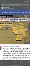
I think I heard the other day , it’s been 7-10 years since DBQ has been under a high wind warning. Guess they are not that common!CDF827AE-6FFD-45CC-81B8-2CB6713CF00B.png
 
I smell a Jammin' January if the trends can hold. :cool:
I’m close to saying I’m all in on a January jackpot. The process reminds me of later dec 2017 into jan 2018 in the pacific, although this time it’ll maybe be harder to transition and it’s slight less favorable looking then dec 2017 from the jump, but I still think the goods will come eventually and as grit said, eventually as we shift into early jan, MJO phase 7-8 start heavily favoring a +PNA
 
I’m close to saying I’m all in on a January jackpot. The process reminds me of later dec 2017 into jan 2018 in the pacific, although this time it’ll maybe be harder to transition and it’s slight less favorable looking then dec 2017 from the jump, but I still think the goods will come eventually and as grit said, eventually as we shift into early jan, MJO phase 7-8 start heavily favoring a +PNA
While I’m not ready to go all in on January Jackpot yet, I do like several things about what we’ve seen the last few days. I would like to start seeing more snow cover put down across the northern US over the next 10 days or so, but it’s hard to deny that is plenty of cold air available in Canada to tap into.
 
Back
Top