Cary_Snow95
Member
GEFS continues to warm post Christmas
Wha whaaaaaaaaaaaaaa??GEFS continues to warm post Christmas
GEFS continues to warm post Christmas
Wha whaaaaaaaaaaaaaa??

No, it's the same storm, it develops on the end of a stalled front, but the low becomes a stand-alone low, not remaining a frontal system.Isn’t this a totally different storm from what you were predicting? There’s too much disagreement between the models to get excited IMO; I’d be shocked if the EPS agreed.
25.8 very heavy frost. Coldest so far..
Preach, this has been a controversy for decades.Me: 32.1F
KATL: 37F
KPDK: 28F
KATL is not even in the realm of normalcy for the area now for overnight lows.
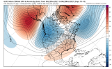
JB of the South has spoken! Sky is the limit , with the upcoming POSSIBLE pattern! View attachment 97908
What’s the unusual set up? Dual blocking?
Sent from my iPhone using Tapatalk
The official temperature needs to be moved to better represent the entire area.Me: 32.1F
KATL: 37F
KPDK: 28F
KATL is not even in the realm of normalcy for the area now for overnight lows.
All time December record highs in jeopardy tomorrow!??View attachment 97912
You guys are not getting cold air darned this weekend (or danged, durn, etc if you don't cuss)
What a bold prediction. I'm not sure what you are trying to do here?You guys are not getting cold air darned this weekend (or danged, durn, etc if you don't cuss)
If you're in the CAD areas of the piedmont and upstate (getting there for NE GA) and you like ice, this is something you absolutely want to see. CAD areas quickly trending colder with 6 days left for continued correction. Keep a -NAO and a 50/50 low and you're almost guaranteed to see trends like these to show up in the medium range. The progression of the -NAO, 50/50 low, and coupled with a generally -EPO and -PNA and I think the CAD areas are inline to get a winter storm of some sort between the end of December through mid January. Especially since some of the coldest air in the northern hemisphere has been sitting in Canada for the last month or 2.This is really Gonna try to sneak up on us ? View attachment 97906
Probably, low track looked comparable to the Euro just isn't cold.The most likely cad to happen View attachment 97916View attachment 97917
Yep actually more Miller A. I’ll take that look right nowProbably, low track looked comparable to the Euro just isn't cold.
Funny how the Lows in NC are about the same as they are in South Florida.Lows on Christmas morning ?View attachment 97920
