1.7" with another gust to 12!
-
Hello, please take a minute to check out our awesome content, contributed by the wonderful members of our community. We hope you'll add your own thoughts and opinions by making a free account!
You are using an out of date browser. It may not display this or other websites correctly.
You should upgrade or use an alternative browser.
You should upgrade or use an alternative browser.
Tropical TS Elsa
- Thread starter Cary_Snow95
- Start date

At least rain totals will be spot on!1.7" with another gust to 12!
LickWx
Member
Red flag warnings ?
snowlover91
Member
Another decent couplet between Snow Hill and Farmville
Just issued a Tor warning for that one too
That one is heading my way too lol hopefully it weakens by the time it makes it here.
Shaggy
Member
Red flag warnings ?

Shaggy
Member
That one is heading my way too lol hopefully it weakens by the time it makes it here.
Couple more getting started to our south. You and bozart need to be watching that one near Farmville.
Attachments
Shaggy
Member
B
Brick Tamland
Guest
WRAL said radar was showing debris near Fountain in Wilson County.
Some of the heaviest rain I’ve seen in a while, and it’s been pouring like this all morning.
Ummm hello

Well I ended up with 3.47 inches… a bit more than the NWS forecast, but not as crazy as the 5-6 inches some of those HRRR runs were spitting out. Now to see how we do with thunderstorms the next few days… I’ve got at least a 40 percent chance the next 5 days.
2.56" and still pouring. Had a gust all the way to 18 now.
blueheronNC
Member
Most unrelenting rain shield the Triangle has had from a tropical system in quite some time. Started raining at 8am and hasn’t abated for even a minute since. 2.46” and the heaviest rain of the day ongoing,
SouthGarnerSleet
Member
2.56" and still pouring. Had a gust all the way to 18 now.
Rate is at 1.7in an hour right now - heaviest yet. No wind really, a 19.5 gust at 10am ish.
Wake County def in a sweet spot for high QPF totals. 3.1 now here just south of Garner
2.4 at the house so far. Pressure down to 1008.4
The center gonna pass very close to you. My pressure bottomed out 1007.3 and looking at the NHC plots the center passed about 8 miles east of me2.4 at the house so far. Pressure down to 1008.4
Yeah going to be close my wind is S now and down to 1007.9 don't think I'll get much lowerThe center gonna pass very close to you. My pressure bottomed out 1007.3 and looking at the NHC plots the center passed about 8 miles east of me
And just like that
NoSnowATL
Member
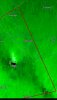
birdman is close by I see.....And just like thatView attachment 86332
He's always watchingbirdman is close by I see.....
Where are you at?And just like thatView attachment 86332
Downeastnc
Member
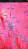
Legit hooked out super over no man's land Hyde Co. Passing right over the prison on the west end of Lake Mattmuskeet
B
Brick Tamland
Guest
Flash Flood Warning
NCC069-077-183-082130-
/O.NEW.KRAH.FF.W.0008.210708T1907Z-210708T2130Z/
/00000.0.ER.000000T0000Z.000000T0000Z.000000T0000Z.OO/
BULLETIN - EAS ACTIVATION REQUESTED
Flash Flood Warning
National Weather Service Raleigh NC
307 PM EDT Thu Jul 8 2021
The National Weather Service in Raleigh has issued a
* Flash Flood Warning for...
West Central Franklin County in central North Carolina...
Southeastern Granville County in central North Carolina...
Central Wake County in central North Carolina...
* Until 530 PM EDT.
* At 307 PM EDT, Doppler radar indicated heavy rain across the
warned area. Between 3 and 3.5 inches of rain have fallen.
Additional rainfall amounts of 1 to 1.5 inches are possible in the
warned area. Flash flooding is ongoing or expected to begin
shortly.
HAZARD...Life threatening flash flooding. Heavy rain producing
flash flooding.
SOURCE...Radar.
IMPACT...Life threatening flash flooding of creeks and streams,
urban areas, highways, streets and underpasses.
* Some locations that will experience flash flooding include...
Raleigh, Wake Forest, Garner, Franklinton, Knightdale, Rolesville,
Youngsville, Purnell, Falls Lake and Lake Wheeler.
Also, portions of Crabtree Creek are running high, nearing flood
stage of 12 feet at Old Wake Forest Road.
LickWx
Member
The storm drains in Raleigh off lake Boone trail were backed up and water was gushing out of them not in.Flash Flood Warning
NCC069-077-183-082130-
/O.NEW.KRAH.FF.W.0008.210708T1907Z-210708T2130Z/
/00000.0.ER.000000T0000Z.000000T0000Z.000000T0000Z.OO/
BULLETIN - EAS ACTIVATION REQUESTED
Flash Flood Warning
National Weather Service Raleigh NC
307 PM EDT Thu Jul 8 2021
The National Weather Service in Raleigh has issued a
* Flash Flood Warning for...
West Central Franklin County in central North Carolina...
Southeastern Granville County in central North Carolina...
Central Wake County in central North Carolina...
* Until 530 PM EDT.
* At 307 PM EDT, Doppler radar indicated heavy rain across the
warned area. Between 3 and 3.5 inches of rain have fallen.
Additional rainfall amounts of 1 to 1.5 inches are possible in the
warned area. Flash flooding is ongoing or expected to begin
shortly.
HAZARD...Life threatening flash flooding. Heavy rain producing
flash flooding.
SOURCE...Radar.
IMPACT...Life threatening flash flooding of creeks and streams,
urban areas, highways, streets and underpasses.
* Some locations that will experience flash flooding include...
Raleigh, Wake Forest, Garner, Franklinton, Knightdale, Rolesville,
Youngsville, Purnell, Falls Lake and Lake Wheeler.
Also, portions of Crabtree Creek are running high, nearing flood
stage of 12 feet at Old Wake Forest Road.
Shaggy
Member
Actually getting a stray gusts now and then but nothing special. Maybe 25 to 30mph
North myrtleWhere are you at?
Looks like the rain is almost over here and the skies will soon begin to heal.
blueheronNC
Member
Center appears to be passing just over or to the east of Durham as we speak.


Shaggy
Member
Got to give a big salute to the GFS track solution from a week out. Hrrr nailed the short range pretty good to.
B
Brick Tamland
Guest
Looks like the rain is almost over here and the skies will soon begin to heal.

blueheronNC
Member
My extremely accurate barometer (recorded 941mb in the eye of Hurricane Hugo in Summerville, SC) seems to have bottomed out at 1006.9mb (29.73 inches).

Strongest winds of the day so far with a few gust of 25
Shaggy
Member
Strongest winds of the day so far with a few gust of 25
Yeah PGV has gusted to 30 but getting biggest gust of today right now so it may break that a bit higher. Lame
A farewell gift from Elsa .. goodbye my sweet beauty .. thank you for the water 
Mine is showing 1007 right now, probably explains my sinus headache at the moment too.... lolMy extremely accurate barometer (recorded 941mb in the eye of Hurricane Hugo in Summerville, SC) seems to have bottomed out at 1006.9mb (29.73 inches).
View attachment 86335
It keeps strengthening.... Lol
5:00 PM EDT Thu Jul 8
Location: 36.3°N 78.3°W
Moving: NE at 21 mph
Min pressure: 1006 mb
Max sustained: 50 mph
5:00 PM EDT Thu Jul 8
Location: 36.3°N 78.3°W
Moving: NE at 21 mph
Min pressure: 1006 mb
Max sustained: 50 mph
1006.6 min pressure at the house. Wind is starting to get some west component so it should start to rise
Center must've passed right over your house. According to NHC coordinates it's now over Henderson which seems that path is about right.1006.6 min pressure at the house. Wind is starting to get some west component so it should start to rise