Really looks like we are going to have to deal with a few strong storms around here tied closely to the sfc low
-
Hello, please take a minute to check out our awesome content, contributed by the wonderful members of our community. We hope you'll add your own thoughts and opinions by making a free account!
You are using an out of date browser. It may not display this or other websites correctly.
You should upgrade or use an alternative browser.
You should upgrade or use an alternative browser.
April 23-25th Severe Threat
- Thread starter Arcc
- Start date
NBAcentel
Member
Getting Concerned about that in-situ wedge boundary setup
Getting Concerned about that in-situ wedge boundary setup
Took the words right of my mouth. This is giving off some Feb 2020 vibes... (Albeit not as widespread).
Z
Zander98al
Guest
RollTide18
Member
Not much convection in south Alabama until the last line comes through, hmm.
Z
Zander98al
Guest
Wouldn't trust that line of thinking just yet lol. So many factors are gonna come in play. I'm curious to whether a boundary comes from the mcs and sets somewhere in the region.Not much convection in south Alabama until the last line comes through, hmm.
NBAcentel
Member
Some cams plow a MCS through south AL/south GA and take SC/NC out of the equation, very possible outcome
Z
Zander98al
Guest
Z
Zander98al
Guest
Can't really look at much in terms of weather models but a few hours early or later could determine if the atmosphere doesn't destabilize or does after that squall line. And also the difference between simulated radar from what I've seen I's a little concerning.
Anyone think a MDT is possible?
Z
Zander98al
Guest
Yes, albeit it'll probably be the day of right before anything happens. A good bit of uncertainty for this event IMOAnyone think a MDT is possible?
I agree. I could see a MDT on the D1 12z updated Sat.Yes, albeit it'll probably be the day of right before anything happens. A good bit of uncertainty for this event IMO
Z
Zander98al
Guest
I gotta say the 3km nam looks ominous. With a couple batches of possible tornadic/severe storms. What complicates things is lack of congealing between models on how the radar will look. If the strong squall line comes in early and fizzles out and sets a boundary and things clear out and bake in the sun. It could get nasty. The highest risk depends on where the boundary sets up. I have a feeling the two batches of storms after the line that the 3km nam shows in the morning will be more broken up than depicted, from peeking at a few other models....As well the Sb Cape keeps bumping up with south Alabama averaging no less than 3500sbcape in most areas by looking at soundings.
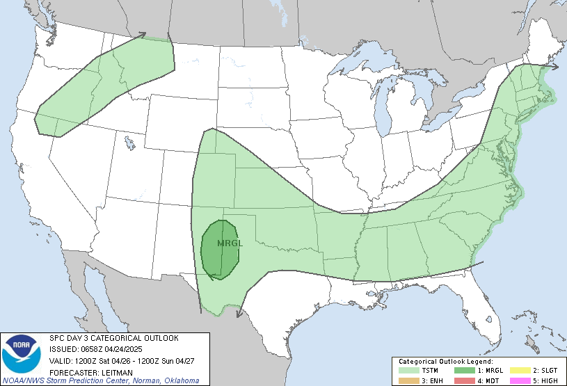
No changes in the latest update to the SPC's Day 2 Outlook.
B
Brick Tamland
Guest
I might actually have a shot at storms if I can stay in the marginal zone.


Z
Zander98al
Guest
Countdown to the 18z model runs lol. modernweenie
NBAcentel
Member
Z
Zander98al
Guest
The LR HRRR builds in the instability quick after the morning MCS. ?
Euro may have went even stronger for southern GA/South Eastern AL.
Z
Zander98al
Guest
With the MCS or the redevelopment after?Euro may have went even stronger for southern GA/South Eastern AL.
The 3KM NAM (as usual) looks Very NASTY here!
With the MCS or the redevelopment after?
Breaks the southern end of the line into individual cells.
Z
Zander98al
Guest
no buenoBreaks the southern end of the line into individual cells.
The 3KM NAM (as usual) looks Very NASTY here!
As crazy as it is to say. This is by far the most high end image the 3km NAM has throw at us all year. Something like you would see a few years ago. It really tries to fire a line of supercells over southern GA as well.

Z
Zander98al
Guest
How is this high end?As crazy as it is to say. This is by far the most high end image the 3km NAM has throw at us all year. Something like you would see a few years ago. It really tries to fire a line of supercells over southern GA as well.

You know how these things work .. I feel like maybe it can push out quick enough to get a back band to form .. it’s already looking fast and most likely it’ll be faster than depicted ... fun to watch .. at least everything will get a good soaking regardlessSee y’all the next severe wx threat lol, HRRR has spoken View attachment 82205
How is this high end?
The 3km NAM had very little UH streaks across AL during the March outbreaks. It used to be completely nuts, so I figured they nerfed it to the point it rarely showed anything. It went from being wrong all the time to being wrong all the time in the other direction.
Although NAM and HRRR look so very different in the overall evolution of things .. I think this is a classic wait and see what the nowcast is saying ... have to develop the storm first and see how they evolve to really get a good idea .. until then we get to see many fun bright cool colors and severe parameters on models
Z
Zander98al
Guest
Didnt know that ?The 3km NAM had very little UH streaks across AL during the March outbreaks. It used to be completely nuts, so I figured they nerfed it to the point it rarely showed anything. It went from being wrong all the time to being wrong all the time in the other direction.
This is actually very interesting. Be a very interesting night to watch the WRFs come in.


Stratiform rain is good! Soaks in nicely!??See y’all the next severe wx threat lol, HRRR has spoken View attachment 82205
Z
Zander98al
Guest
Yeesh. It sure does isolate those cells. Nothing would be in the way to stop them.
Yeesh. It sure does isolate those cells. Nothing would be in the way to stop them.
Now the NAM does like the cap everything if I remember right, so it’s probably gonna be more messy.
Just noticed the 18z HRRR is about to punish south GA.
Too bad the WRFs don’t run four times a day so we wouldn’t have to watch the peanut gallery.
Z
Zander98al
Guest
Just realized the LCL in south alabama are almost sub 500. Along with lapse rates being relatively impressive.
Is there much to worry about in the ATL area with these models?
If the 3km NAM is right, yes metro ATL may have some problems. However, the truth is the NAM is likely getting the instability too far north while the low level helicity is highest. As of right now, I think the threat of tornadoes and possibly strong or greater tornadoes is in South GA. Atlanta is probably looking at an isolated large hail threat with the last batch.
Z
Zander98al
Guest
Z


