• Hello, please take a minute to check out our awesome content, contributed by the wonderful members of our community. We hope you'll add your own thoughts and opinions by making a free account!

Wintry King Kong Winter Storm Potential Feb 13th-16th

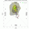
Phase 7 MJO in a La Niña is terrible for the SE, maybe this tropical forcing mode is the reason why the cold keeps getting “pushed back”, you would think the giant west based -NAO would squeeze it East but it’s retrograding into a TPV thats being tugged west by another TPV, which pushes it west
That composite is ugly. But I remember Webb saying every single La Nina since 1980 had a +NAO in Feb if my memory serves me correct. So you would think the -NAO would have to help.
 
We losing our -NAO if I have been reading the model runs right . I don’t want to be that guy but @Webberweather53 and a few others swore up and down it would be there for a long time and there was 0 sign it was going anywhere this week . Not tryna be hateful here just kinda a hahah ooops moment .
You may wanna wait till verification on that. Models have been trying to get rid of it all season.
 
Phase 7 MJO in a La Niña is terrible for the SE, maybe this tropical forcing mode is the reason why the cold keeps getting “pushed back”, you would think the giant west based -NAO would squeeze it East but it’s retrograding into a TPV thats being tugged west by another TPV, which pushes it west
Finally the demon is being called out by his name .....“phase 7” we rebuke you in every conceivable way possible.....you know exactly where you can go”. Seriously this is a very interesting observation snd im honestly astounded none of that has been included in CPC/NWS published discos...or Maybe it has and I didn’t realize
 
looking at the EPS, it’s warmer for much of the SE, however much more of a CAD signal and about the same for CAD regions temp wise
 
What would be interesting to me, since Mythro injected the MJO, during this “waiting for models to lock on phase”, is for GaWx to provide his stat analysis in some relevant format as it relates to our current situations.g. MJO 7, Feb, 12-16 last 200 years etc etc. he is unbelievable for anyone on here who hasn’t seen his work. He can certainly put a lot of data and context around a given weather scenario.
 
This system is going to pique Bruce's (tennesseestorm) interest by this time tomorrow

It may tomorrow but not by the weekend. The trend so far this winter is to trend warmer then trend colder.

Id guess heavily that by Thursday it would have trended to slightly below average temp wise with rain.
 
The + with this event is there’s a chance we could have elevated thunderstorms rotating around on the edge of the ridge if we warm up enough/strengthen the H5 ridge
 
Last edited:
The + with this event is there’s a chance we could have elevated thunderstorms rotating around on the edge of the ridge if we warm up enough
Hahaha warm up enough aahahahah no bud sorry not happening. The CAD signal is there , unfortunately for us we will be settling for CAD. Maybe just maybe we warm up enough but CAD has been incredible this year .
 
Does anyone know when the actual data will first get sampled/ingested?

Not sure- @deltadog03 or @Webberweather53 - when do you think the earliest opportunity would be any of this data could be sampled into the North American upper air network?

Furthermore- do you think it would make any difference in the set-up of the PV over Manitoba vs where (most) of us need it to be?
 
Back
Top