Webberweather53
Meteorologist
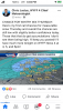
Close up of the 12z EPS for NC
.png")
.png")
.png")
.png")
I really like how the OP has some snow and many of the ensemble members do also. IMO, that is what makes a solid signal for winter weather.

RAH not biting:
Mid and high level moisture will increase rapidly on Thursday ahead
of a positively tilted trough digging through the Midwest. Precip
will spread along the stalled frontal zone over the SE US, with
cyclogenesis induced off the SE coast. Models continue to trend a a
bit closer to the coast with the surface low bringing more moisture
inland. The low is still relatively weak, however, and moves east
with the digging trough. The bigger question is whether or not the
arctic air associated with a 1045+ mb high over the central US will
spill across the mountains in time to cause a mix of rain and snow
or changeover to rain. The high is not in a favorable location for
the dense cold air to make it into NC very quickly...likely having
to filter across the central Appalachians and south through VA...and
so the probability of probability more than a rain/snow mix appears
very low at this time. If there is an opportunity for phasing of
sufficiently deep moisture/omega and cold air, it would be north and
east of the Triangle, which is where the outlier EPS solutions
lie..while the the GFS and GEFS appear to be too aggressive with
with cold air.
He’s literally copy and pasting the Euro 1” probability map. Big head shakeChris justice thoughts
RAH not biting:
Mid and high level moisture will increase rapidly on Thursday ahead
of a positively tilted trough digging through the Midwest. Precip
will spread along the stalled frontal zone over the SE US, with
cyclogenesis induced off the SE coast. Models continue to trend a a
bit closer to the coast with the surface low bringing more moisture
inland. The low is still relatively weak, however, and moves east
with the digging trough. The bigger question is whether or not the
arctic air associated with a 1045+ mb high over the central US will
spill across the mountains in time to cause a mix of rain and snow
or changeover to rain. The high is not in a favorable location for
the dense cold air to make it into NC very quickly...likely having
to filter across the central Appalachians and south through VA...and
so the probability of probability more than a rain/snow mix appears
very low at this time. If there is an opportunity for phasing of
sufficiently deep moisture/omega and cold air, it would be north and
east of the Triangle, which is where the outlier EPS solutions
lie..while the the GFS and GEFS appear to be too aggressive with
with cold air.
.png")


GSP
There now looks to be a brief break in the precip Wednesday night as
the first wave of forcing moves east and some drier air moves in. Of
course, this sets the stage for the potential for some wintry precip
as moisture moves back in Thursday ahead of the surface wave moving
along the front and some upper divergence associated with a coupled
jet streak. The guidance still doesn`t agree on how far north the
moisture moves or just how cold the air will be. That said, it is
now looking like there will be precip at least as far north as the I-
85 corridor and likely the NC mountains. Precip tapers off quickly
Thursday night as the wave moves east of the area. The thermal
profiles and partial thickness progs show the precip to be rain or
snow with no significant warm nose. I`m beginning to become wary of
the snowfall potential given the previous 2 snow events where the
thermal profile and thickness values were quite similar. I suspect
this event could be similar where precip begins as snow over the
western CWFA along and north of the I-85 corridor with accumulations
developing where precip can fall for the longest period of time.
That said, have followed the national guidance for now which keeps
the accumulating snow across the higher elevations and mainly rain
outside of the mountains. Of course, this forecast could go either
way, so interested parties will need to stay abreast of the latest
updates.
Sent from my iPhone using Tapatalk


NAM is good if it can hold for a few more days. But on its own island IMO.


Was just thinking the same thing, I mean look at the accums up in Va now, of course if the NAM were correct but still there's ton's of time for this thing to correct NW even moreLet’s just hope the Nw trend hasn’t started too soon.
Surely these aren’t 4/12 ensembles advertising accum for Ga along I-20??SREF mean and members. Some big dogs are farther south (Sorry of the blurriness)
View attachment 34940
View attachment 34941
.png")
