Ilovesnow28
Member
Yep that's all we are ever good for in the South severe weatherThe 6z GFS is a tornado outbreak for AL, MS, TN and GA in the 27-28th area. Just no bones about it.
Yep that's all we are ever good for in the South severe weatherThe 6z GFS is a tornado outbreak for AL, MS, TN and GA in the 27-28th area. Just no bones about it.
But you are. You’re mildly excited right?If I was in northern NC I'd be mildly excited......
Yes I am and no I'm not excited haha, I'm cautiously optimisticBut you are. You’re mildly excited right?
Sent from my iPhone using Tapatalk


Yes I am and no I'm not excited haha, I'm cautiously optimistic
Closest we've come all winter and the ensembles keep putting you and I in the sweet spot. You know as well as I do, that's good and bad haha.This is me. Looks good its an solid threat but nothing is written in stone yet. Still have a couple of days to watch it.
Still a lot of models that say there’s no snow. However 4 days out, I’m very satisfied with the way things are looking.This is me. Looks good its an solid threat but nothing is written in stone yet. Still have a couple of days to watch it.
I noticed it has become closer even for N GA. Just compare 18Z to 6Z on the GFS.This has over performer written all over imo, webb and others have mentioned how horrible models handle northern extent of overrunning precip. And in the possibility of a late blooming coastal.....who knows ??
.png")
.png")
Same here. My 2 biggest concerns are having the best frontogenesis sitting along the nc/sc border and we have light green over us on radar but can't overcome the dry layer in between 850 and 925 or we get better frontogenesis but we stay too warm at 925 to the sfc and it's 36 and rain scenarioYes I am and no I'm not excited haha, I'm cautiously optimistic
CAE will never get snow again. This is getting ridiculous.


It would only be fitting this goes SE over the next 3 daysBeing an eastern NC'er I hate when lows start to trend even the slightest NW. Usually a harbinger of disappointment but what's worse is hearing every one cheer for it.
It would only be fitting this goes SE over the next 3 days
I wish I lived S/E of Raleigh now (like Rain Cold’s area) rather than Durham. I thought we were supposed to get more snow here. ?If I was in northern NC I'd be mildly excited......
This post deserves an...Looks like the Euro/EPS have screwed the pooch on this one & have been behind the curve from the onset. Everyone that was worried about having this model on board before seriously believing this threat have egg on their face. It was honestly kind of strange to see the EPS and Euro more progressive with the northern stream than the GFS a few days ago, it’s almost always the other way around, this fact certainly left me scratching my head. Moral of the story here: no matter how good a model and its ensemble suite are, they are never infallible & it’s rarely a good idea to put all or even a majority of your eggs into one basket.
This looks like a very legit threat for the I 40 corridor (TN, NC, upstate SC, and VA), Warm advection, isentropic upglide, & frontogenesis will be the primary forcing agents for ascent here, most of the time global models will low ball the magnitude of one, two, or all of the above due to their coarse spatiotemporal resolutions, leading to more widespread and intense precip verifying
")
Oh well. I don't live in the center of the universe NC so I'm out. I can't unsee some of these latest temp profiles and be all in for upstate SC.
.gif")
I was in Rock hill. I saw the band forming in the foot hills and drove up 77 to my dads house. Got there and the sky looked like a Summer day due to the convective nature of the set up and it was in the mid 40s. 30 mins later after getting there. I heard a crack of thunder, then it poured graupal and covered the ground in seconds. Turned into a moderate to heavy snow for several hours. Got about 3-4 inches. Was a fun experience and gained a lot of knowledge on convective snow.7 years ago today. One of the best events around here in the last decade only because of how strange it was. Zero hype the day before. Later on in the day of the 16th temps were in the mid to low 40’s and then boom out of nowhere heavy snow started falling and fell for the duration of the event with temperatures in the upper 30’s to near 40 degrees. Thundersnow was reported around GSP. I remember accumulating a quick 3”. Rates overcame that day. View attachment 34642View attachment 34643

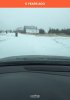
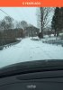
Your meltdown is gonna be epic when you get blanked!?The family and I are at Great Wolf Lodge in Concord until Tuesday. Kids are out of school Monday and Tuesday. Probably not the only days they will be out this week. Fun at the water park, and then fun in the snow later on.
The proverbial writing is on the wall, but desperate times call for desperate measures.This is not going to end well fellas.
Mid 30’s DP’s north of Richmond VA prior to precip is not going to get it done..and that’s what the NAM was showing at 84hr...I’m skeptical that it trends betterI do think there will be moisture much north of what the euro shows, just temps man.. freakin' temps. timing. ugh