Better to show it now so it will change in later runs! Srry for those in SC wanting rain. Bullseye jinx just a little too early.
-
Hello, please take a minute to check out our awesome content, contributed by the wonderful members of our community. We hope you'll add your own thoughts and opinions by making a free account!
You are using an out of date browser. It may not display this or other websites correctly.
You should upgrade or use an alternative browser.
You should upgrade or use an alternative browser.
Tropical Major Hurricane Humberto
- Thread starter GeorgiaGirl
- Start date
Tropical Depression 3 formed in a similar spot back in July of this year. I would consider it an analog given the GFS’s lack of development. Levi notes, a middle ground would be delayed development which the GFS might be seeing. Who knows.
Shaggy
Member
If we are lucky euro will trend east more and catch the next storm and tow it out to sea too! 2 for 1 from Humberto (the storm that replaced Hugo)!
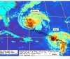
Heres a sat pic of edourd and fran and how close they were to each other. One exitng stage right did not automatically mean the other followed.
Attachments
1. Satellite derived winds and surface observations indicate that the
disturbance in the Bahamas has not yet developed a closed
circulation, and that the winds are not strong at this time.
However, surface pressures remain low and environmental conditions
are favorable for a tropical depression or tropical storm to form
within the next day or two as the system moves toward the northwest
at 5 to 10 mph through the northwestern Bahamas and toward the
Florida Peninsula. Potential Tropical Cyclone advisories could be
needed later today or Friday, and interests in the central and
northwestern Bahamas as well as Florida should monitor the progress
of this disturbance. Regardless of development, this disturbance
will bring heavy rainfall and gusty winds to portions of the Bahamas
through Friday, including areas of the northwestern Bahamas affected
by Hurricane Dorian. An Air Force Reserve reconnaissance aircraft is
still scheduled to investigate the system this afternoon.
* Formation chance through 48 hours...high...70 percent.
* Formation chance through 5 days...high...80 percent.
Shaggy
Member
Euro initializing with the low deep in the Bahamas. A might be some model trouble until an actual Center forms and the models initialize that better

12Z Euro: a bit W of 0Z and close to 6Z so far just offshore FL


And Alabama!!! LOL
Naw that’s Mississippi.
accu35
Member
I just want rain
You can already see at 84, if it's not inland yet it will be tough to make it inland.
View attachment 23478
Yep, those of us more west are done unless this just doesn’t develop.
Yep, those of us more west are done unless this just doesn’t develop.
Yeah, it will be tough. Essentially need the opposite...need the trough over newfoundland to be a ridge and the ridge over the lakes to be a trough. Unless this develops further east and is weaker.

Good trends on euro don’t need a strong hurricane coming at ?? let it go east if it wants to be a major
Hmmm might not escape ots after all

Sent from my SM-G950U using Tapatalk

Sent from my SM-G950U using Tapatalk
944 and dropping. New England don’t want that either.
Still in the right direction if not out to sea..was New Jersey...hopefully Canada this run but looks like New England....


Further east, no Jersey, maybe NYC

Still in the right direction if not out to sea..was New Jersey...hopefully Canada this run but looks like New England....
Yep hello New England.
Edit: Or not North at 192 then OTS at 216 misses New England.
Last edited:


Henry2326
Member
Both OTS. Good direction maybe it keep it up
Yep going in the right direction. Both fishies but close to Canada yet againIt will miss NYC looks like Eastern Long Island and North.
B
Brick Tamland
Guest
This feels like Dorian on repeat.
Stormsfury
Member
I expect more wild swings until we get a dominant circulation... If that happens..
I see hints of SSW winds actually South of Cuba on the Eastern side but Cuba's disrupting with some of the higher terrain. Lots and lots of stuff to iron out
I see hints of SSW winds actually South of Cuba on the Eastern side but Cuba's disrupting with some of the higher terrain. Lots and lots of stuff to iron out
ForsythSnow
Moderator
Recon is on the way in by the way. The data may help some if they find anything.
Shaggy
Member
I expect more wild swings until we get a dominant circulation... If that happens..
I see hints of SSW winds actually South of Cuba on the Eastern side but Cuba's disrupting with some of the higher terrain. Lots and lots of stuff to iron out
It seems that the best looking area if rotation is a bit NE of where the euro initialized it. That's gonna be a big step to getting more consensus on the models.
For me and you how far west it gets and when it takes that north motion is going to be crucial. If its deep in the west Atlantic and the east motion doesnt pan out as much then theres trouble brewing for the SE coast again.
Of course if it develops further east and stays east more then the recurve and NE threat goes way up.
Henry2326
Member
72 hour Hot off the press....apparently split the baby....and not good if that should occur, based on the curve we are seeing.

Henry2326
Member
48 hour...

Stormsfury
Member
Close inspection of visible satellite loop. I am seeing some hints of westerly winds around 22.8N, 73.5W.
Ethan80963!
Member


12Z EPS early maps suggest there should be a lot of OTS members but with probably a nontrivial minority being possibly dangerous due to not being fully OTS. Looks a touch E of the 6Z and a touch W of the 0Z.
Confirmed: Good news. Many OTS but some hanging around and a couple coming back to shore so far.
Henry2326
Member
I think the only operational model that looks like the surface maps is CMC....and it stalls in the frames after this point.72 hour Hot off the press....apparently split the baby....and not good if that should occur, based on the curve we are seeing.
View attachment 23488
Confirmed: Good news. Many OTS but some hanging around and a couple coming back to shore so far.
Final verdict on this run: most 12Z EPS OTS but ~25% problematic for the SE US (FL-NC) with ~2/3 of the 25% stopping and coming back west under the ridge into N FL/GA/SC. Some also threaten or even hit NE US.
Henry2326
Member
Maybe that's the reason for the placement on the surface map....Final verdict on this run: most 12Z EPS OTS but ~25% problematic for the SE US (FL-NC) with ~2/3 of the 25% stopping and coming back west under the ridge into N FL/GA/SC. Some also threaten or even hit NE US.
Edit- 12z spaghetti is all over this spot although it diverged at 18z.
Last edited:


