ATLwxfan
Member
The high pressure lagging behind unfortunately
Yeah...cold rain unless we get some back end energy.
Sent from my iPhone using Tapatalk
The high pressure lagging behind unfortunately

Very true .This run is def a point in the right direction . definitely colderFolks along and just north of the I-20 corridor, especially from Atlanta to Columbia, definitely want to see a lot more where this came from.
as usual its going to go just northwest of us. northwest arkansas and missouri bootheel always sits prettyMS/AL may see something out of this
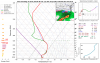
I think the moment of truth on the intensity of this s/w will come no later than about Thursday when a portion of it will be directly sampled as it approaches the coast of California, until then anyone from the TN/OH Valley to the deep south is still in the game.Very true .This run is def a point in the right direction . definitely colder
AgreedI think the moment of truth on the intensity of this s/w will come no later than about Thursday when a portion of it will be directly sampled as it approaches the coast of California, until then anyone from the TN/OH Valley to the deep south is still in the game.
need it about 50 miles east but its trending in the right directionNW Mississippi loves this run
Sent from my iPhone using Tapatalk
We got a lot of Temp problems down here.Folks along and just north of the I-20 corridor, especially from Atlanta to Columbia, definitely want to see a lot more where this came from.
If I got that I wouldn’t beg the rest of the winter. Drops 3 inches on me wow
The track is going to have to be near perfect imo because we’re not working with a particularly cold high relatively speaking vs past SE winter storm setups. Chicago’s coldest low is forecasted to be only down into the high teens to near 20 and NYC mid 20s. While cold, many times with major SE winter storms Chicago’s coldest is closer to low teens or lower and/or NYC closer to 20. So, this is pretty marginal cold to work with. So, it needs to be fully taken advantage of with not much room for error imo.