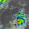
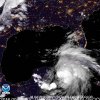
Taken verbatim, this would be a huge problem for the Florida panhandle.
-
Hello, please take a minute to check out our awesome content, contributed by the wonderful members of our community. We hope you'll add your own thoughts and opinions by making a free account!
You are using an out of date browser. It may not display this or other websites correctly.
You should upgrade or use an alternative browser.
You should upgrade or use an alternative browser.
Tropical Major Hurricane Michael
- Thread starter ForsythSnow
- Start date
pcbjr
Member
Henry2326
Member
The earlier the landfall, I think the more N this can go,into GA/SC before rocketing NE18z ICON, has practically the same path as 12z Euro, but...landfall about 18 hours sooner than Euro and weaker at 969.
View attachment 6752
pcbjr
Member
Whatever ... somebody's not gonna be happy ...The earlier the landfall, I think the more N this can go,into GA/SC before rocketing NE
... and there's a funny feelin' about who that might could be ...
BHS1975
Member
Whatever ... somebody's not gonna be happy ...
... and there's a funny feelin' about who that might could be ...
I’m thinking the death ridge will keep it far enough west of your area.
Sent from my iPhone using Tapatalk
pcbjr
Member
battle of forces, but anything with Cedar Key on it demands preparation ...I’m thinking the death ridge will keep it far enough west of your area.
Sent from my iPhone using Tapatalk
Psalm 148:8
Member
- Joined
- Dec 25, 2016
- Messages
- 322
- Reaction score
- 718
New advisory... winds at 60mph
Psalm 148:8
Member
- Joined
- Dec 25, 2016
- Messages
- 322
- Reaction score
- 718
Hoping this doesn’t wind up to be Opal’s little brother
Yellow Snow
Member
A live streaming cam at the Hyatt Ziva Cancun - things are getting a bit breezy there...
Just checking back in and Michael looks to be getting closer to hurricane status. It looks like a faster forward motion for this storm would bring him closer to the a north central Gulf coast landfall vs a slower motion getting picked up by the trough moving down. Interestingly, Michael looks to be our catalyst for the overdue fall weather.
Henry2326
Member
pcbjr
Member
W
WeatherLC
Guest
He looks ugly... what's a pic worth? a 1000 words?
View attachment 6755
View attachment 6756
View attachment 6757
Henry2326
Member
A million words in this case and he hasn't gotten started yet.... what's a pic worth? a 1000 words?
View attachment 6755
View attachment 6756
View attachment 6757
Looky...he's trying to decide if he's gonna make a run for passage gate tomorrow...
He will improve significantly, unfortunately, once he clears the YucatanHe looks ugly
Sent from my SM-G920V using Tapatalk
snowlover91
Member
Something we should keep in mind is that the GOM has been untouched this season from any storms. The whole path to the Gulf coast is unfortunately gasoline fuel for Michael. Everyone from north FL to the SE LA coast should keep an eye on this storm.
ForsythSnow
Moderator
At the moment, I believe a cat 3 is a reasonable strength to predict for landfall due to the situation. Only exception is if the shear decides to rip the west side apart more than expected. I'm sure there will be a lot of "That's the ugliest category 2 I've seen" comments from this storm if it stays slow.Michael is in the process of organizing an inner core and building an upper level outflow pattern. As the shear relaxes further it will be off to the races. Unfortunately intensity models are ramping up even more tonight. Some are bringing this near cat 4 for landfall with good agreement on cat 2.
View attachment 6759
B
Brick Tamland
Guest
So, the new Halloween movie is coming out Oct 19. Can we call this hurricane Michael Myers?
One thing to remember as well, as it heads inland it will start to quickly transition due to the approaching trough. That will make this extremely east sided and also expand the wind to that side.
Something we should keep in mind is that the GOM has been untouched this season from any storms. The whole path to the Gulf coast is unfortunately gasoline fuel for Michael. Everyone from north FL to the SE LA coast should keep an eye on this storm.
It isn't just that it is untouched. It has been exposed to air that is well above normal, thus leading to SSTs that are 5-6 warmer than normal in the far N Gulf south of the FL Panhandle, which is the normal for late July through early Sep. This is not at all normal for early Oct. This is more like the normal in early Oct way down in the W Caribbean!

WxSouth just said the exact opposite on FB. Said band will get heavy on NW side of storm as front approaches.One thing to remember as well, as it heads inland it will start to quickly transition due to the approaching trough. That will make this extremely east sided and also expand the wind to that side.
View attachment 6761
WxSouth just said the exact opposite on FB. Said band will get heavy on NW side of storm as front approaches.
Not really. He is talking about the rain shield rotating around the storm which is likely. However the wind threat will primarily be on the eastern side in the strong convective band.
Henry2326
Member
In my crude analysis, after reviewing 5th grade geography again,Positions as of 8 PM EDT:
18Z GFS: 19.9N, 86.1W
18Z FV3: 20.3N, 85.5W
12Z UKMET: 19.5N, 85.6W
Actual: 19.9N, 85.4W
It will be interesting as well to see how thr FV3 performs again. If it nails this, alright we finally have an American model that can hang with the Euro.
Looks like not much change D3-5, but a little east in short term.
Brent
Member
Interesting uh discussion
Last I saw the Euro and GFS and FV GFS? was a global and pretty intense
The HWRF model is the most robust of the
intensity guidance and makes Michael a category 4 hurricane just
prior to landfall. However, all of global models and the HWRF and
HMON regional models are indicating westerly to west-northwesterly
shear keeping the upper-level outflow restricted to the eastern
semicircle, which is not a pattern conducive for the development of
an intense hurricane.
Ya, I didn't really understand the wording on that. I thought most models show a pretty descent storm.Interesting uh discussion
Last I saw the Euro and GFS and FV GFS? was a global and pretty intense
The HWRF model is the most robust of the
intensity guidance and makes Michael a category 4 hurricane just
prior to landfall. However, all of global models and the HWRF and
HMON regional models are indicating westerly to west-northwesterly
shear keeping the upper-level outflow restricted to the eastern
semicircle, which is not a pattern conducive for the development of
an intense hurricane.
Brent
Member
Ya, I didn't really understand the wording on that. I thought most models show a pretty descent storm.
I mean I'm not even saying it'll definitely be a major but it just seems like a weird comment with all the evidence supporting it
Blue_Ridge_Escarpment
Member
0Z ICON with a sizable jump NW
0z GFS a hair east of 18z.
snowlover91
Member
RGEM, CMC and GFS so far have all slowed down some and shifted east. Trending to the Euro idea here and the Euro makes the most sense in this synoptic setup. A landfall in the big bend area then traveling up the GA to NC coast looks very reasonable to me.
Snowflowxxl
Member
Ehh it really didn’t shift east much at all. Icon went west a good bit. Will be interesting what FV3 shows in a bit.
snowlover91
Member
It’s been my experience that with some westerly shear and an approaching trough these systems usually turn NE sooner than most models show. In this synoptic setup I think the Euro and UK have the right idea. GFS slowed down a lot this run once inland and RGEM did too. Models are catching up here.
Despite an eastern shift early, the 0Z UKMET shifted west vs the 12Z at landfall and beyond:
TROPICAL STORM MICHAEL ANALYSED POSITION : 19.6N 85.1W
ATCF IDENTIFIER : AL142018
LEAD CENTRAL MAXIMUM WIND
VERIFYING TIME TIME POSITION PRESSURE (MB) SPEED (KNOTS)
-------------- ---- -------- ------------- -------------
0000UTC 08.10.2018 0 19.6N 85.1W 998 38
1200UTC 08.10.2018 12 20.8N 84.8W 989 50
0000UTC 09.10.2018 24 22.5N 85.4W 973 61
1200UTC 09.10.2018 36 24.1N 85.8W 969 63
0000UTC 10.10.2018 48 25.8N 86.1W 966 65
1200UTC 10.10.2018 60 27.8N 85.8W 952 74
0000UTC 11.10.2018 72 30.1N 84.4W 941 71
1200UTC 11.10.2018 84 32.5N 82.3W 969 50
0000UTC 12.10.2018 96 34.7N 79.2W 976 52
1200UTC 12.10.2018 108 37.2N 75.0W 977 58
0000UTC 13.10.2018 120 40.5N 68.2W 972 61
1200UTC 13.10.2018 132 44.4N 58.1W 971 59
0000UTC 14.10.2018 144 47.1N 45.7W 986 46
snowlover91
Member
Notably the 941mb pressure prior to landfall...
That's a pretty good jump west both at coast and inland right?Despite an eastern shift early, the 0Z UKMET shifted west vs the 12Z at landfall and beyond:
TROPICAL STORM MICHAEL ANALYSED POSITION : 19.6N 85.1W
ATCF IDENTIFIER : AL142018
LEAD CENTRAL MAXIMUM WIND
VERIFYING TIME TIME POSITION PRESSURE (MB) SPEED (KNOTS)
-------------- ---- -------- ------------- -------------
0000UTC 08.10.2018 0 19.6N 85.1W 998 38
1200UTC 08.10.2018 12 20.8N 84.8W 989 50
0000UTC 09.10.2018 24 22.5N 85.4W 973 61
1200UTC 09.10.2018 36 24.1N 85.8W 969 63
0000UTC 10.10.2018 48 25.8N 86.1W 966 65
1200UTC 10.10.2018 60 27.8N 85.8W 952 74
0000UTC 11.10.2018 72 30.1N 84.4W 941 71
1200UTC 11.10.2018 84 32.5N 82.3W 969 50
0000UTC 12.10.2018 96 34.7N 79.2W 976 52
1200UTC 12.10.2018 108 37.2N 75.0W 977 58
0000UTC 13.10.2018 120 40.5N 68.2W 972 61
1200UTC 13.10.2018 132 44.4N 58.1W 971 59
0000UTC 14.10.2018 144 47.1N 45.7W 986 46


