• Hello, please take a minute to check out our awesome content, contributed by the wonderful members of our community. We hope you'll add your own thoughts and opinions by making a free account!

Misc Winter Whamby 2020, a New Decade

Status
Not open for further replies.
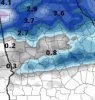
Yes, the 0z Euro isn't close to my prediction...but it could become closer to what I'm predicting. I still think it's possible a shortwave may come rushing down and phase with the main low. It just may turn out to be the storm on the scale of what I predicted. I can tell many other predictions for this storm, but a lot will think it's crazy lol. But, I wouldn't really mind telling them anyway. I mean -- I have said the storm would dump feet of snow in my prediction, and the 0z Euro does show that across some area's...and that makes me more confident about my prediction. It's actually quite amazing that I predicted snow in feet with this possible storm, and the most reliable model ends up showing it.

Sent from my SM-A102U using Tapatalk

You are at least 0 for 3 this winter in snow predictions... You can delete your private accounts but the posts are still here.

giphy.gif
 
Man you can cut the tension in here with a knife while waiting for the Euro to finish..... it's been that kind of winter

giphy.gif
 
I don't know where all this hype for the 12Z euro run is coming from. Boundry temps suck, Moisture is Meh, and the low slides out to sea stage right....
 
At least this 12z run isn't holding back...
I like the position of the high pressure. If we can just get that energy not to be too suppressed or strung out. It's a long, long way to go.
 
I like the position of the high pressure. If we can just get that energy not to be too suppressed or strung out. It's a long, long way to go.
Right and just because it's been wet doesn't guarantee anything with the next system...
 
I like the position of the high pressure. If we can just get that energy not to be too suppressed or strung out. It's a long, long way to go.
I still like this run. At hour 216 we would get back into the snow. It looks like a classic central/east SC/NC winter storm setup.
 
Snow hole 3 inches to my south 3 inches to my north. I think it would be snow or mix just north of Macon though.
 

Attachments

  • D39D102D-4130-42AA-BB5C-E6FBE6E4EAA7.jpeg
    D39D102D-4130-42AA-BB5C-E6FBE6E4EAA7.jpeg
    139.3 KB · Views: 15
Sound the alarm!

https://1.--.blogspot.com/-l_vCr7FgAN8/Wn8yp8-J5AI/AAAAAAAABr8/wXovDFulomURd5_XSm_vme8Z8Xr71wRRACLcBGAs/s1600/alert.gif
 
I like the position of the high pressure. If we can just get that energy not to be too suppressed or strung out. It's a long, long way to go.

I like that the EURO shows it not the GFS, but it's still on it's own. I'm very very skeptical, but at least it's some fantasy snow to play with. I've got no expectations.
 
I like that the EURO shows it not the GFS, but it's still on it's own. I'm very very skeptical, but at least it's some fantasy snow to play with. I've got no expectations.

Depends on how you look at it. This can work. After this frame the cold arrives and suppresses the moisture too far South. At this stage we've got the NW trend possibly working in our favor. With the signal it's showing I wouldn't put the EURO on an island by itself.

prateptype.conus.png

This is 2/20 at 6Z. It's solution is closer to the EURO than the GFS.

prateptype_cat_ecmwf.conus.png
 
I have not experienced a true accumulating snow fall in South Charlotte since March of 2018. Last year, it snowed in April and we scored a good inch of white powder, but unfortunately it was all gone by 2. While I've managed to see snow this year, I'd love to go sledding again for the first time in two years. The biggest snow I've experienced was the first year I lived here, in February of 2014 with roughly 7 inches.
 
Status
Not open for further replies.
Back
Top