• Hello, please take a minute to check out our awesome content, contributed by the wonderful members of our community. We hope you'll add your own thoughts and opinions by making a free account!

Wintry Winter 25-26 Winter Battle Zone

I just looked up -ENSO winters with a -PNA in Dec to see how often it went to a +PNA in Jan. In what winters did this occur?

-1954-5: -0.52 to +0.40

-1962-3: -0.08 to +0.58

-1983-4: -0.31 to +0.97

-1984-5: -1.60 to +1.63

-1996-7: -1.23 to +0.63

-1998-9: -0.09 to +0.16

-2008-9: -1.41 to +0.61

-2010-11: -1.78 to +1.29

-2012-3: -1.01 to +0.55

-2013-4: -0.86 to +0.97

-2016-7: -0.35 to +0.28

-2021-2: -2.56 to +1.01

-2022-3: -0.66 to +0.22

So, although it wasn’t common from 1954-5 through 1971-2, when only 2 of 9 (22%) switched, here’s something that just blew my mind:

-ALL 11 -ENSO -PNA Decs since 1983-4 switched to +PNA Jans (listed above)!

-These 11 averaged +0.76 in January!

-Now, check out the -ENSO Jan PNAs since 1983-4 that had a +PNA in Dec:

1) 1985-6 went from +1.39 to +0.97

2) 1988-9 went from +0.63 to -0.72

3) 1995-6 went from +0.92 to -0.02

4) 1999-00 went from +0.21 to -0.82

5) 2000-01 went from +1.23 to +1.51

6) 2001-2 went from +0.56 to -0.04

7) 2005-6 went from +1.38 to -0.43

8) 2007-8 went from +0.14 to -0.32

9) 2011-2 went from +0.36 to +0.60

10) 2017-8 went from +0.89 to +0.40

11) 2020-1 went from +1.58 to +0.19

12) 2024-5 went from +1.70 to +1.05

-So, for these 12 -ENSO Decs since 1983-4 with a +PNA, only 50% also had a +PNA in Jan.

-So, since 1983-4, whereas only 50% of the 12 -ENSO Decs with a +PNA also had a Jan +PNA, 100% of the 11 -ENSO Decs with a -PNA in Dec went to a +PNA in Jan! Thus, having a -PNA in Dec during -ENSO since 1983-4 has, if anything, meant a big increase in the chance for a +PNA in Jan whether random or not! I didn’t know this til just now.


Link to monthly PNA table:
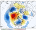
Larry, If the rmm charts are accurate, the ensembles and models should reflect sooner rather than later.
 
It feels like we've already kicked the can from early December to now mid-December lol

Not really. Even I've said & agreed that later in December looked better for winter storm potential.

Btw, I'm still expecting us to transition from a -PNA/-NAO to +PNA/-NAO type pattern here in early December. That probably will happen once the -EPO block retrogrades back into Siberia & accelerates the exit region of the Pacific Jet. My guess is that happens probably near the end of the first week into the 2nd week of December.
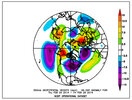
Still suspect we will see a transition from a -PNA/-NAO late Nov to +PNA/-NAO/-EPO in early December as the upper-level footprint of the MJO goes from the West Pac (phase 7) to the Western Hemisphere (phase 8). This CPC outlook in week 3-4 is the average of these two patterns.

Very tricky sensible weather forecast in the Carolinas and Mid-Atlantic tho with potential for some wild swings. We may find ourselves in the battle zone between cold CAD nosing in from New England and substantial bouts of milder air trying to push in from the Southern Plains & Lower MS Valley

We should see the -NAO/-EPO persist for the bulk of December and progressively lose the +PNA late in the month as the MJO re-enters the Indian Ocean again late December or so (phase 2). Of course, there’s absolutely nothing wrong with that, especially if we’ve got a respectable amount of snow cover and cold already entrenched over the CONUS. Losing the +PNA may just mean many more opportunities for storms with much better late Dec climatology to boot as @1300m alluded to


We've talked about the upcoming -EPO episode nearly a month ago, things are mostly going as I thought they would so far. That includes the MJO progression into the Western Hemisphere.

Latest Euro weeklies generally make sense to me.

Big +EAMT driven jet extension this week drives a trough over the Gulf of Alaska and it slowly retrogrades as November progresses w/ -EPO appearing late in the month into early December as this trough reaches the Kamchatka Peninsula. We could be cooking right off the hop this winter over the CONUS

View attachment 175639
 
It was never early December. However someone mark this post. Cause if we start talking about the end of December here in a week or two I think we have begun can kicking.

Not really. Even I've said & agreed that later in December looked better for winter storm potential.

Btw, I'm still expecting us to transition from a -PNA/-NAO to +PNA/-NAO type pattern here in early December. That probably will happen once the -EPO block retrogrades back into Siberia & accelerates the exit region of the Pacific Jet. My guess is that happens probably near the end of the first week into the 2nd week of December.


We've talked about the upcoming -EPO episode nearly a month ago, things are mostly going as I thought they would so far. That includes the MJO progression into the Western Hemisphere.
Eric, sometimes pattern changes get delayed more than we first thought due to unforseen situations. It's what makes weather fascinating
 
Not really. Even I've said & agreed that later in December looked better for winter storm potential.

Btw, I'm still expecting us to transition from a -PNA/-NAO to +PNA/-NAO type pattern here in early December. That probably will happen once the -EPO block retrogrades back into Siberia & accelerates the exit region of the Pacific Jet. My guess is that happens probably near the end of the first week into the 2nd week of December.


We've talked about the upcoming -EPO episode nearly a month ago, things are mostly going as I thought they would so far. That includes the MJO progression into the Western Hemisphere.
I’m pretty sure you disagreed with every part of early December not coming in with a full-on winter regime.

Ah yes, you did.

I strongly disagree with this entire take but to each his own.

Clearly, you just don’t understand how S2S forecasting actually works or simply aren’t intelligent enough come up with your own, well thought out responses and interpretations of this information.

I would highly recommend staying in your lane from now on and leave the S2S forecasts to the real experts 😉

Ouch. I'd take your own advise, and get back in your lane and let the real experts take it from here.

source.gif
 
Eric, sometimes pattern changes get delayed more than we first thought due to unforseen situations. It's what makes weather fascinating

Things haven't really changed much, people are just impatient & unfortunately some like 1300m want to take things way out of context.

The -EPO is here late Nov as expected, the Canadian warming event is occurring as you expect it would following a pacific mjo event during a Nina winter, and we'll probably see a transition out of this -PNA/-NAO in late Nov before the -PNA probably tries to come back again with the next MJO orbit into the eastern hemisphere near the end of December. Don't see the issue
 
Destroying your identity? Bud, you're using a burner account because you're too chicken 💩 to use your main, where even you half heartedly admitted you have basically no credibility left here. Get a life.
I actually enjoyed reading 1300m’s stuff. He just got too caught up on being right or wrong, and it’s never that serious.
 
Destroying your identity? Bud, you're using a burner account because you're too chicken 💩 to use your main, where even you half heartedly admitted you have basically no credibility left here. Get a life.
The poster 1300m won't be returning. The forum isn't looking for a professional meteorologist who can accurately forecast (speaking of cowards, who was too scared to enter the snowfall contest and take me on like a man last winter?), that's why they keep you around, to provide inaccurate long range hopium. Keep up the good work from all the way out in NM 🤣.
 
He clearly has a lot of personal issues to sort out. Using a burner account is just his way of trying to find himself again I guess.
Says the guy who picked a fight, lost, then tries to deflect. You wanted a fight, you got one. And since the mods would rather keep the circus going than ban your know-nothing-a$$, I'm out.

Mods - if you got rid of this clown, you'd get more mets to come in here. As it is, who wants to deal with this petulant, childish behavior? The forum is great, and it's pretty sad y'all let one poster hold the entire forum's potential back.
 
The poster 1300m won't be returning. The forum isn't looking for a professional meteorologist who can accurately forecast (speaking of cowards, who was too scared to enter the snowfall contest and take me on like a man last winter?), that's why they keep you around, to provide inaccurate long range hopium. Keep up the good work from all the way out in NM 🤣.
Im hopeful we will get at least one opportunity at a winter event in my area, which we only average 4-5 inches snow a winter. Maybe some sleet and fzr also. It's probably a little less in the southeast
 
Just a note moving forward - a real scientist (or even man, for that matter) wouldn't be scared of competing ideas if they actually had confidence in their own take. Keep that in mind the next time @Webberweather53 cowardly challenges an opposing viewpoint.

And mods - feel free to ban this account but you own a lot of this. This type of behavior should never be allowed. It is disrespectful, disruptive and inappropriate. Real people don't behave this way - it's also why this individual couldn't get a job anywhere remotely close to his home because he burned every bridge from here to Narnia.

I strongly disagree with this entire take but to each his own.

There’s a lot of glaring issues and inconsistencies here that need to be pointed out.

For one thing, RMM MJO only explains a third of the subseasonal variance in U200, U850, & OLR, the other 67% of that variability is very important, especially when you’re advancing towards a warm enso state (EOF-3). As Ventrice et al pointed out in their creation of the VPM MJO index over 10 years ago, RMM has a lot of issues tracking the MJO outside the Warm Pool. The index crashing into the null phase doesn’t mean what you think it does

Most models also have a weak and fast bias with the MJO, this is supported by literature and having seen hundreds upon hundreds of mjo forecasts over the decade plus I’ve been doing this. Some people have to learn the hard way about these and that’s fine.

Even still, let’s say hypothetically for some odd reason this doesn’t verify, are those height anomalies on the phase 7 composite even significant? Better yet, are they actually representative of how the current base state will interact with MJO?

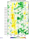
The low frequency + MJO constructed analog (which accounts for both), created by Dr Roundy says that’s a hard no.

View attachment 176114

Clearly, you just don’t understand how S2S forecasting actually works or simply aren’t intelligent enough come up with your own, well thought out responses and interpretations of this information.

I would highly recommend staying in your lane from now on and leave the S2S forecasts to the real experts 😉
 
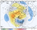
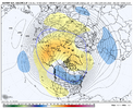
Today’s 12z GEFS probably isn’t too far off in the grand scheme of things if this blocking ridge over the Bering Sea is generally in the right place by this point in time.

The details (timing and placement etc) will move some, but should see a big, healthy chunk of the troposphere polar vortex drop to near the Hudson Bay at some point.


IMG_6616.png

IMG_6609.jpeg
 
This is the wrong battle being fought in this Winter Battle Zone thread and thus is badly disrupting the flow ITT. Would it be possible for this battle of the two pro mets to be moved into its own “Battle of the mets” thread or better yet into PM?
 
Today’s 12z GEFS probably isn’t too far off in the grand scheme of things if this blocking ridge over the Bering Sea is generally in the right place by this point in time.

The details (timing and placement etc) will move some, but should see a big, healthy chunk of the troposphere polar vortex drop to near the Hudson Bay at some point.


View attachment 176705

View attachment 176706
Tries to begin rebuilding credibility as a LR expert by showing the 300 hr GEFS. I can’t even.
 
Let me attack everything you say and let’s see how easy it is to get along.

Wait a sec - I think we tried that once before and you didn’t take it so well!

Dude, I was literally hounded in the severe weather outbreak in the spring. In the end, one was wrong and one was right. You just have to let it float over your head if you feel you are confident.
 
Dude, I was literally hounded in the severe weather outbreak in the spring. In the end, one was wrong and one was right. You just have to let it float over your head if you feel you are confident.
Not the way it should be. Again, where is the moderation. If this is going to be the Wild West I can play that too but it won’t be pretty when I start pointing out all the asinine posts made including by their beloved LR expert.
 
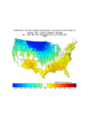
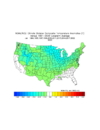
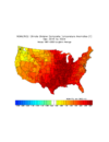
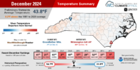
Followup: here’s the average temp. anomaly of all Decs, Jans, and Febs for -ENSO winters since 1983-4 with a -PNA in Dec:

Dec (all had -PNA with avg. -0.99): slightly warmer than normal E US (most pronounced SE) and very cold N Plains/Rockies:
IMG_5444.png


Jan (all had +PNA with avg. +0.76): slightly colder than Dec Chicago S and E but N Plains/Rockies not as cold:
IMG_5446.png


Feb (all 11 PNAs dropped back down with Feb avg. PNA of -0.19): other than GA to TX, this is easily the warmest of 3 months averaged out in the E 2/3 of US with warmest SC to NE:
IMG_5447.png
 
Last edited:
Not the way it should be. Again, where is the moderation. If this is going to be the Wild West I can play that too but it won’t be pretty when I start pointing out all the asinine posts made including by their beloved LR expert.

Just set to ignore and post. If we are the audience, we can judge in the end.
 
Idk if this post belongs here but I just wanna bring this up for those who view last Monday's cold snap as a waste.

If we had a trough like that even in December let alone January, it probably would've resulted in a classic dry cold pattern that very few of us actually like. I've noticed over the years that arctic outbreaks don't usually produce winter storms for us

Also, I personally don't view cold weather and good patterns as a limited resource that can be wasted lol
 
Fool's Gold. The LR euro weeklies are not to be trusted.
ecmwf-weeklies-avg-nhemi-z500_anom_7day-1763164800-1765152000-1765152000-20.gif

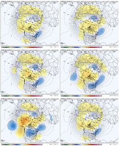
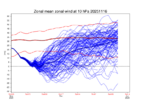
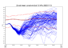
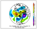
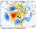
Euro weeklies, extended GEFS, and CMC weeklies all pretty much have the general same idea wrt the NAO and PNA as we head into early December

View attachment 176093


View attachment 176094

View attachment 176095

The low frequency base state + MJO + Eq Rossby Wave analog also agrees
View attachment 176096

My confidence is still low for early December. IMO, unless you are looking for heartache, I wouldn't be putting any stock in the long range ensembles / weeklies. Last 14 run loop for week 1 of December shows how clueless the euro weeklies are.

View attachment 176098View attachment 176099

MJO forecasts continue to slow down in P7 now well into the first week of December. That is not going to help with getting a favorable eastern U.S. pattern going.

View attachment 176100View attachment 176102

Allan also makes a good point about the lag between an SSWE and resultant impacts - another reason to doubt December is going to come in with a winter pattern already established for us. If the MJO lags in P7 through week 1 of December + SSWE doesn't occur until around early December, we're looking at realistically week 2 or week 3 before an atmospheric response to those impulses would be expected and that is if they even occur at all.


I see a lot of competing factors for early December as it stands now, which leads me to believe early December may not feature a locked-in winter weather regime with a strong west-based -NAO and a downstream eastern U.S. trough and favorable Pacific, but as always, would love to be wrong.

If confidence in the MJO moving into P8 increases, I'll feel a lot better about things, but I remain skeptical of that happening as of now considering the research done showing the present -NAO we have may actually increase potential for the MJO to not move in that direction, but instead work against it.

Some people have to learn the hard way about these and that’s fine.
 
When do you believe a more favorable pattern for cold and wintry weather east of the rockies may evolve? Just curious
Week 2 - 3 of December. It will take time for the full atmospheric response to the weakened SPV + eventual P8 MJO to occur. First true southern winter storm threat could be the week of Christmas if things go right!
 
Week 2 - 3 of December. It will take time for the full atmospheric response to the weakened SPV + eventual P8 MJO to occur. First true southern winter storm threat could be the week of Christmas if things go right!
I live in west tennessee and like i mentioned before, we average 4-5 inches snow a year, but I like our opportunity when we get them!
 
Fool's Gold. The LR euro weeklies are not to be trusted.
View attachment 176712


Some people have to learn the hard way about these and that’s fine.

Not sure what your grand revelation is here.

The EPO/NAO/AO and general idea of a west pac to western hemisphere mjo orbit were all there even that far out. The PNA will probably follow suit once the North Pacific block runs its course.

You’re making a whole lot out of nothing
 
Not sure what your grand revelation is here.

The EPO/NAO/AO and general idea of a west pac to western hemisphere mjo orbit were all there even that far out. The PNA will probably follow suit once the North Pacific block runs its course.

You’re making a whole lot out of nothing
If you’re saying your analysis was worth nothing, I tend to agree. Also, just teaching you a lesson before you come at somebody again. You ain’t all that, kid. Stay in your lane and don’t respond to me again.
 
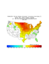
Followup: here’s the average temp. anomaly of all Decs, Jans, and Febs for -ENSO winters since 1983-4 with a -PNA in Dec:

Dec (all had -PNA with avg. -0.99): slightly warmer than normal E US (most pronounced SE) and very cold N Plains/Rockies:
View attachment 176709


Jan (all had +PNA with avg. +0.76): slightly colder than Dec Chicago S and E but N Plains/Rockies not as cold:
View attachment 176710


Feb (all 11 PNAs dropped back down with Feb avg. PNA of -0.19): other than GA to TX, this is easily the warmest of 3 months averaged out in the E 2/3 of US with warmest SC to NE:
View attachment 176711

For 1983-4+ -ENSO: Now I’ll compare the 3 winter maps when there’s been a -PNA in Dec (see those in what I’m quoting) to the same for a +PNA in Dec:

+PNA Decs: significantly colder than -PNA Decs (as expected) and coldest of DJF from Mack’s abode E and S
IMG_5448.png


Jans following +PNA Decs: warmer than Jans that followed -PNA Dec (almost entire US) and warmer than those +PNA Decs, themselves, Plains eastward; warmest of DJF Plains eastward except SE/MidAtlantic
IMG_5449.png


Feb following +PNA Decs: mild E 1/4 of US but coldest of DJF Plains to Pac NW
IMG_5450.png
 
Last edited:
If you’re saying your analysis was worth nothing, I tend to agree. Also, just teaching you a lesson before you come at somebody again. You ain’t all that, kid. Stay in your lane and don’t respond to me again.

There’s nothing to teach anyone here, other than we’re just nitpicking details in the planetary wave pattern several weeks out for a specific forecast period that mind you, hasn’t verified yet. The forecast could look even more -PNA heavy in a week or so or vis versa.

If the +PNA doesn’t show up exactly during the first week of December but appears several days later, big deal, it’s still arguably early December. Even if it doesn’t happen, oh whale it’s just not that serious to me, especially since I handled the upcoming phases of the EPO/NAO/AO and MJO generally correct nearly a month ago. If you can’t handle any discourse between yourself and I, and you also don’t want to get banned again, then just ignore and move on.
 
Back
Top